
-
2:10

Plymouth High School hosts ’Steps for Stegs’
-
2:05

Drier but cooler to wrap up the weekend
-
6:23

ABC57’s Arts and Acts: Local dance stars shine at A&A Ballet...
-
2:49

St. Adalbert Church celebrates Cinco De Mayo, announces fundraising...
-
0:40

Congressman Rudy Yakym awards local high school artists
-
2:06

Thundershowers tonight, a cooldown tomorrow following cold front
-
0:52

Bethel University celebrates 77th commencement
-
1:36

Beautiful start to the weekend despite morning fog
-
1:03

’Pedals and Petals’ in downtown South Bend
-
3:18

Owners urged to vaccinate dogs after puppy left for dead outside...
-
1:54

Threat of drought, even with rainy spring in Michiana
-
3:43

Protestors arrested on campus of Notre Dame

Storms likely along and a head of a cold through that will sweep through Michiana this evening. Focus will be where storms initialize. The farther northwest storms fire, the greater storms could be strong for all of Michiana. If storms fire more south and east, severe threat shifts higher towards Ft. Wayne.
Feeling fall-like this week as temperatures struggle to break 70. Fair but breezy Tuesday and much cooler midweek, with highs in the mid-60s. The northwest flow will produce lake effect clouds and rain showers, as air temps will be in the 60s and water temps are still in the 70s. Next weekend, fair and milder weather returns.
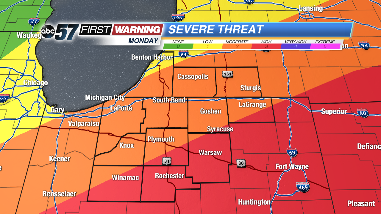 The farther south and east you live the greater the severe threat. The closer to Warsaw you live the more likely storms could be strong.
Tonight: Evening storms, then clearing and cooling, low of 56.
Tuesday: Mostly sunny to partly cloudy, high of 70.
Wednesday: Mostly cloudy with showers likely, high of 64.
Thursday: Partly cloudy, a chance of showers, highs in the mid-60s.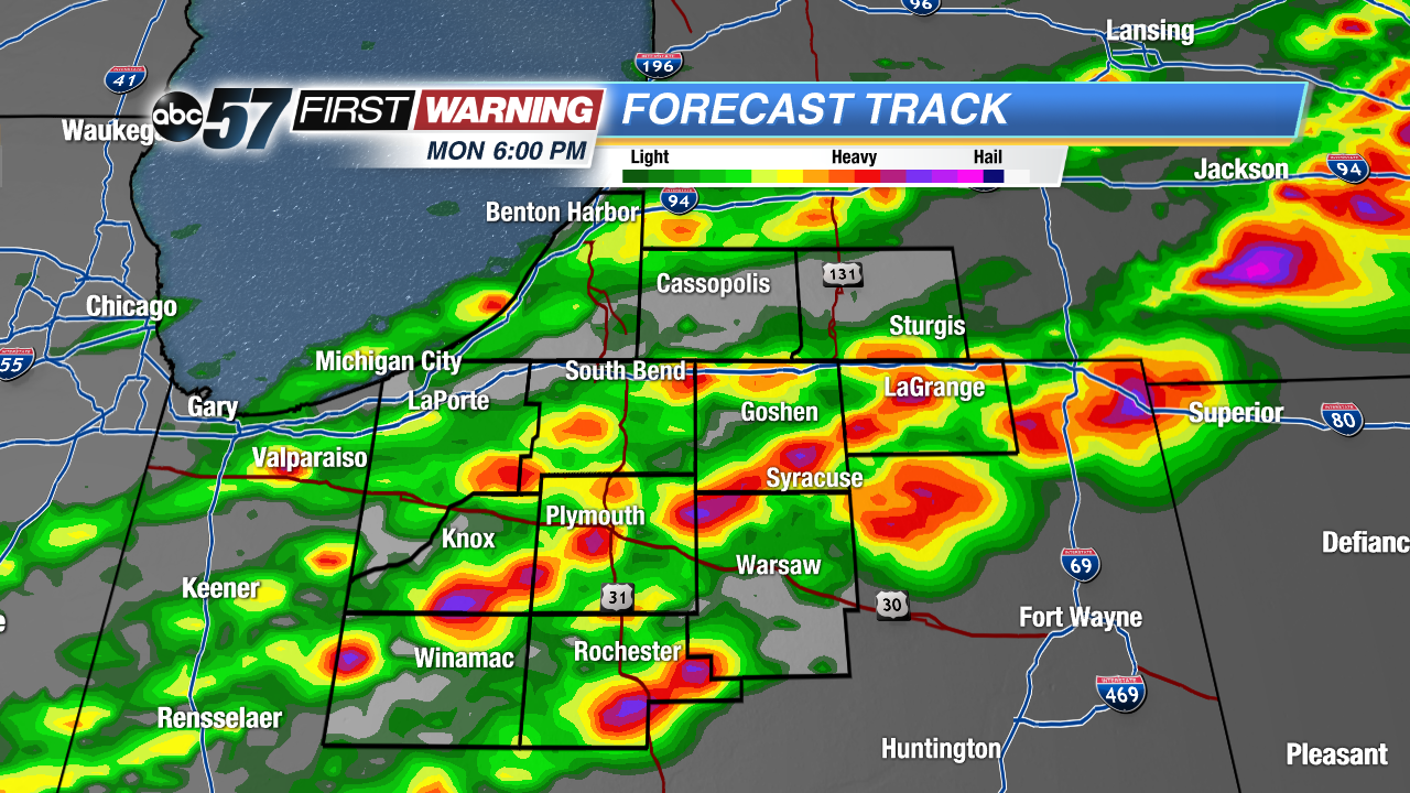 High resolution models pinpoint a quick initialization of storms. Most likely time frame between 5 PM and 7 PM.