Winter weather will impact Michiana through the overnight


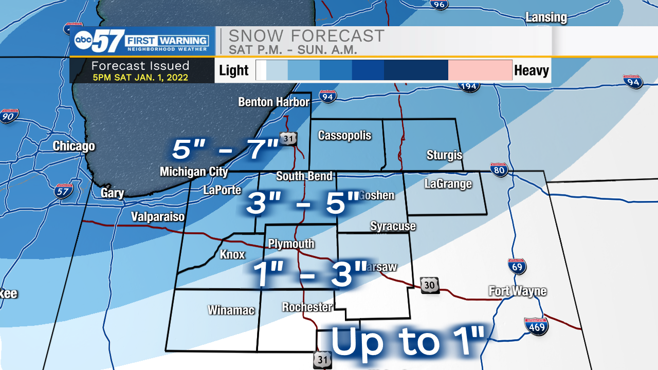
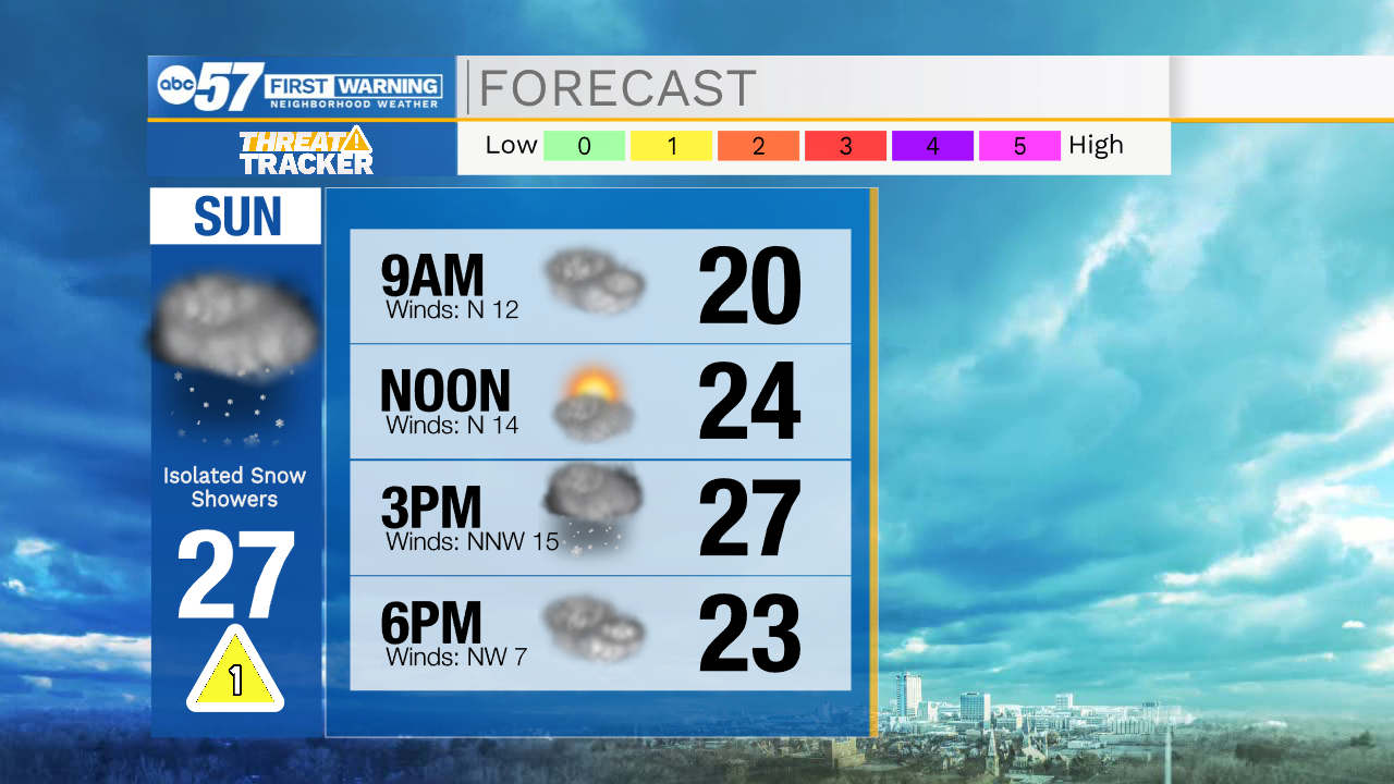
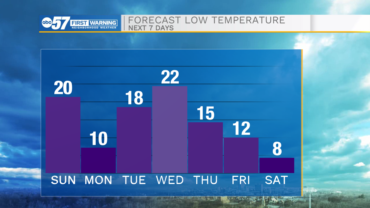
Scattered snow showers are ongoing throughout Michiana, and will remain with us through the evening and overnight. Snow showers will be heavy at times, which will greatly reduce visibilities. Stay off the roadways tonight, if travel isn’t necessary. Snow showers from this system will clear out by 7am tomorrow. After that round, lake effect snow will develop leading to isolated snow showers throughout the afternoon. Isolated areas throughout Michiana could see around half a foot of snow, with most places ranging from 3-6” after its all said and done. Temperatures will begin to plummet tomorrow with highs only topping out in the upper 20s. Monday morning lows will drop into the single digits for some. Another round of snow is possible later Wednesday evening, and Thursday. Overall impacts look low, but more cold air will be quick to follow after that round moves through.
Tonight: Scattered snow showers. Low 20.
Tomorrow: Isolated lake effect snow. High 27.
Monday: Mostly sunny. High 25.
Tuesday: Mostly sunny. High 36.