
-
2:34

Pro-life group files lawsuit against IDOH for access to abortion...
-
1:01

South Bend students gain hands-on experience at first ’GEAR...
-
1:48

Temperatures swing with rounds of rain
-
2:56

Senior citizens feeling taxed out of their neighborhoods
-
0:26

Monterey adds around-the-clock cameras to combat crime
-
5:06

The NALC is looking for volunteers to ’Stamp Out Hunger’...
-
2:19

Dry and mild start to Thursday, but rain arrives this evening
-
2:56

Pro-Palestinian protesters fill intersection of Walnut and Western...
-
1:55

’Water shut off notices’ return in Benton Harbor
-
0:57

Indiana Lt. Gov. Suzanne Crouch makes local campaign stop
-
3:55

Deliberation about changes to Indiana’s high school graduation...
-
1:44

Temperatures rise and fall to end the week, rain Friday

Whiteout conditions likely west of South Bend. An intense lake effect snow band Tuesday night will hamper parts of Berrien, LaPorte and Starke counties. This will be a highly localized but intense event with more than six inches of snow possible by Wednesday morning. Overnight lows will vary from around 10 degrees under the snow band to near zero under clear skies.
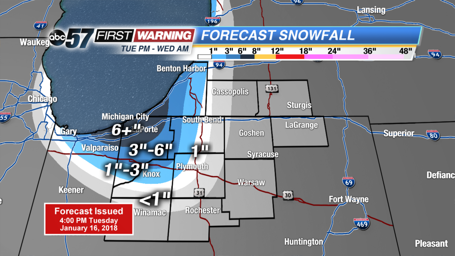
Light lake effect snow Wednesday morning, otherwise another cold but clearing day. The forecast is quiet the rest of the week with sunshine Thursday and Friday. We’ll have some bitter cold nights but temperatures rise into the weekend, highs will be in the 40s through Monday. The best chance of rain is Sunday into Monday.
Tonight: Lake effect snow west of South Bend, partly cloudy, lows near zero.
Wednesday: Lake effect ending, partly cloudy, high of 20.
Thursday: Mostly sunny, high of 28.
Friday: Mostly sunny, highs in the mid-30s.