
-
3:43

ND Eviction Clinic exposes ’shameful’ living conditions at...
-
3:59

Neighbors share traffic, noise concerns about proposed Capital...
-
1:50

Leaf pick up resumes in South Bend after weather postpones service...
-
1:02

Another rollercoaster ride to end the week
-
3:41

Present Pillars to host “Dad Strong 5K“ to support fathers...
-
1:44

Warming up through Wednesday
-
2:34

From Niles to South Bend: Jays 2 Keeps the Spirit Alive for basketball...
-
0:46

44th annual Tri Kappa Antique Show boosts charities and scholarships
-
1:48

Scattered showers this evening, Much cooler overnight
-
1:50

Showers and storms this afternoon
-
0:20

One person injured in shooting
-
0:36

Eddies Circuit Robotics holds competition Saturday

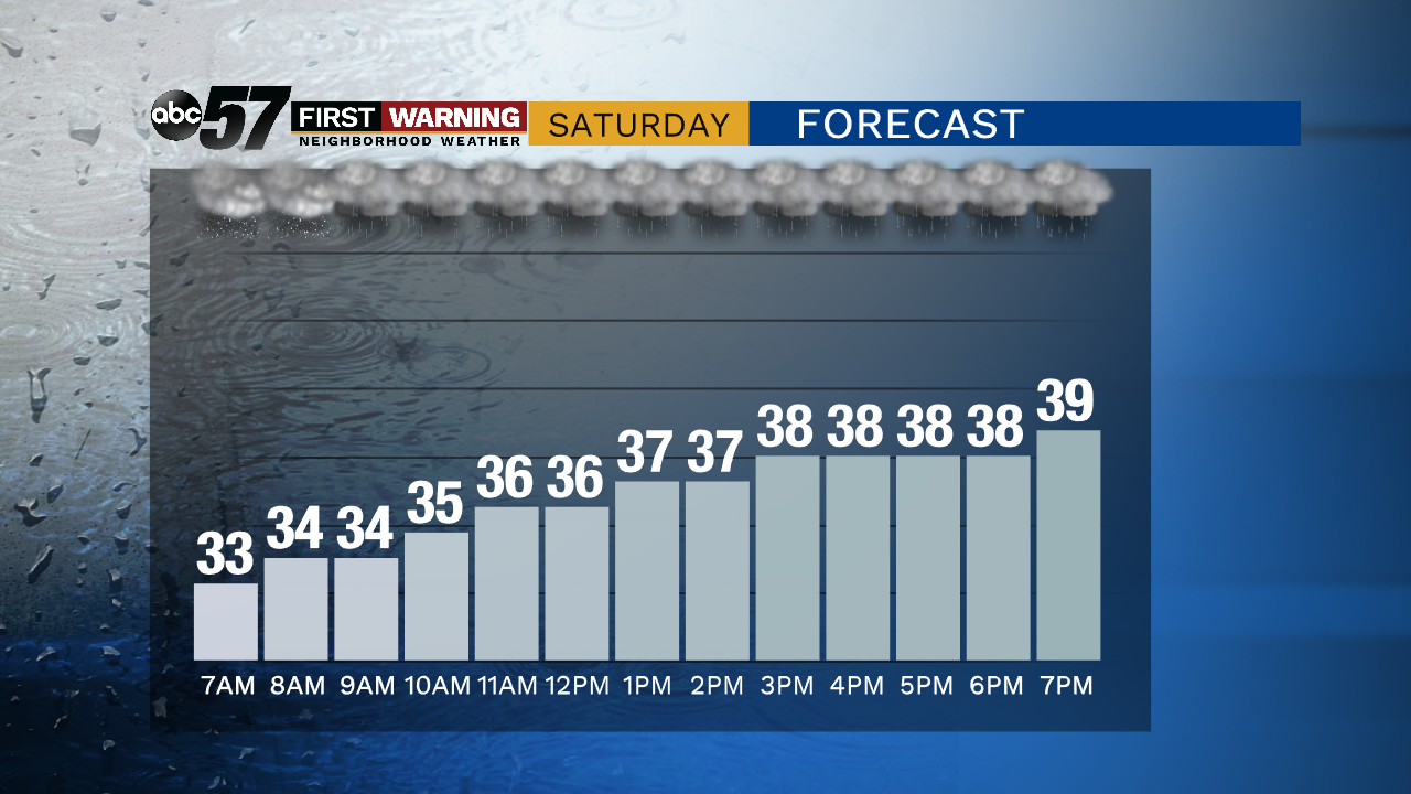
The weekend is wet and breezy as our next fall storm moves through. This will not be windy as our last storm but it may be wetter. Rain is likely most of Saturday and the wind picks-up into Sunday. Sunday rain showers changes to a wet rain/snow mix as temperatures fall. A few flurries are possible Monday then the pattern stays relatively quiet.
Tonight: Cloudy with a wintry mix late. Low of 34.
Saturday: Rainy, slow warm-up to 40 just before midnight.
Sunday: Temperatures falling from the low 40s, afternoon rain/snow showers
Monday: Mostly cloudy with a chance of L.E. rain/snow showers. High of 38.
Sign up for the ABC 57 Newsletter