Warming trend continues this week

-
1:45

Windy and wet this weekend, but unseasonable warmth as well
-
3:13

Local players react to $3 million investment in Byer Softball...
-
0:32

Layoffs at Whirlpool could affect workers in Benton Harbor
-
1:03

Annual District Sisterhood Conference at Ivy Tech empowers students
-
1:49

Back home in downtown South Bend, YMCA to open new location
-
2:16

This week’s ABC57 Cub Reporter is Nicholas Zentz
-
3:05

Amazon Web Services invests $11 billion to build data center...
-
4:05

Riley High School student center stage at the NFL Draft
-
1:35

Rain, wind, and milder temperatures forecast this weekend
-
2:49

Joe Alt expected to be drafted in the first round of NFL Draft
-
2:11

Students gearing up for local careers in Manufacturing
-
2:13

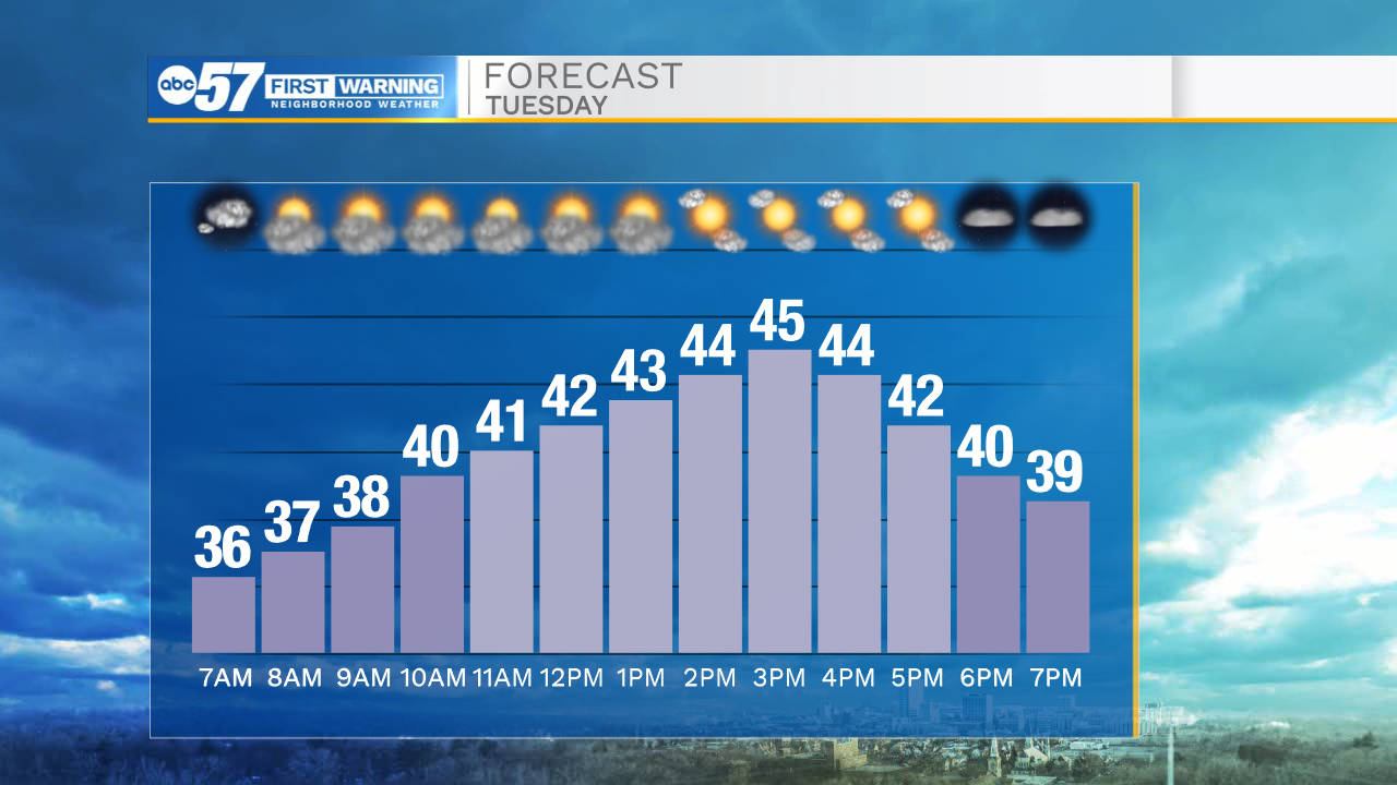
Sunny today, but expect a wetter and warmer weekend

The final day of November will go down as a quiet one. Temperatures are still cool today, but slightly warmer than Monday. We’ll see a little sunshine later this afternoon.
Tonight clouds return and temperatures fall into the low 30s.
Clouds stick around through Wednesday. It is possible to see a quick shower Wednesday, but it won’t be wet for the entire day.
The warming trend continues through the week – both Wednesday and Thursday will bring 50 degree temperatures. Thursday looks to be the best day to get outdoors to hang Christmas lights or rake any lingering fall leaves.
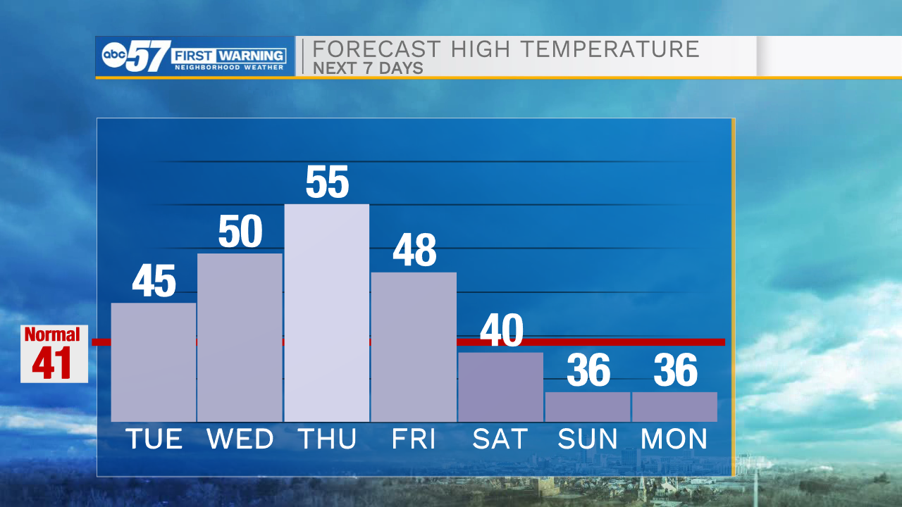
Temperatures fall over the weekend to the low 40s/upper 30s.
There is a chance for snow showers overnight Sunday into Monday, with lake effect snow possible Monday.
Today: Partly cloudy. High 45.
Tonight: Mostly cloudy. Low 30.
Wednesday: Mostly cloudy and breezy. Stray shower possible. High 50.
Thursday: Periods of sunshine. High 55.