Warmer weekend and turning active
By: Emily Kennedy
Posted: Aug 15, 2019 3:12 AM EDT

-
4:24

Michiana Crime Stoppers shredding event
-
1:16

’IvyCares’ program setting students up for success in and...
-
1:45

Windy and wet this weekend, but unseasonable warmth as well
-
3:13

Local players react to $3 million investment in Byer Softball...
-
0:32

Layoffs at Whirlpool could affect workers in Benton Harbor
-
1:03

Annual District Sisterhood Conference at Ivy Tech empowers students
-
1:49

Back home in downtown South Bend, YMCA to open new location
-
2:16

This week’s ABC57 Cub Reporter is Nicholas Zentz
-
3:05

Amazon Web Services invests $11 billion to build data center...
-
4:05

Riley High School student center stage at the NFL Draft
-
1:35

Rain, wind, and milder temperatures forecast this weekend
-
2:49

Joe Alt expected to be drafted in the first round of NFL Draft

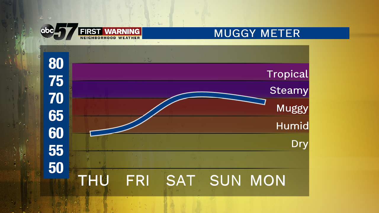
It’s cooler today and comfortable with some sunshine! There is still an isolated shower chance but most should stay dry. Clouds increase tomorrow with showers and thunderstorms possible after midday. That chance of rain lingers into Saturday along with the heat and humidity going up. Daytime rise to the mid-80s for the weekend with a chance of rain again Sunday. It is not a washout though. The pattern remains active through Tuesday before we see a stretch of sunshine.
Today: Partly cloudy, isolated shower possible, high of 77.
Tonight: Partly cloudy, low of 58.
Friday: Increasing clouds, shower/storm possible after midday, high of 78.
Saturday: Partly to mostly cloudy, showers/storms possible, high of 84.
Sign up for the ABC 57Newsletter