Warm temperatures tomorrow, Rain chances next week

-
2:25

’Twas the day after Christmas at University Park Mall
-
1:30

A soggy end to the year
-
2:04

The Elkhart Fairgrounds “Dash Away 5K” encourages families...
-
1:52

Dreary and soggy weather amidst warming temperatures this weekend
-
1:47

A Christmas Potluck at Fairview Grange #2177
-
0:50

Staying gray and mild
-
1:19

A dreary holiday expected for Michiana
-
2:49

Lightshow of a lifetime: Dowagiac community goes above and beyond...
-
0:47

Christmas Delight in Osceola
-
6:34

ABC57 News Investigates: A year in review
-
2:19

A gray Christmas tomorrow, rain showers return by the weekend
-
0:47

Local bank matches Red Kettle donations to Salvation Army on...

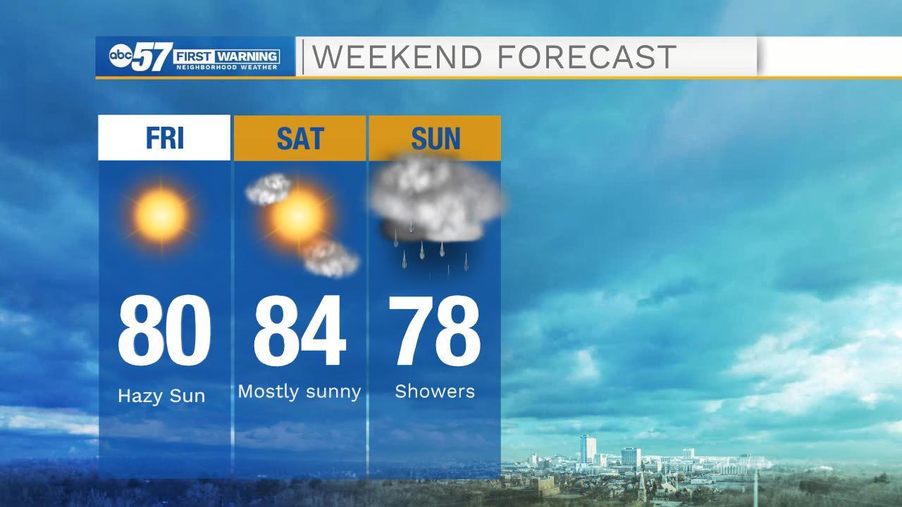
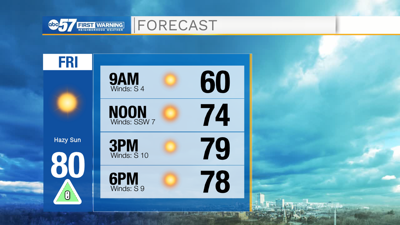
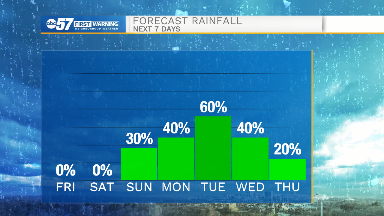
Dry, sunny, and warm weather is on the way for this afternoon. High temperatures will top out in the lower 80s. This evening if you are headed out the door for any Friday night plans you can leave the jacket at home. Temperatures will stay in the upper 60s through 10pm. Tomorrow will be even warmer during the day with highs topping out in the mid 80s under mostly sunny to partly cloudy skies. A cold front looks to arrive here in Michiana on Sunday. This will spark a few scattered rain showers that will stick with us into Monday.
Monday through Thursday morning next week, off and on rain showers are expected with a few thunderstorms possible. Our best chance for widespread showers here in Michiana will be Monday night into Tuesday late morning. Another cold front will move into Michiana on Wednesday afternoon keeping the rain around through the first half of Thursday. Temperatures next week will be in the upper 60s on Monday, but then drop all the way into the mid 50s by Thursday and Friday.
Today: Sunny. High 80.
Tonight: Mostly clear. Low 60.
Tomorrow: Partly cloudy. High 84.
Sunday: Isolated showers. High 78.