Tropical downpours tonight, heat wave begins Wednesday

-
2:56

The partial government shutdown is impacting travel across the...
-
1:33

Cool out the door, Mild by afternoon
-
1:50

Top Ten Snow Year 2025-26
-
1:17

South Bend Cubs unveil fan-focused upgrades ahead of Opening...
-
2:21

Notre Dame Fighting Irish ready for spring football
-
2:06

Fighting Irish using time off to refocus ahead of spring practice
-
2:35

What are the privacy implications of SBPD’s ’Drone as First...
-
1:22

Expert discusses Wednesday’s Fed decision
-
3:19

New legislation could make Michigan the 30th constitutional carry...
-
2:15

SBPD using drones to help improve response time
-
1:20

The March roller coaster ride continues
-
1:52

Snow today, rain tomorrow, and warm this weekend

Scattered showers and storms continue through tonight, localized downpours of +1” are possible.
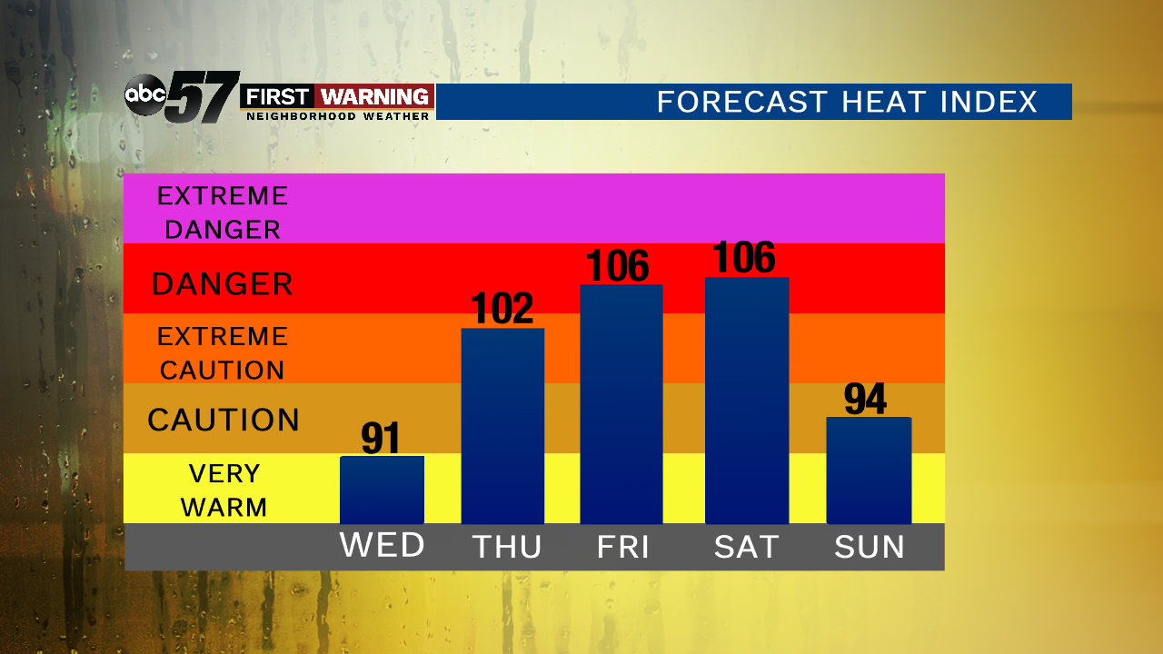
The heat wave begins Wednesday as highs will make a run towards 90, the heat index will reach the mid-90s thanks to sweltering humidity. A few pop-up showers are still possible but as ‘Barry’ exits the more sunshine will only make it hotter.
Extreme heat and humidity will last from Thursday through Sunday with Friday and Saturday being the hottest days, the heat index could peak as high as 110. Be proactive in keeping cool and hydrated, heat is the number one weather killer.
Tonight: Scattered showers/storms, low of 72.
Wednesday: Partly cloudy, chance of a shower, high of 90.
Thursday: Hot and very humid, slight chance of storms, high of 92.
Friday: Extreme heat, high of 95.