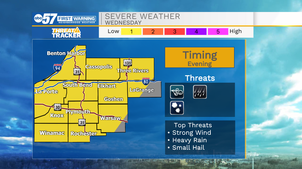
Tracking another round of storms Wednesday night
By: Emily Kennedy
Posted: Oct 12, 2021 3:30 AM EDT

-
3:19

Mishawaka apartment resident raises concerns over algae-filled...
-
2:55

USA World Cup watch party at Manny’s Sports Bar
-
3:15

RedBud Nationals brings 4th of July motocross tradition back...
-
1:49

RedBud organizers prepare for high temps at this weekend’s...
-
2:10

Indiana FSSA breaks down report on SNAP error rates
-
2:53

Street camping now illegal across Hoosier state
-
2:37

Preview the possibilities at the St. Joseph County 4H Fair
-
1:17

Local reactions to the Supreme Court’s ruling on transgender...
-
2:32

Local experts and politicians weigh-in on the Supreme Court’s...
-
8:00

250 years of Indiana sports history, a legacy built across generations
-
7:19

Savoring Michiana
-
3:16

Dowagiac residents seek class action over noise from hyperscale...
ABC57 First Warning Neighborhood Weather Forecast
Tuesday, October 12th, 2021
A few more clouds will hang around for part of Tuesday with areas of drizzle possible, especially in the morning. More sunshine and warmer on Wednesday. Another round of showers and storms moves through Wednesday night into Thursday morning. As these storms first move in, they could be strong. The chance of rain continues for Friday and true fall weather arrives behind it over the weekend.
Today: Mostly cloudy. High 70.
Tonight: Partly cloudy. Low 54.
Wednesday: Partly cloudy. High 76.
Thursday: Rain showers. High 72.
Sign up for the ABC 57 Newsletter