Have you noticed the lack of thunderstorms recently? It's June 8, and South Bend has had just two days with thunderstorms in 2021.
Typically, we see an uptick in thunderstorm activity as we warm up in the spring and summer. It's been dry recently, which has fizzled countless "could-be" rain showers and thunderstorms.
Humidity is increasing this week, so thunderstorms seem a bit more promising.
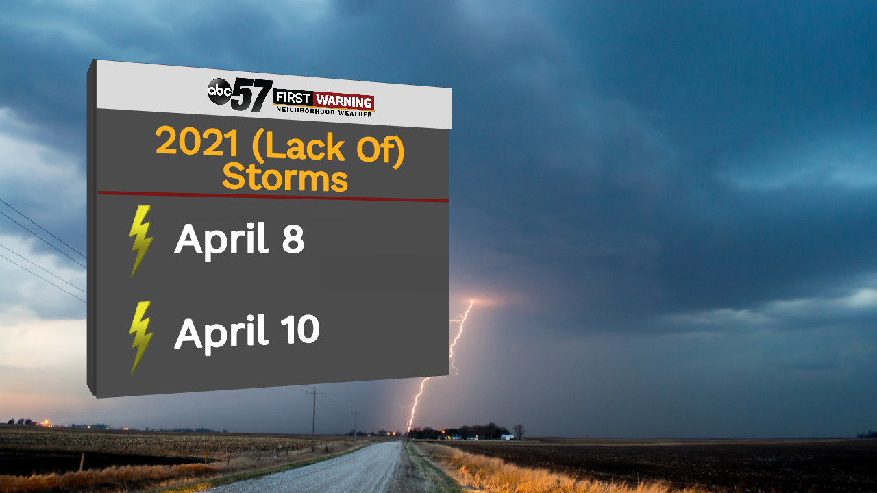
So far, we've only had thunderstorms on April 8 and April 10 this year.
It's also been a while since we've had any severe thunderstorm watches or warnings. Our last severe thunderstorm warning was November 11, 2020, when we had an unusually warm start to November.
It's been over 200 days since that last warning.
Many people, meteorologists included, appreciate storms for their beauty. Beyond this, storms can be helpful for crops.
As storms form, nitrogen in the air is converted to nitrates, which fall to Earth as raindrops. In the ground, nitrates are helpful fertilizers. In the spring, this can cause trees and plants to turn green. It can also be helpful as plants continue to grow during the summer.
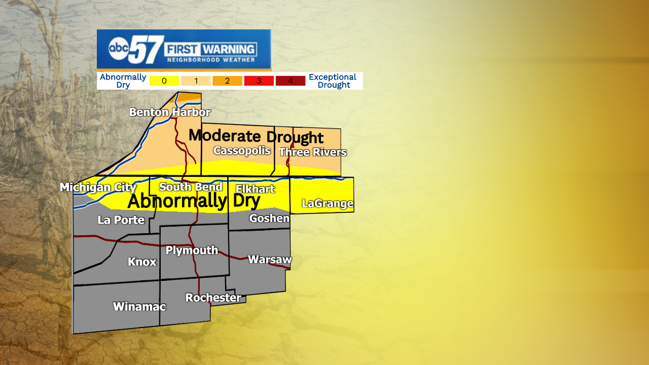
Any thunderstorms this week will also bring some much needed rain. The most recent drought monitor has shown some improvement from previous weeks.
Northern Michiana could still use a decent soaking - these are the areas in level D0 and D1 on drought monitor. Northern Berrien County is in stage D2, which is severe drought.
Southern Michiana could still use some rain, but they are not currently on the drought monitor.
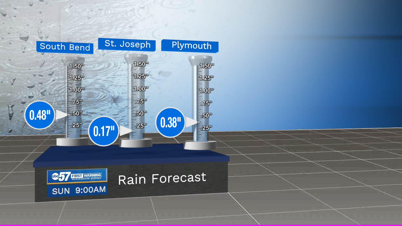
Here are a few rain totals expected for the rest of the week (through Sunday morning). Any rain, even if the totals are low, is helpful. If we have any thunderstorms, isolated areas could see higher rain totals.