The heat breaks but not the humidity, heavy rain and storms.
By:
Tom Coomes
Posted: Jun 18, 2018 4:32 PM EDT

-
3:19

Mishawaka apartment resident raises concerns over algae-filled...
-
2:55

USA World Cup watch party at Manny’s Sports Bar
-
3:15

RedBud Nationals brings 4th of July motocross tradition back...
-
1:49

RedBud organizers prepare for high temps at this weekend’s...
-
2:10

Indiana FSSA breaks down report on SNAP error rates
-
2:53

Street camping now illegal across Hoosier state
-
2:37

Preview the possibilities at the St. Joseph County 4H Fair
-
1:17

Local reactions to the Supreme Court’s ruling on transgender...
-
2:32

Local experts and politicians weigh-in on the Supreme Court’s...
-
8:00

250 years of Indiana sports history, a legacy built across generations
-
7:19

Savoring Michiana
-
3:16

Dowagiac residents seek class action over noise from hyperscale...

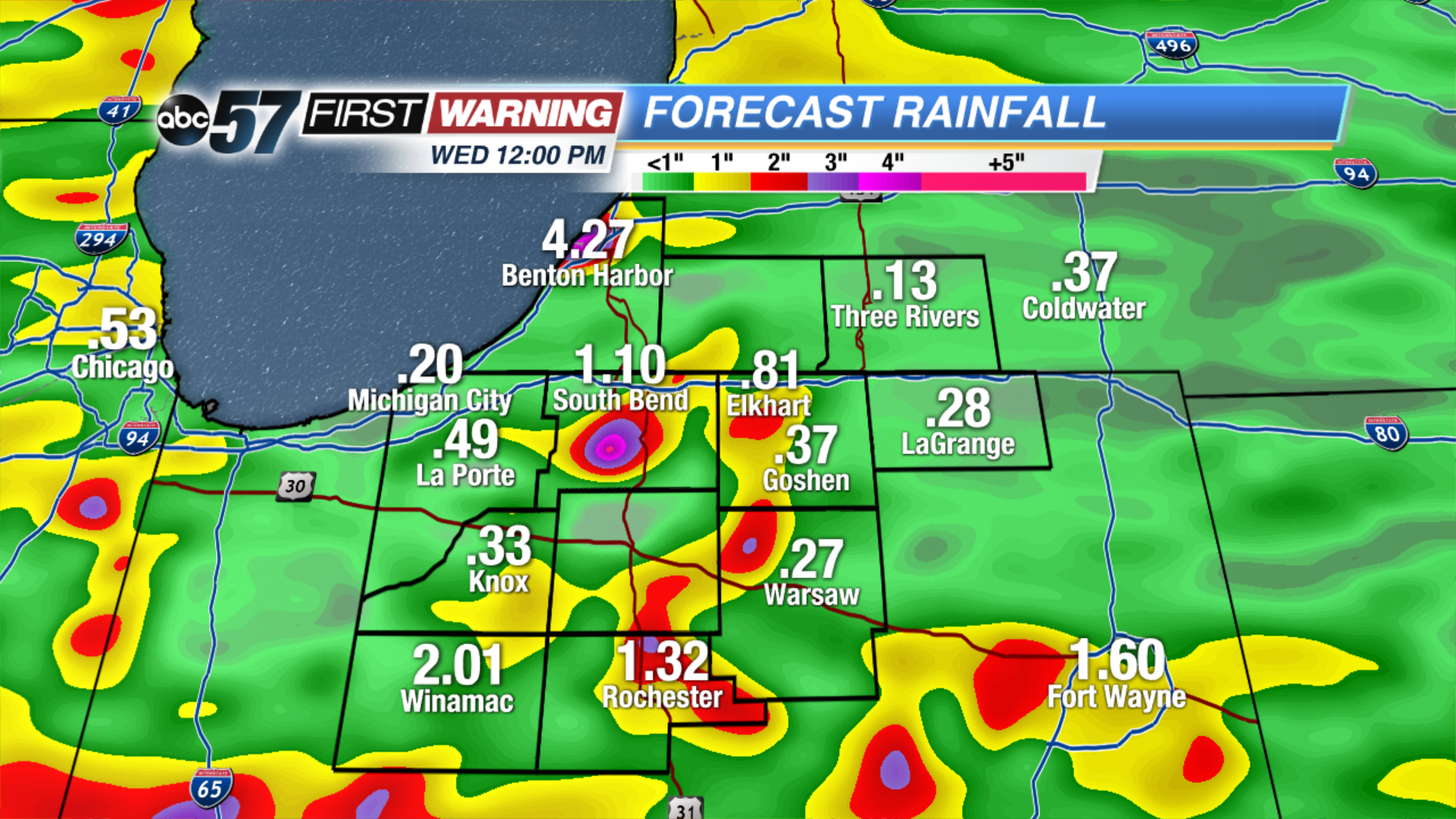
Scattered showers and thunderstorms Monday night will bring heavy downpours and break the heat but not the humidity.
The heat breaks Tuesday, as temps only warm into the low 80s but the mugginess persists for another day. Showers and storms stay in the forecast, the greatest threat being heavy rain and flooding. More than two inches of rain is possible through Wednesday. The forecast turns drier and milder midweek as skies clear Wednesday afternoon into Thursday.
Tonight: Scattered showers and storms, low 70.
Tuesday: Partly to mostly cloudy, scattered showers and storms, high of 80.
Wednesday: Morning showers and storms, high of 78.
Thursday: Mostly sunny, high of 80.
Sign up for the ABC 57 Newsletter