Temps head for 40s and even the 50s!
Posted: Nov 16, 2019 6:20 PM EDT
WEATHER FORECAST FOR SATURDAY, NOVEMBER 16TH
The pattern for the next four days will be relatively quiet aside from a slight chance of a light shower and/or snow shower late in the Sunday into Monday. Many of us will stay entirely dry, but that chance is there. No impacts are expected with highs pushing into the upper 30s each afternoon.
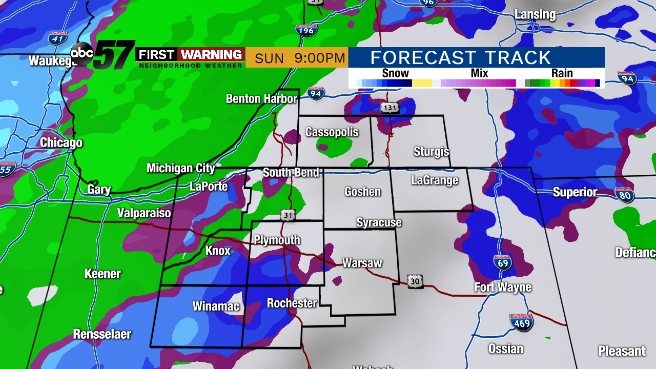 Small chance of light rain and/or snow Sunday evening/night.
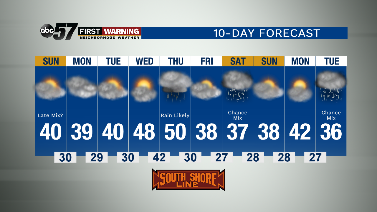
TONIGHT: Partly cloudy and cold. Low 25.
SUNDAY: Some sun during the morning with cloudy skies for the afternoon. Slight shower chance late. High 38.
MONDAY: Cloudy skies. High 39.
TUESDAY: Mostly cloudy. High 40.
