Another big drop in temperatures heading into the work week


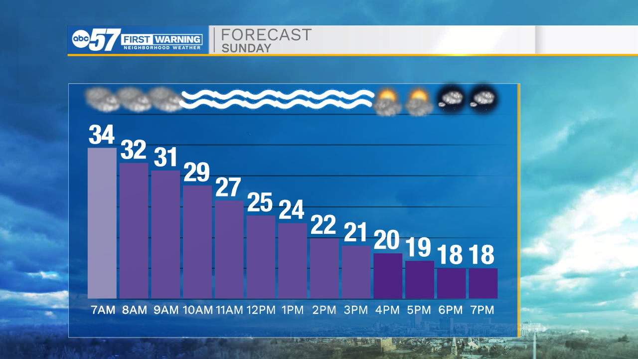
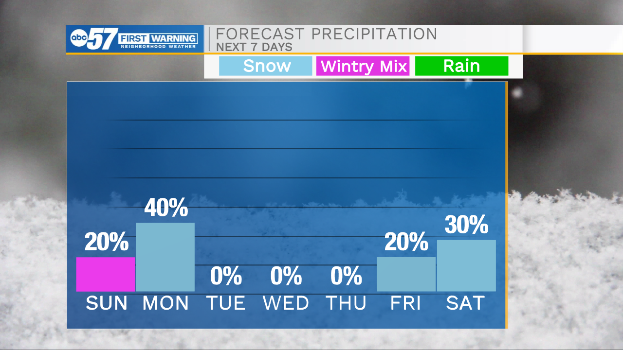
This morning temperatures are holding steady in the mid 30s, helping to keep from widespread slick spots on the roadways. However, as a cold front moves out of Michiana temperatures will begin to fall through the rest of the day. Temperatures will fall below freezing later this morning, this could lead to some refreeze of wet roadways, especially untreated roadways. Make sure to take it slower and leave yourself extra time to get where you need to go. Sidewalks and parking lots this morning are also slick, so be careful. Temperatures will fall into the teens by early this evening, and keep dropping through the overnight. It will be a bitter cold start to your Monday morning. Lake effect snow is possible throughout Monday morning as well. This will primarily impact northern Michiana again, bringing chances for another 1-2 inches. Dryer weather is in store for the middle part of next week with high temperatures in the 30s.
Today: Cloudy AM/Sunny PM. High 35.
Tonight: Isolated snow showers. Low 12.
Tomorrow: Lake effect snow. High 17.
Tuesday: Partly cloudy. High 26.