


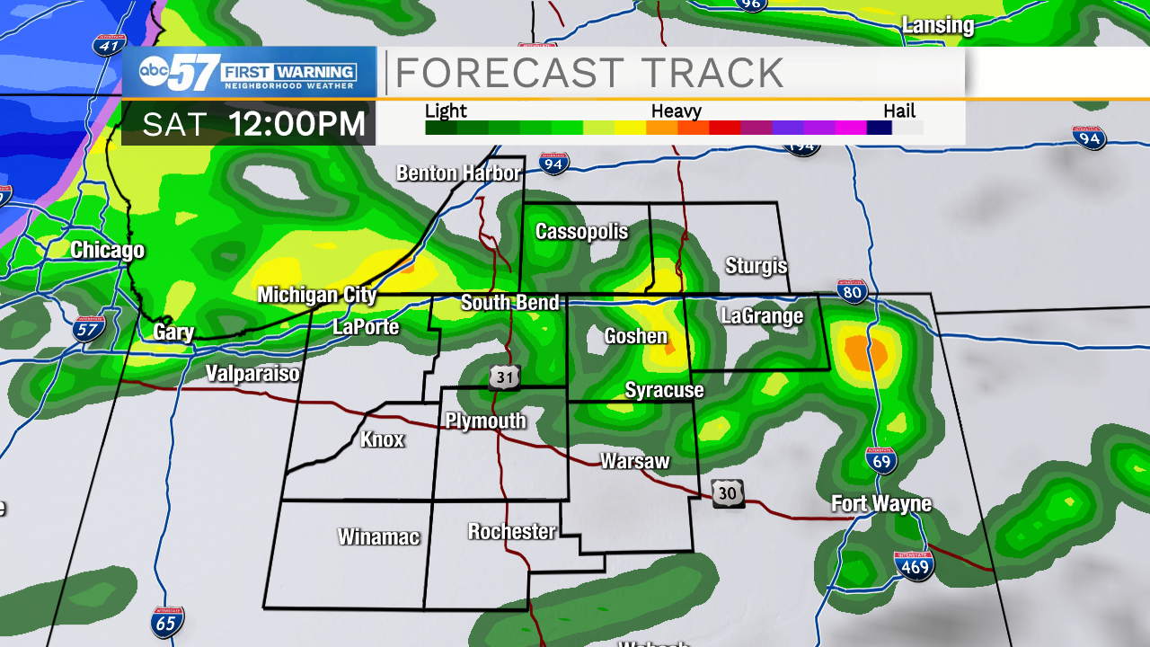
It's a wet start to the weekend. Rain stays widespread until noon, then showers become more scattered this afternoon.
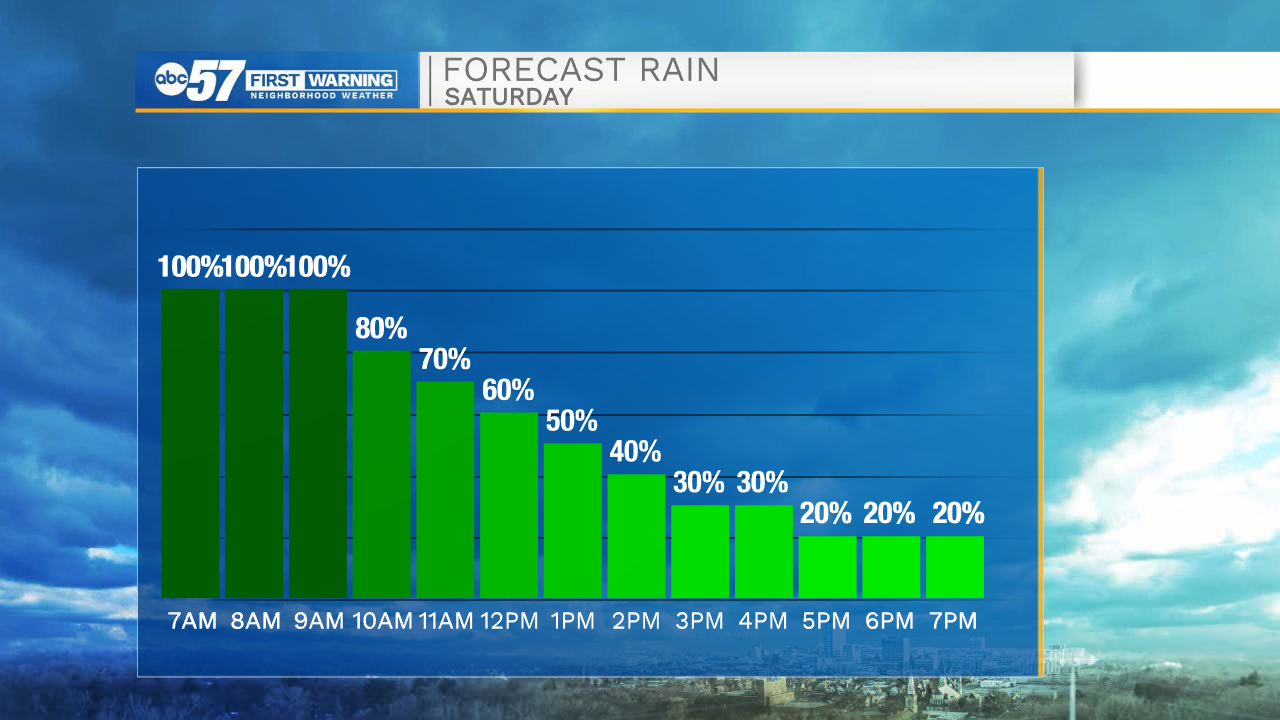
Temperatures Saturday morning are in the mid 40s. The high temperature for today is technically 50 degrees, but after we hit 50, temperatures will fall back into the mid 40s by afternoon.
Overnight temperatures continue to fall to a low in the mid 30s.
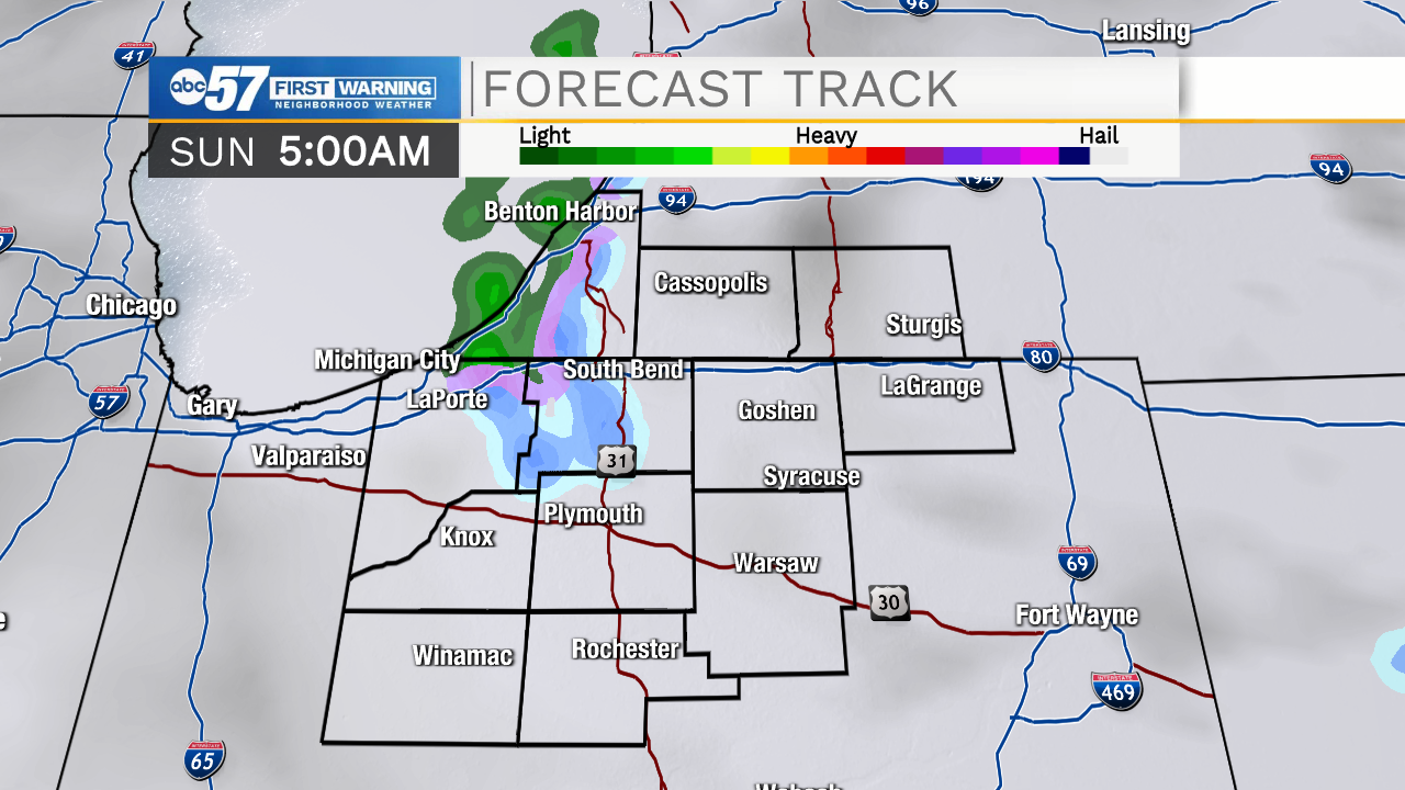
Most of the precipitation also wraps up overnight, but early Sunday morning, we could see a few lake effect snowflakes.
Thankfully after a wet Saturday, it isn't looking like the snow will stick. The rest of Sunday looks dry but cool. The high will be in the upper 30s. Looking ahead to this week, it is going to be a bit dreary with daytime highs in the low to mid 30s and generally cloudy conditions.
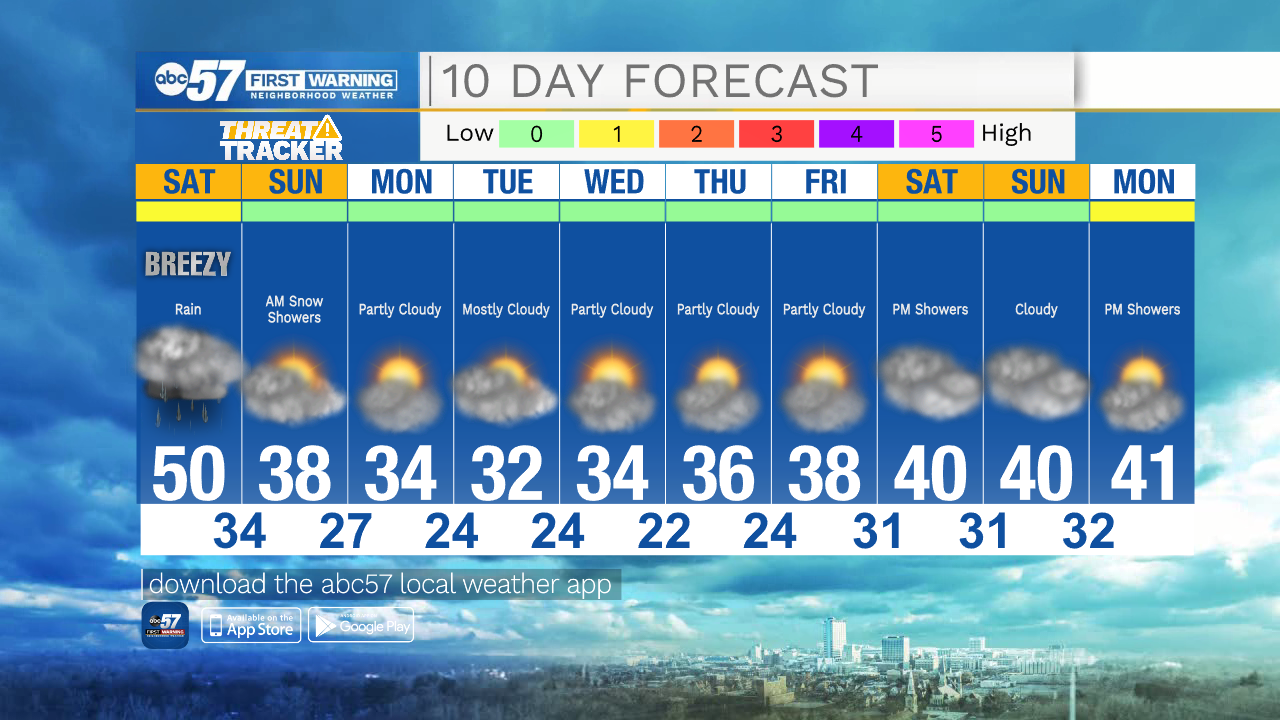
Today: Rainy. Temperatures falling from 50 degrees.
Tonight: Cloudy, few snow showers. Low 34.
Sunday: Mostly cloudy. High 38.
Monday: Partly cloudy. High 34.