Snowy Saturday, Michiana on the edge of a Midwest storm
By:
Tom Coomes
Posted: Jan 11, 2019 4:41 PM EDT

-
2:31

National Weather Service confirms tornadoes
-
2:04

Cold out the door, Fair by afternoon
-
0:20

School City of Mishawaka approves Growing Together Preschool,...
-
2:15

“Hoosier Hospitality, Hoosier Lanes” local business in Wheatfield...
-
2:34

Local student earns spot at the Scripps Howard National Spelling...
-
2:38

NWS confirms EF-2 tornado hits Starke County Tuesday night
-
0:59

Edwardsburg tornado cleanup continues after second round storm
-
2:28

Once in “tornado emergency,“ Knox residents reflect on twister’s...
-
3:11

SJC police officer talks flooding danger on roads
-
2:18

People in Starke County prepare to fix damage after Tuesday night’s...
-
1:07

A reminder it’s March, snow returns by next Monday
-
2:15

Starke County face-to-face with severe weather

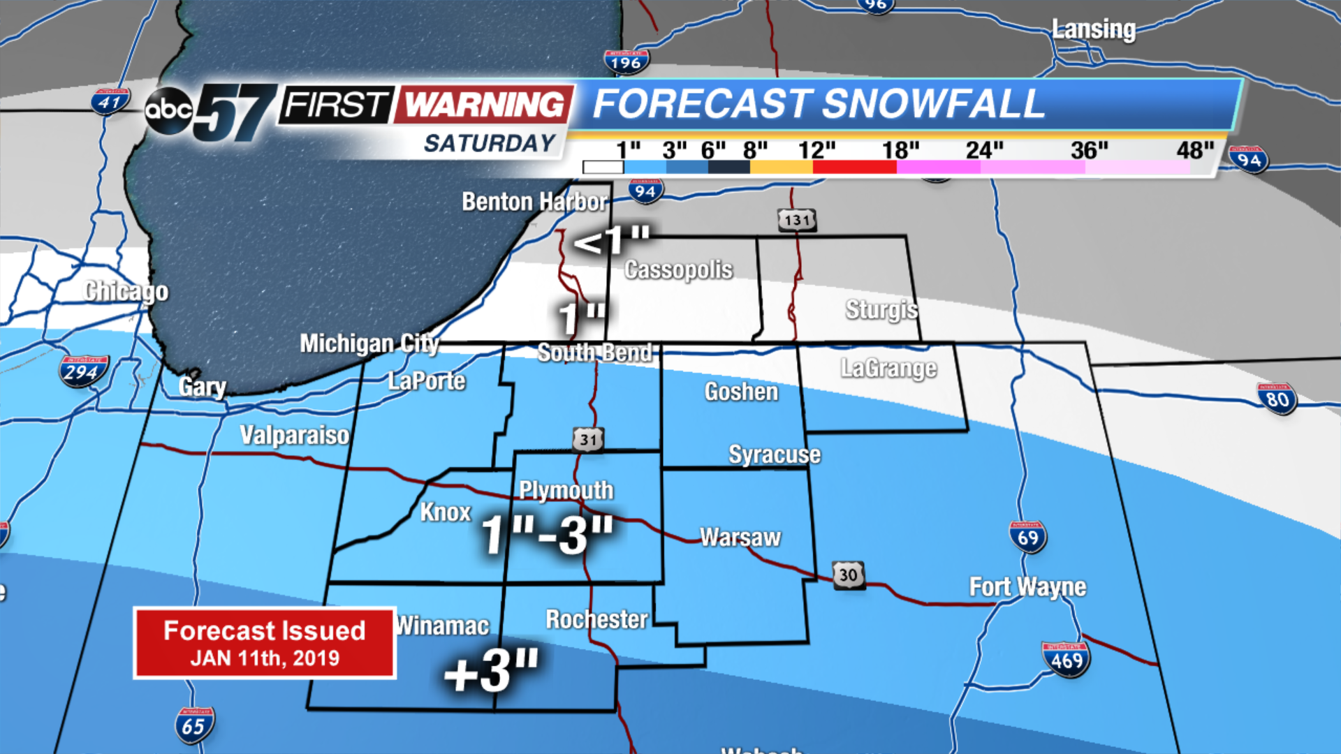
Snow starts for some Saturday morning, increasing northward with a peak of steady snow through the afternoon and evening, ending around midnight. Michiana remains on the edge of this headline Midwest storm with marginal amounts predicted mostly in the one to three inch range. Areas south of U.S. Highway 30 will see the most snow, with the likelihood of six inches towards Indianapolis. Skies clear into Sunday, fair weather to end the weekend and to start next week.
Tonight: Cloudy. Low of 24.
Saturday: Snow showers. High of 32.
Sunday: Mostly sunny. High of 32.
Monday: Mostly sunny. High of 34.
Sign up for the ABC 57 Newsletter