Snow starts again Monday

-
2:15

Concerns for rise in gun violence after five-year-old injured...
-
2:39

Early voting ahead of May primary
-
2:41

Questions remain after missing 15-year-old Benton Harbor boy...
-
3:24

Landlords feel ’forced’ to raise rent amid rising property...
-
2:15

Two rounds of storms Tuesday
-
1:31

Benton Harbor Area Schools washing away worries for families...
-
2:12

Quiet today, storm threat tomorrow and Wednesday
-
3:50

Plymouth community hosts 5K in the fight against ALS
-
2:10

Sunny Monday ahead, but showers and thunderstorms later this...
-
2:10

Plymouth High School hosts ’Steps for Stegs’
-
2:05

Drier but cooler to wrap up the weekend
-
6:23

ABC57’s Arts and Acts: Local dance stars shine at A&A Ballet...

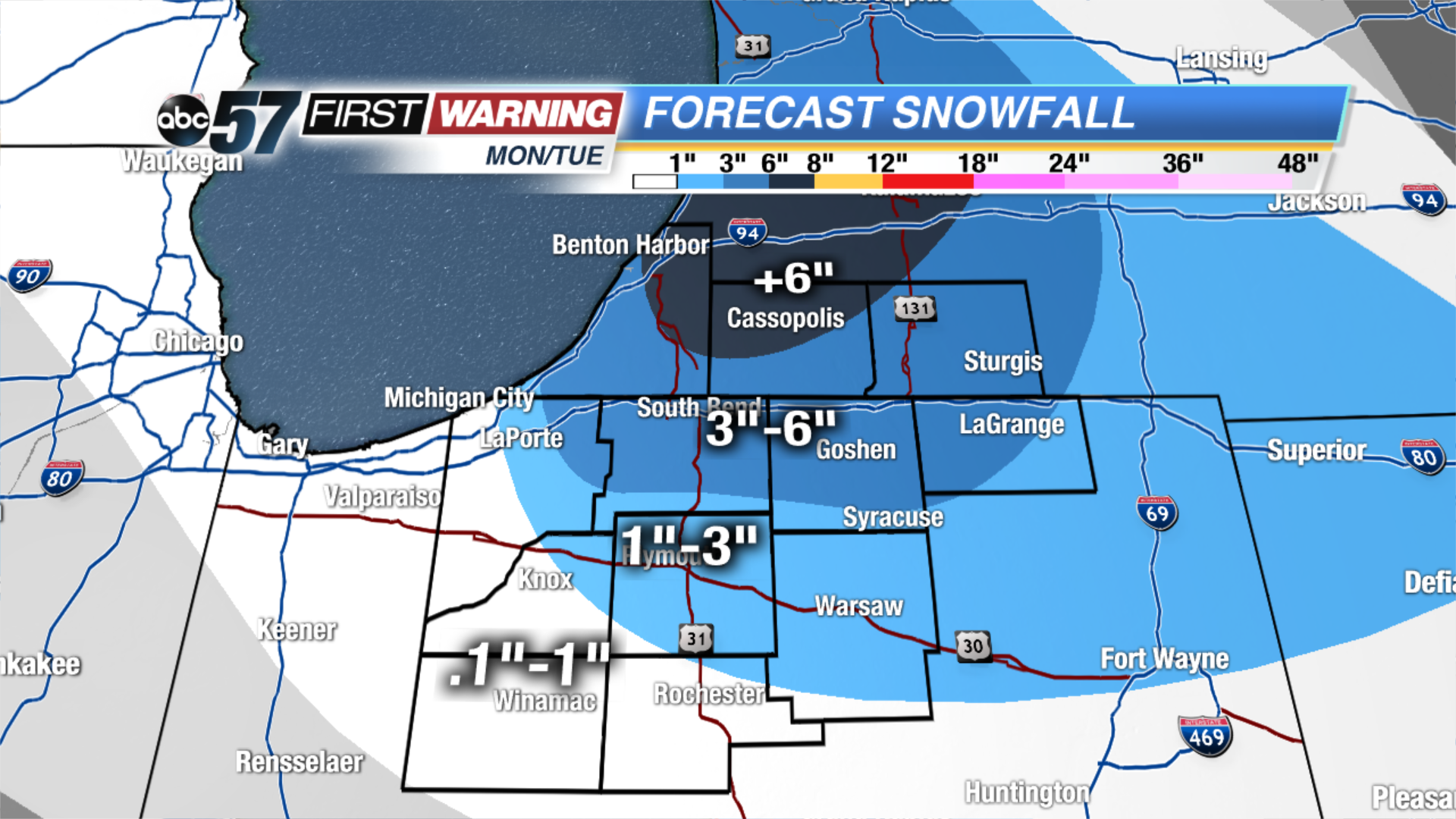
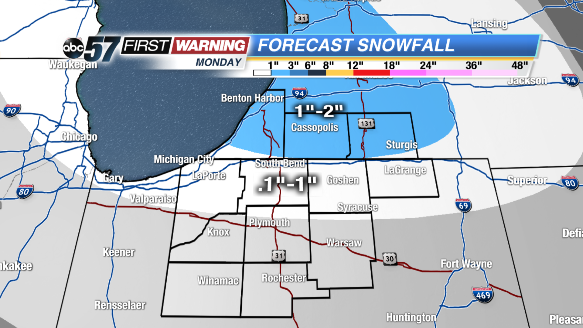
We have a snowy week ahead of us! The next winter system will bring snow showers and then lake effect snow, starting Monday and lasting until Wednesday. The system will bring light snow showers during the midday on Monday, mainly for our Michigan counties, and far northern Indiana counties. The snow will intensify for this area during the evening. Then, on Tuesday, a lake effect snow band will develop in the north/south direction. This will bring the snow further south to parts of Starke, Marshall, and Kosciusko counties.
Overall from Monday through early Wednesday morning, up 5-almost 8” will fall for Berrien and Cass counties. 3-5” for parts of Berrien, LaPorte, St. Joseph (IN), Elkhart, LaGrange, and St. Joseph (MI) counties. 1-3” for the northeast corner of Starke, Marshall, Kosciusko and eastern LaGrange counties. Less than or equal to 1” for parts of Starke, Pulaski, Fulton and far south Kosciusko counties.
Tonight: Mostly cloudy. Flurries possible. Low of 22.
Monday: Mostly cloudy with snow showers developing midday. High of 34.
Tuesday: Mostly cloudy with L.E. snow. Highs in the mid 20s.