Snow showers start this evening, slick roads and periods of heavy snow possible


ABC57 First Warning Neighborhood Weather Forecast
Monday, January 25th, 2020
The first half of today is quiet with a flurry possible. Around 6-7pm is when the snow and wintry mix begins. It is a split forecast across Michiana, the dividing line is near Plymouth. Everyone will be impacted by this storm but snowfall totals will vary greatly from north to south.
North of US-30: Snow showers pick up after 6pm with the heaviest snow expected around midnight. Roads will quickly turn slick with gusty wind causing some blowing and drifting snow. Most will be 3-5” of snow but up to 6” of snow is possible.
South of US-30: The system starts out as a wintry mix for you with light freezing rain possible. Any untreated roads will likely be slick. The wintry mix turns to snow between 2-3am. 1-3” of snow is possible through Tuesday.

Scattered light snow showers wrap up Tuesday afternoon. It turns colder for Wednesday with a chance of lake effect flurries in the evening. Much quieter for the rest of the week with some sunshine. The next system moves in Saturday evening, bringing the chance of rain and snow.
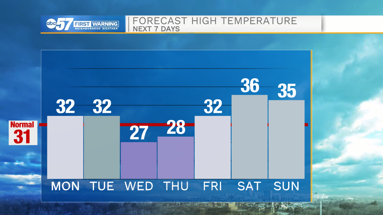
Today: PM Snow showers. High 32.
Tonight: Snow showers. Low 27.
Tuesday: Scattered snow showers. High 32.
Wednesday: Partly to mostly cloudy, flurries possible. High 27.