Snow lasts through the evening, cold & slick morning
By:
Tom Coomes
Posted: Feb 17, 2022 4:53 PM EDT

-
2:59

Dusty May leads Michigan back to Final Four with dominant win...
-
0:37

Vendors and cosplayers showcase art at South Bend Anime Fest
-
3:06

Palm Sunday procession in South Bend unites faiths in call to...
-
0:48

2026 Auto Show brings crowd to Century Center Sunday
-
2:34

Warm to start the week, Rainy week ahead
-
2:44

Warmer, breezier, and cloudier than yesterday
-
0:46

Crowds gather for Fins and Feathers Fest at La Porte City Fairgrounds
-
0:46

Paramount School of Excellence hosts teacher fair
-
2:30

Voting advocacy, peaceful demonstrations and donations: South...
-
2:04

Warming to start the week, Showers and storms by Tuesday
-
2:10

Cool, but calm, today
-
1:23

City of South Bend presents an ’Age-Friendly Plan’ to better...

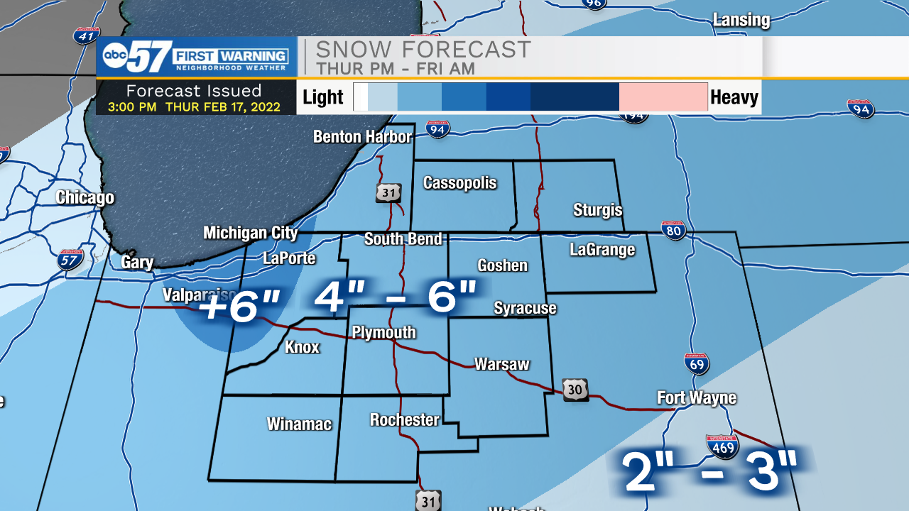
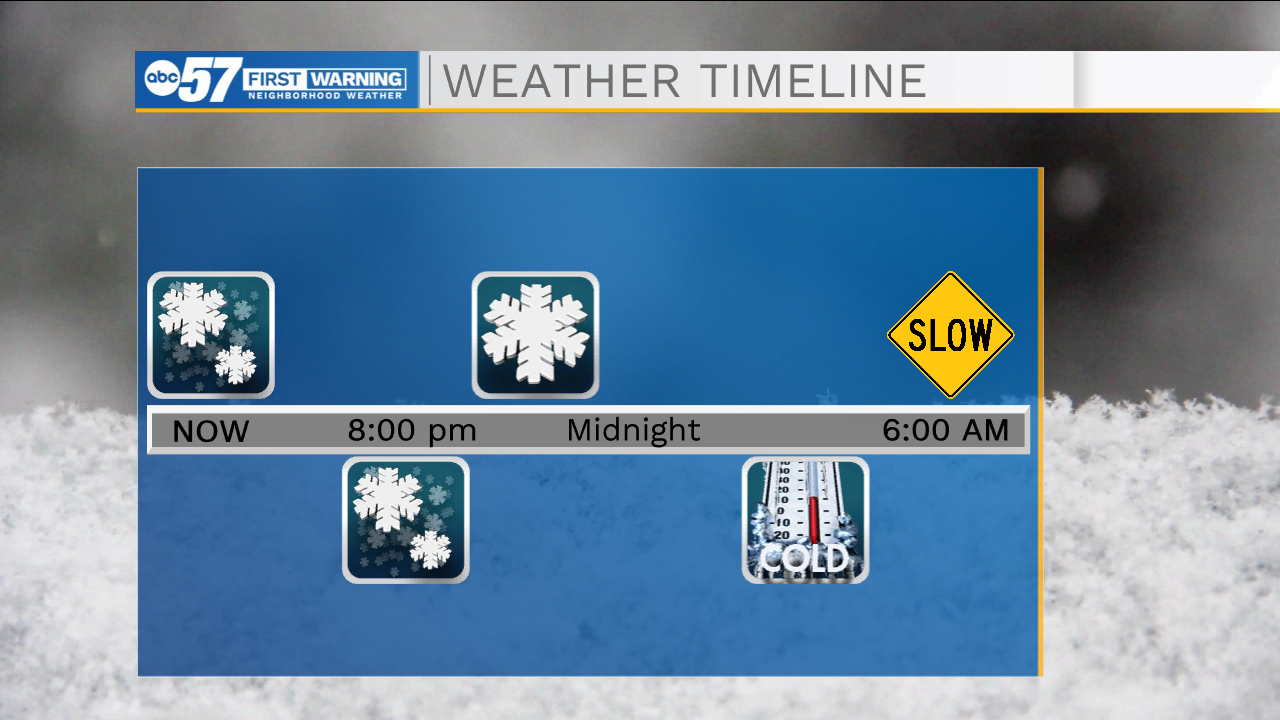
The snow is at its peak 4:00 to 8:00 PM, where a quick 4" could fall, most will see final totals in the 4" to 6" range. The snow ends after 10:00 PM. Temperatures fall quickly and slick, snowy travel is still likely Friday morning.
Friday and Saturday are cold and breezy days, then temperatures warm Sunday and Monday, likely melting the latest round of snow. Early next week may have continued flood concerns with snow-melt and rainfall. Temperatures swing from 50 back to the 20s.
Tonight: Snow early. Low 14.
Friday: Clearing High 26.
Saturday: Partly cloudy. High 24.
Sunday: Mostly sunny. High 42.
Sign up for the ABC 57 Newsletter