Snow continues to melt and the quiet weather remains

-
1:06

Marshall County Humane Society reschedules Dog Egg Hunt
-
2:01

Martin Luther King Dream Center hosts MLK March in South Bend
-
1:54

South Bend Cubs opener postponed by weather, but fans still find...
-
2:01

Sights and sounds from South Bend Cubs Opening Day
-
1:32

NIPSCO ’flatly rejected’ further negotiations, USW workers...
-
3:36

The art of groundskeeping at Four Winds Field
-
3:32

The history behind America’s only ballpark synagogue turned...
-
1:59

South Bend opens season against Quad Cities in familiar Midwest...
-
4:21

South Bend Cubs owner discusses $48M stadium expansion, changes...
-
3:19

A look into the new South Bend Cubs 2026 roster
-
5:17

Expansion goes beyond Four Winds Field, new restaurants, bars,...
-
6:18

What’s new this season? South Bend Cubs unveil major improvements...

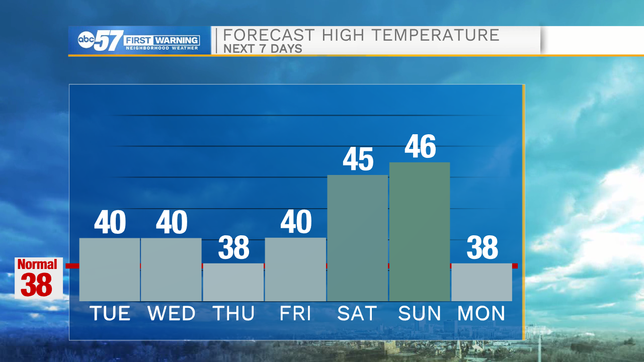
ABC57 First Warning Neighborhood Weather Forecast
Tuesday, February 23rd, 2021
Clouds break up late this morning with daytime topping out at 40 degrees! We will be watching for potential fog development in the nights to come from the mix of all the melting snow and calming winds. A few more clouds on Wednesday with the chance of an isolated shower. More sunshine to come Thursday and Friday. Daytime highs will remain in the upper 30s to low 40s through Friday. Temperatures rise into the mid 40s over the weekend. We are just tracking the chance for minor precip on Saturday.
Today: AM clouds then partly cloudy. High 40.
Tonight: Partly to mostly cloudy. Low 32.
Wednesday: Mostly cloudy, isolated shower possible. High 40.
Thursday: Partly cloudy. High 38.