
-
3:19

Mishawaka apartment resident raises concerns over algae-filled...
-
2:55

USA World Cup watch party at Manny’s Sports Bar
-
3:15

RedBud Nationals brings 4th of July motocross tradition back...
-
1:49

RedBud organizers prepare for high temps at this weekend’s...
-
2:10

Indiana FSSA breaks down report on SNAP error rates
-
2:53

Street camping now illegal across Hoosier state
-
2:37

Preview the possibilities at the St. Joseph County 4H Fair
-
1:17

Local reactions to the Supreme Court’s ruling on transgender...
-
2:32

Local experts and politicians weigh-in on the Supreme Court’s...
-
8:00

250 years of Indiana sports history, a legacy built across generations
-
7:19

Savoring Michiana
-
3:16

Dowagiac residents seek class action over noise from hyperscale...

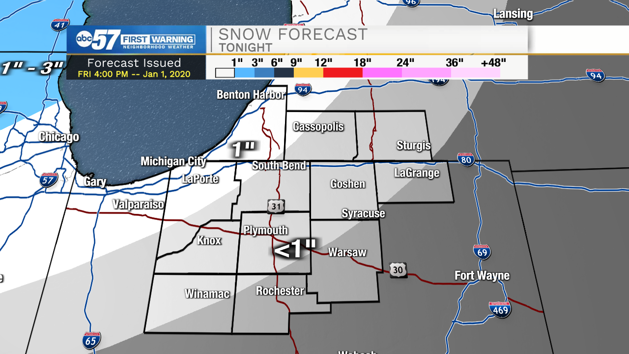
Tonight: Slick travel is still a concern. A wintry mix changing to snow around midnight could add up to an inch of snow to an already slippery situation. Temperatures stay below freezing overnight.
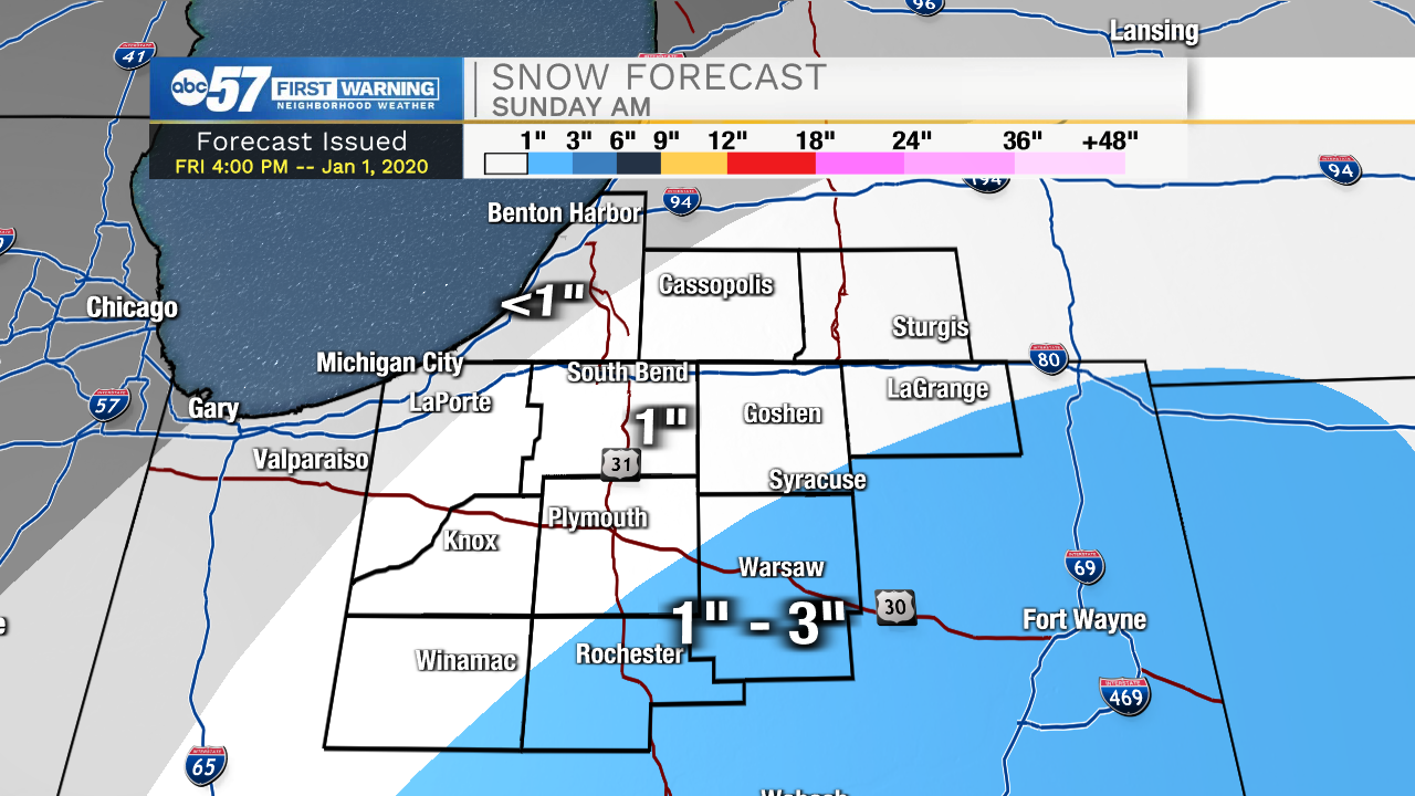
Saturday should bring some relief from slick conditions with some sunshine and highs in the mid-30s. The next storm system skirts the area Sunday morning, favoring the most snow towards the southeast where up to three inches are possible. The snow will melt next week with highs in the upper 30s to low 40s. A relatively mild start to January.
Saturday: Mostly cloudy. High 36.
Sunday: Morning light snow, mostly cloudy. High 36.
Monday: Mostly cloudy. High 38.
Sign up for the ABC 57 Newsletter