Slick spots possible Tuesday morning, watching the weekend snow

-
1:45

Windy and wet this weekend, but unseasonable warmth as well
-
3:13

Local players react to $3 million investment in Byer Softball...
-
0:32

Layoffs at Whirlpool could affect workers in Benton Harbor
-
1:03

Annual District Sisterhood Conference at Ivy Tech empowers students
-
1:49

Back home in downtown South Bend, YMCA to open new location
-
2:16

This week’s ABC57 Cub Reporter is Nicholas Zentz
-
3:05

Amazon Web Services invests $11 billion to build data center...
-
4:05

Riley High School student center stage at the NFL Draft
-
1:35

Rain, wind, and milder temperatures forecast this weekend
-
2:49

Joe Alt expected to be drafted in the first round of NFL Draft
-
2:11

Students gearing up for local careers in Manufacturing
-
2:13

Sunny today, but expect a wetter and warmer weekend

Light freezing drizzle or fog may develop overnight into early Tuesday leading to a glaze of ice and slick spots early Tuesday.
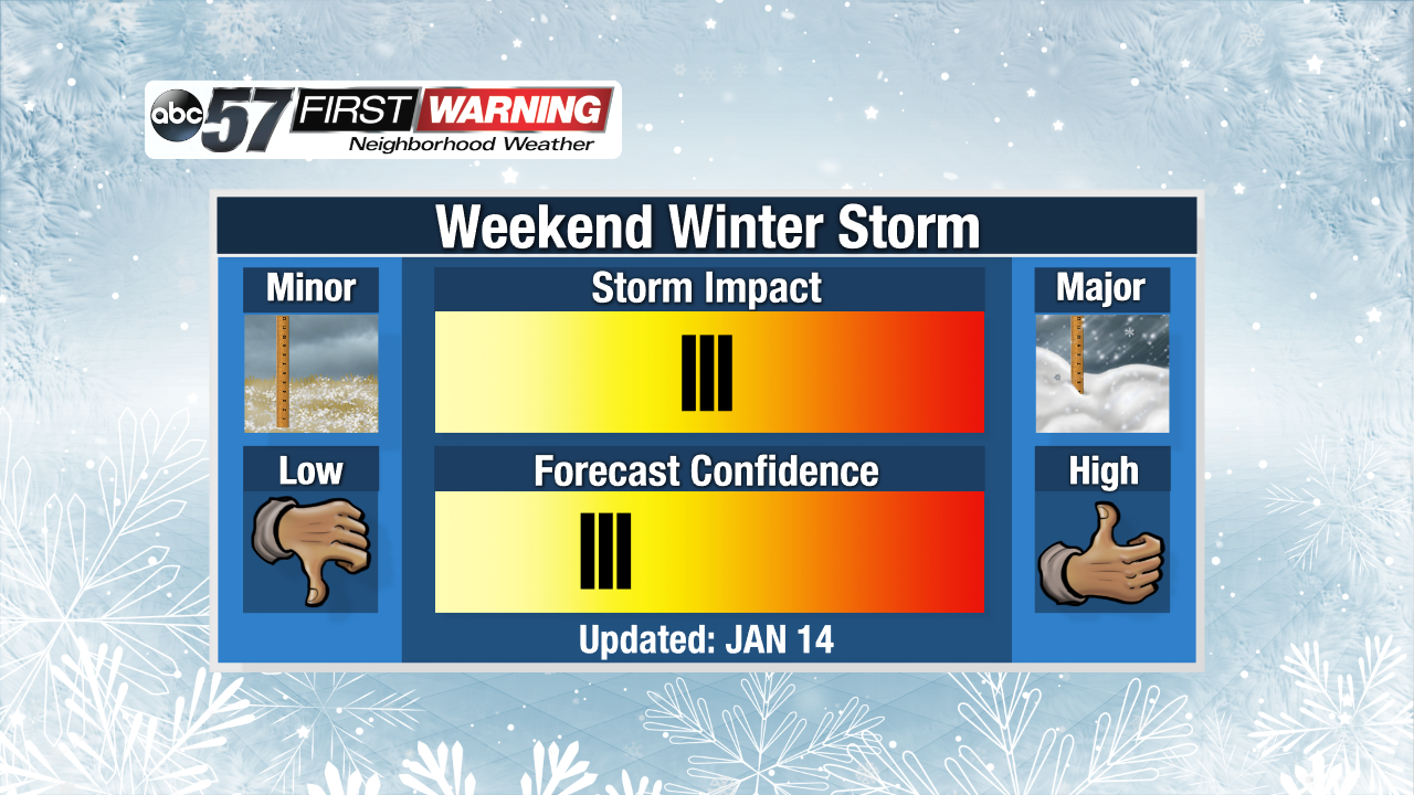
Cold and cloudy weather continues Tuesday and Wednesday with highs peaking just above freezing and the possibility of freezing fog or drizzle. A weak system will bring a chance of snow Thursday, followed by a lull Friday. The focus will be on a system that could bring widespread snow Saturday and lake effect Sunday. Snow looks likely but the finer details will become more clear later this week.
Tonight: Cloudy, patchy freezing fog / drizzle. Low of 22.
Tuesday: Cloudy, patchy freezing fog / drizzle. High of 34.
Wednesday: Mostly cloudy, patchy freezing fog / drizzle / snow. High of 34.
Thursday: Light snow showers, high of 32.