


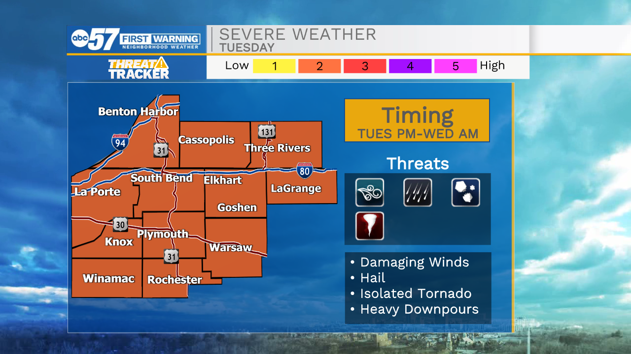
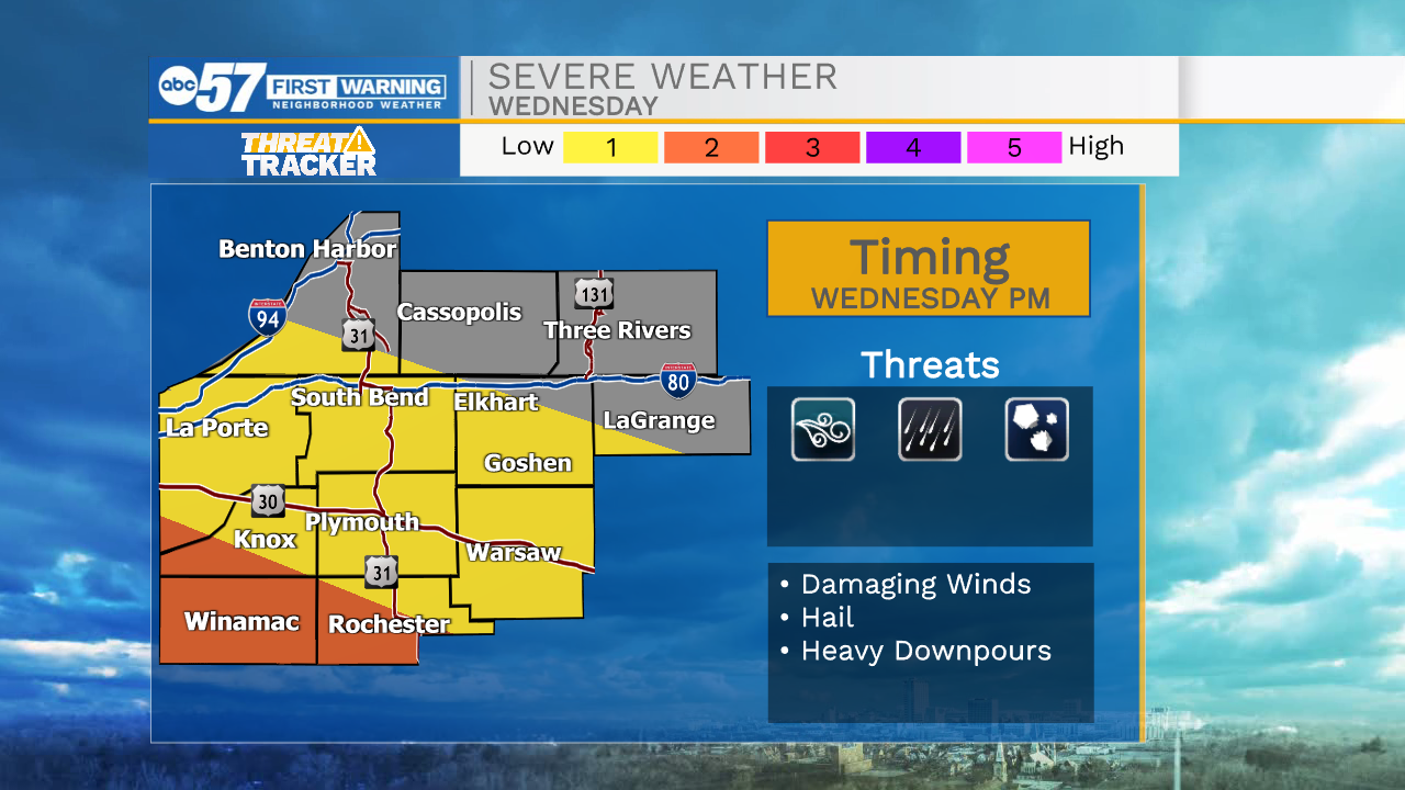
Rain showers and thunderstorms will move into Michiana during the early evening. That round will clear out before another round moves in after midnight. Any storms that do develop will have the chance to be on the strong to severe side. The main threats will be damaging wind gusts, hail, and very heavy downpours. There is a low tornado threat as well, but seems very unlikely. Showers and storms will stick around throughout mid-morning tomorrow before mostly clearing out into tomorrow afternoon. High temperatures for Tuesday will top out in the lower 90s. More rain showers and thunderstorms will arrive tomorrow evening and stick around into Wednesday. There is also a low severe potential with that round as well. Off and on showers/storms will impact us here in Michiana Wednesday and Thursday. Finally, rain will begin to move out Friday, then dry weather is in store for next weekend. High temperatures will drop into the 80s later through the week.

Tonight: Scattered showers/storms. Low 72.
Tomorrow: Partly cloudy/PM showers/storms. High 90.
Wednesday: Scattered showers/storms. High 87.
Thursday: Scattered showers/storms. High 85.