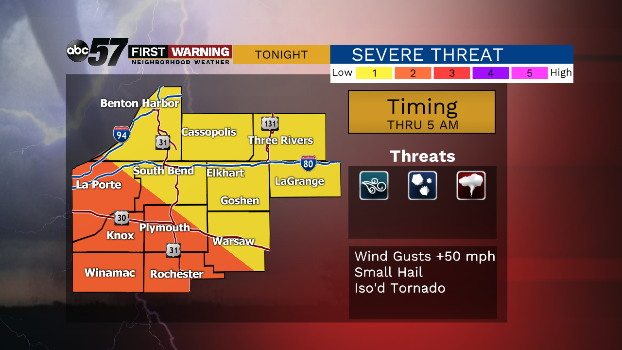
Scattered storm threat overnight, much colder Friday

-
1:45

Windy and wet this weekend, but unseasonable warmth as well
-
3:13

Local players react to $3 million investment in Byer Softball...
-
0:32

Layoffs at Whirlpool could affect workers in Benton Harbor
-
1:03

Annual District Sisterhood Conference at Ivy Tech empowers students
-
1:49

Back home in downtown South Bend, YMCA to open new location
-
2:16

This week’s ABC57 Cub Reporter is Nicholas Zentz
-
3:05

Amazon Web Services invests $11 billion to build data center...
-
4:05

Riley High School student center stage at the NFL Draft
-
1:35

Rain, wind, and milder temperatures forecast this weekend
-
2:49

Joe Alt expected to be drafted in the first round of NFL Draft
-
2:11

Students gearing up for local careers in Manufacturing
-
2:13

Sunny today, but expect a wetter and warmer weekend

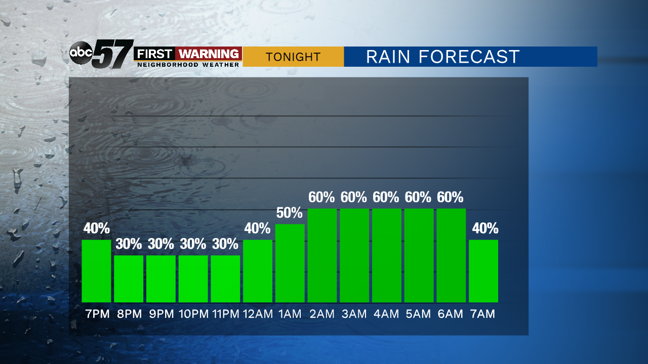
Widespread rain ends this evening and temperatures spike into the 60s. The milder conditions fuel the possibility of scattered thunderstorms through the early morning. Temperatures will fall sharply early Friday morning.
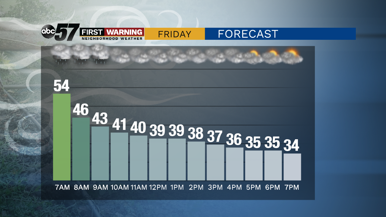
Friday temperatures only get colder. Falling from the 50s early to the mid-30s by the afternoon. Wind gusts could gust as high as 40 mph. Clouds clear into the weekend, chilly but fair Saturday and Sunday. Temperatures return to the 50s by the middle of next week. The pattern turns wet and possibly stormy again next Wednesday and Thursday.
Tonight: Scattered storms, strong to severe possible. Low 54.
Friday: A few AM showers then partial clearing. Breezy with temperatures falling from 54.
Saturday: Mostly sunny. High 38.
Sunday: Mostly sunny. High of 42.