Scattered showers will move into Michiana later this evening

-
3:13

Local players react to $3 million investment in Byer Softball...
-
0:32

Layoffs at Whirlpool could affect workers in Benton Harbor
-
1:03

Annual District Sisterhood Conference at Ivy Tech empowers students
-
1:49

Back home in downtown South Bend, YMCA to open new location
-
2:16

This week’s ABC57 Cub Reporter is Nicholas Zentz
-
3:05

Amazon Web Services invests $11 billion to build data center...
-
4:05

Riley High School student center stage at the NFL Draft
-
1:35

Rain, wind, and milder temperatures forecast this weekend
-
2:49

Joe Alt expected to be drafted in the first round of NFL Draft
-
2:11

Students gearing up for local careers in Manufacturing
-
2:13

Sunny today, but expect a wetter and warmer weekend
-
0:54

Goodwill ’Little Black Dress’ event raises funds for community...

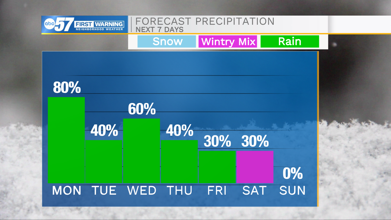
Scattered showers return to Michiana by 10-11pm this evening. Rain will impact everyone heading into Monday morning. Showers will begin to move out closer to lunchtime tomorrow. A few isolated showers will linger into the afternoon and evening, but those should remain very low impact. High temperatures for tomorrow afternoon will top out in the lower 50s. The next round of rain will arrive Tuesday evening, and again turn scattered heading into Wednesday morning. Rain chances will remain in the forecast for Thursday and Friday as well. Some of that rain will turn to a wintry mix heading into next weekend. Dry weather returns for next Sunday, giving us a day to dry out from this wetter pattern. Temperatures through the week will warm into the lower 60s on Wednesday then drop back into the 40s heading into the weekend.
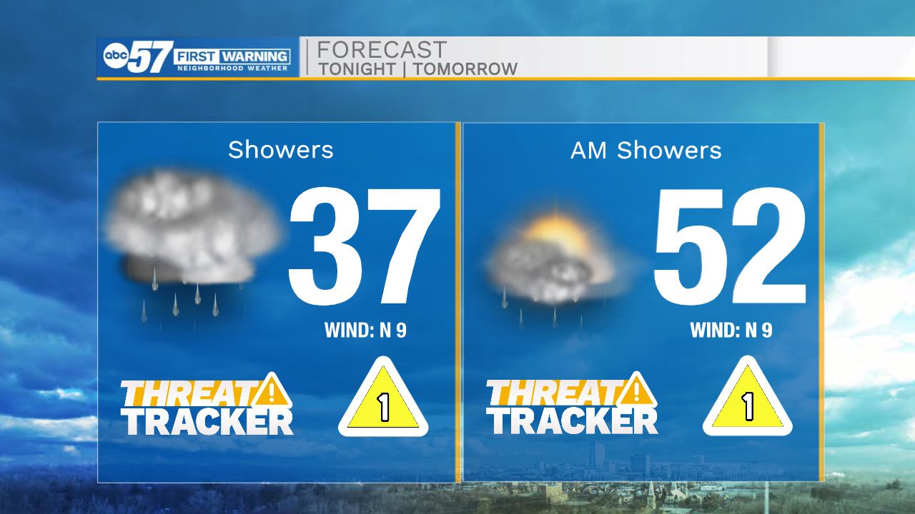
Tonight: Scattered showers. Low 37.
Tomorrow: AM scattered showers. High 52.
Tuesday: PM rain. High 58.
Wednesday AM scattered showers. High 60.