


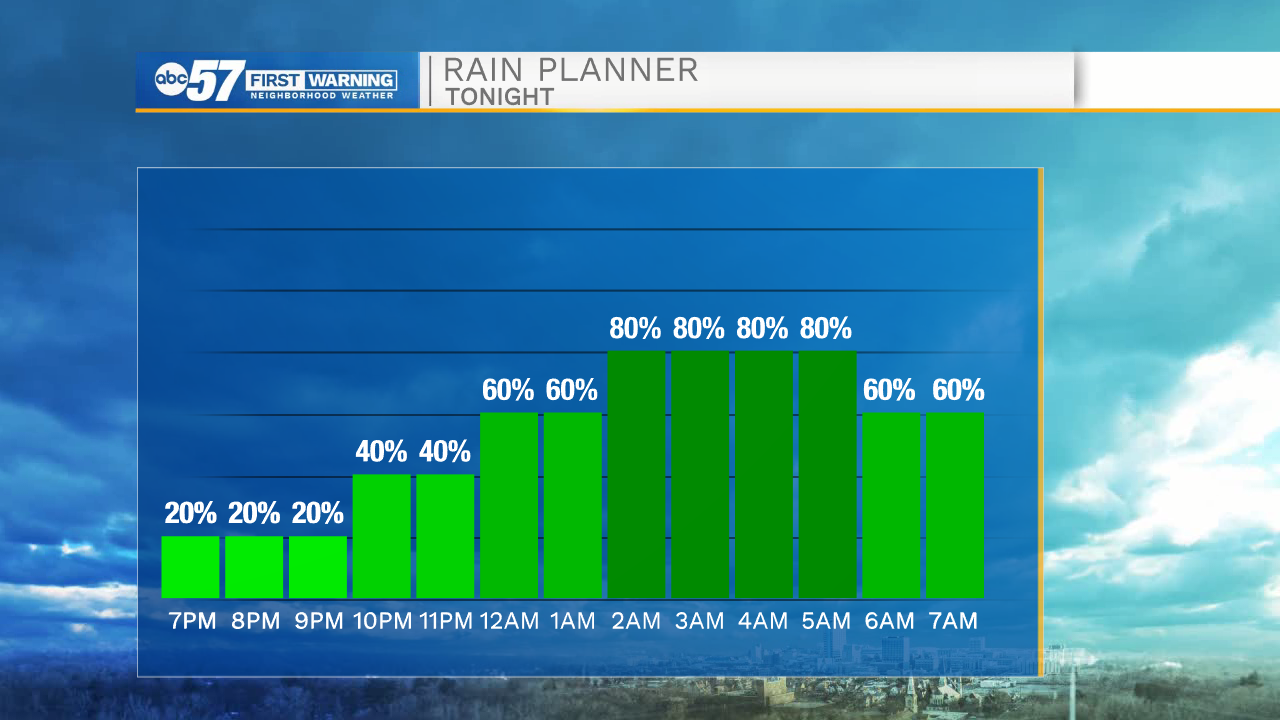
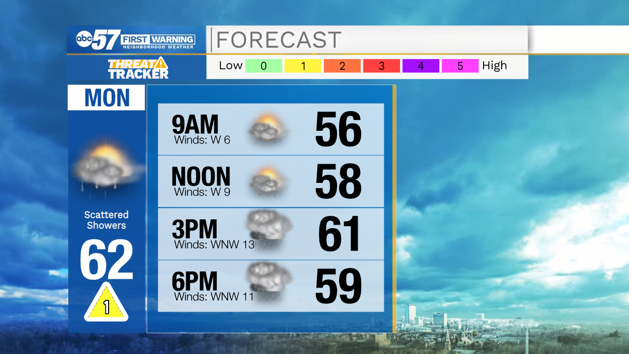
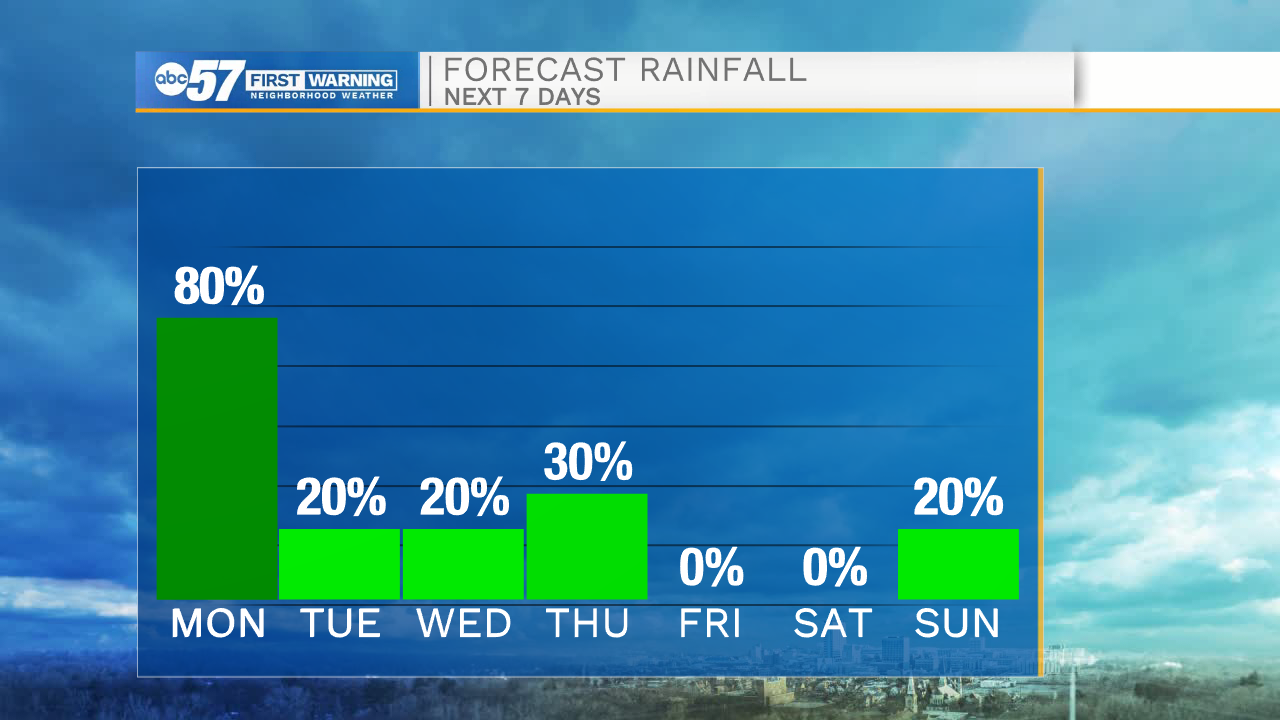
Cloud cover will continue to increase as we go throughout the evening and overnight hours. Rain showers will develop out to the west and push east during the early morning tomorrow. Moderate to heavy downpours are expected along the line of rain tonight. Rain activity will stick around through most of the morning tomorrow, but then turn isolated during the afternoon. High temperatures tomorrow will only hit the lower 60s. Tuesday and Wednesday look mostly dry, but a few isolated showers can’t be ruled out.

Another cold front will move into Michiana Wednesday evening, bringing better chances for a few showers on Thursday. High temperatures by Thursday afternoon will be in the mid 50s. Friday looks dry for now, but then more rain chances move back in Saturday night into next Sunday. High temperatures next weekend will hold in the mid 50s.
Tonight: Scattered showers. Low 55.
Tomorrow: Isolated showers. High 62.
Tuesday: Partly cloudy. High 64.
Wednesday: Partly cloudy. High 64.