Scattered showers and thunderstorms Monday

-
1:55

Baugo Township to hold meeting to discuss special audit
-
2:36

Strict security measures for Sugar Bowl
-
3:12

Former NYPD Police Officer shares how much planning goes into...
-
2:16

Jay’s Lounge honors New Orleans ahead of Sugar Bowl
-
3:03

Cold & breezy now, chances for intense snow return Sunday Night
-
5:35

Notre Dame fans react to deadly Bourbon Street attack
-
0:28

Elkhart General Hospital welcomes its first baby of the new year
-
2:02

Snow tonight, sub-freezing temperatures through next week
-
1:38

Remembering New Orleans terror attack victims
-
2:28

Travelers navigate hotel and flight changes following the New...
-
3:27

ABC57 speaks with Louisiana Attorney General Liz Merrill following...
-
6:49

ABC57 speaks with Bourbon St. business owner on the aftermath...

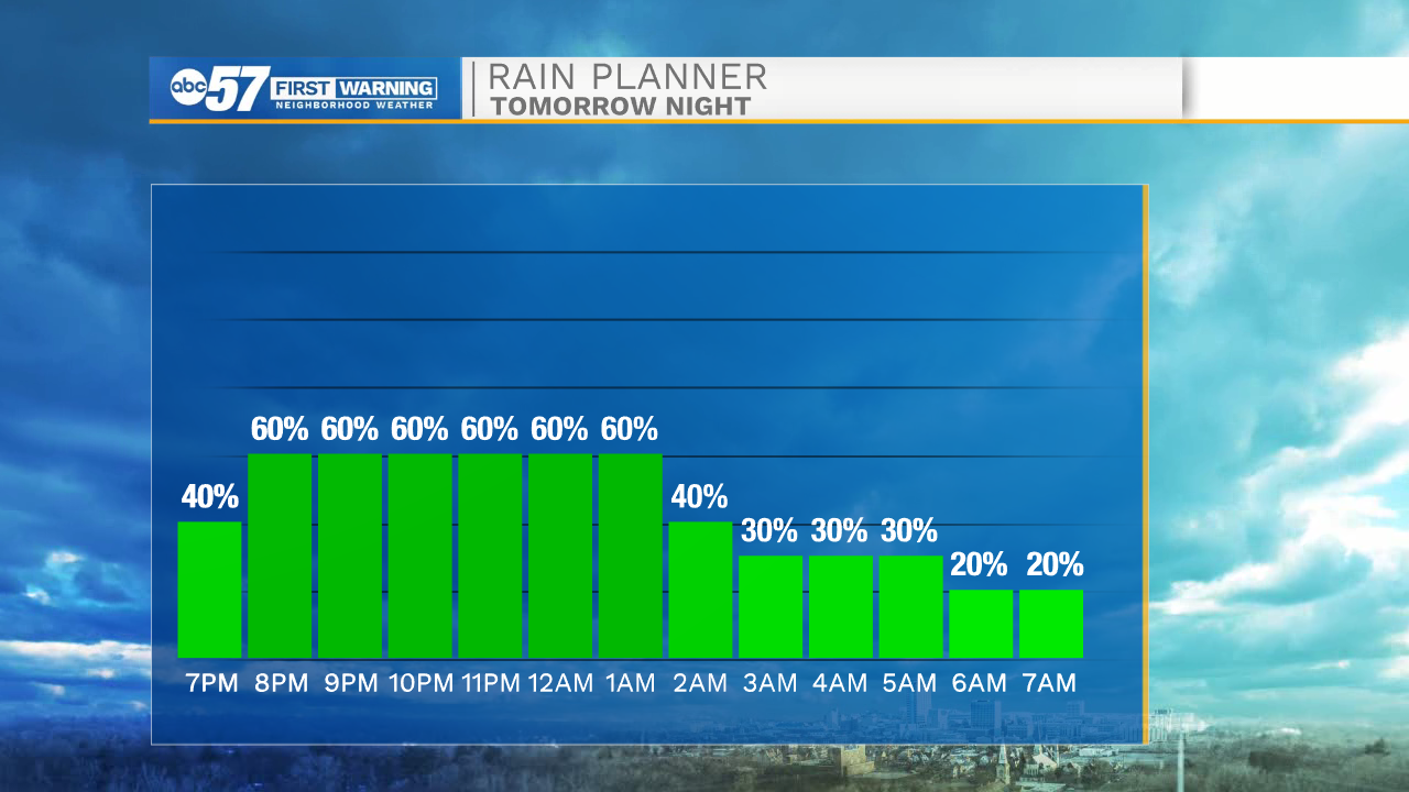
A few isolated showers and thunderstorms are possible later tonight in our western and southern Michiana counties. Showers should clear by mid to late morning tomorrow. We will catch some dry weather tomorrow afternoon with highs in the upper 80s, but then widespread showers and storms return tomorrow evening. A few of those storms could be on the strong to severe side with the main threat being wind gusts up to 50 mph. Heavy rain will last through the early morning Tuesday. Tuesday afternoon high temperatures will drop back into the low to mid 80s.
We have dropped the rain chances for Wednesday and Thursday. We should get a little sunshine to return mid to late week with highs holding in mid 80s. Another chance for isolated showers and storms return Friday afternoon. Pop up showers and storms can’t be ruled out for next Saturday and Sunday as well. Highs next weekend will be in the mid 80s.
Tonight: Partly cloudy with showers overnight. Low 70.
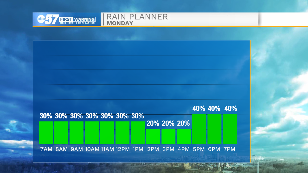
Monday: Showers and thunderstorms early. Dry afternoon. Thunderstorms evening/overnight. High 88.
Tuesday: Mostly/partly cloudy. Chance for isolated shower or thunderstorm. High 84.
Wednesday: Partly cloudy. High 82.