Rounds of thunderstorms and hot

-
2:12

St. Joseph County Commission primary results
-
1:00

Storms are done, fair Wednesday, rain Thursday
-
2:02

District 10 Senator David Niezgodski provides statement on recent...
-
1:43

Indiana’s 3rd Congressional District primary
-
2:35

Tornado Watch issued for Michiana this afternoon
-
0:38

Former assistant theater director charged with Child Seduction...
-
2:49

Upgrading Tuesday’s severe storm threat
-
2:15

Concerns for rise in gun violence after five-year-old injured...
-
2:39

Early voting ahead of May primary
-
2:41

Questions remain after missing 15-year-old Benton Harbor boy...
-
3:24

Landlords feel ’forced’ to raise rent amid rising property...
-
2:15

Two rounds of storms Tuesday

ABC57 First Warning Neighborhood Weather Forecast
Monday, August 9th, 2021
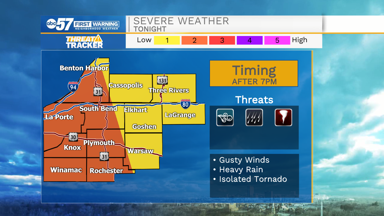
A round of scattered thunderstorms after 9am into the early afternoon. We'll have a break from the rain before another round of storms moves in late in the evening. This round could be strong to severe. Strong wind is the main threat, but heavy rain is also possible and isolated weak tornado cannot be ruled out.
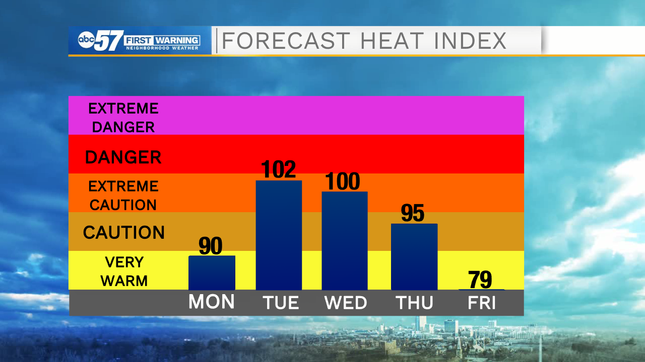
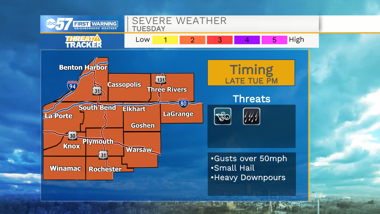
A few more isolated storms Tuesday with hot temperatures and some sunshine at times. Another round of scattered storms moves in Tuesday night. This round again could be strong to severe. A few more thunderstorms possible Wednesday before we dry out Thursday. Its nice into the weekend, with sunshine and low 80s.
Today: Scattered thunderstorms. High 85.
Tonight: Scattered thunderstorms, possibly strong to severe. Low 72.
Tuesday: Isolated storms. Strong storms possible late. High 90.
Wednesday: Scattered thunderstorms. High 88.