Remnants of tropical storm brings heat, humidity and storm threat

-
1:53

Local churches gearing up for the easter holiday amid a possible...
-
1:27

Wind Advisory in effect, Risk for severe weather still present
-
1:48

Preparations underway as Indiana University football trophies...
-
3:09

Indiana Utility Regulatory Commission collecting consumer data...
-
1:18

St. Joseph County officials host Election 101 Workshop on voting...
-
5:36

Hannah Hidalgo wins Naismith Defensive Player of the Year
-
2:50

New South Bend Cubs manager Daniel Wasinger ready for opening...
-
2:24

South Bend Cubs pitcher Kenten Egbert looks to build on strong...
-
1:52

Hoosiers face a gas tax increase as gas prices continue to rise
-
1:45

Iranian cybercrime group claims to have hacked St. Joseph County’s...
-
1:17

Cold and soaking rain today, another severe risk tomorrow
-
0:44

South Bend High School Music Festival highlights student talent

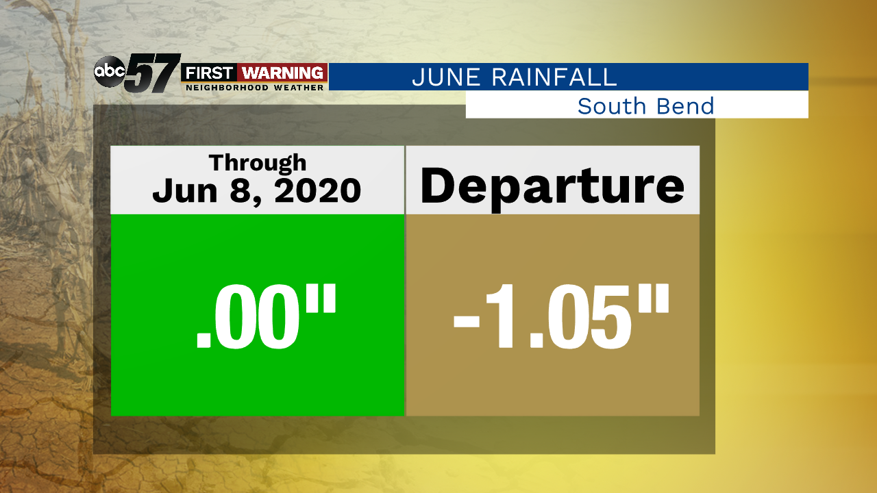
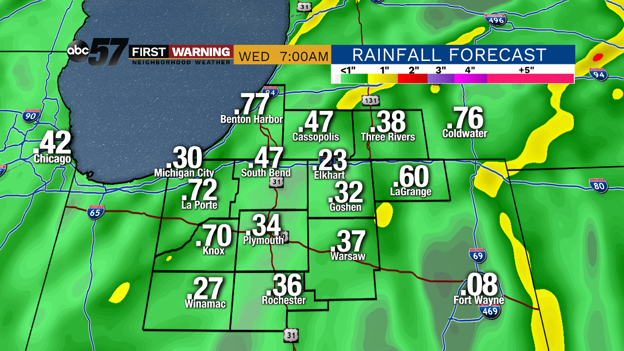
The heat and humidity surges Tuesday as we see an influx of tropical air with the remnants of Cristobal moving northward. The main circulation of the storm tracks northward through Illinois and Wisconsin but the outer bands of the system will bring showers and thunderstorms. No surprise tropical systems have spinning wind associated with them, so there is a severe threat that includes tornadoes Tuesday. That does not mean there will be widespread damage but tornadoes are possible. The storm / severe threat lasts from Tuesday afternoon through the evening. The rain is much needed with upwards of a half inch likely through Wednesday morning. The weather turns dry and mild again the rest of the week.
Tonight: Mostly clear. Low 65.
Tuesday: Partly cloudy, PM storms. High 90.
Wednesday: AM rain, breezy. High 76.
Thursday: Mostly sunny. High 75.