Rainy with thunderstorms possible; BIG temperature drop tonight

-
2:00

A sunny Monday ahead, rainy almost every other day this week
-
2:59

Dusty May leads Michigan back to Final Four with dominant win...
-
0:37

Vendors and cosplayers showcase art at South Bend Anime Fest
-
3:06

Palm Sunday procession in South Bend unites faiths in call to...
-
0:48

2026 Auto Show brings crowd to Century Center Sunday
-
2:34

Warm to start the week, Rainy week ahead
-
2:44

Warmer, breezier, and cloudier than yesterday
-
0:46

Crowds gather for Fins and Feathers Fest at La Porte City Fairgrounds
-
0:46

Paramount School of Excellence hosts teacher fair
-
2:30

Voting advocacy, peaceful demonstrations and donations: South...
-
2:04

Warming to start the week, Showers and storms by Tuesday
-
2:10

Cool, but calm, today

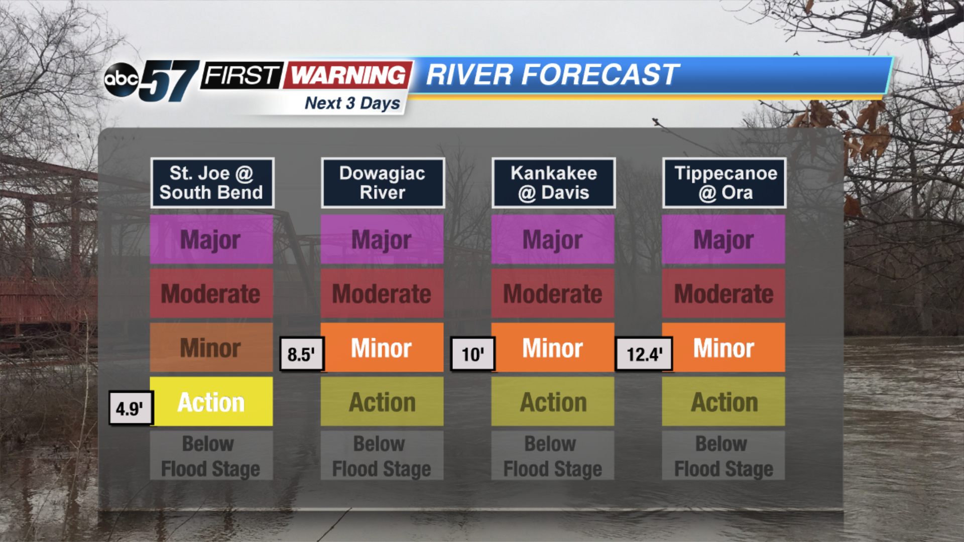
Scattered showers spread across our area today with pockets of heavy rain possible. It could lead to minor flooding along rivers and in low-lying. A couple of thunderstorms could be embedded in the showers with gusty winds possible. Cold air wraps in behind this system, drastically dropping our temperatures into the teens by tomorrow.
Friday is windy and cold with a few lake effect snow showers possible mainly in our Michigan counties. Skies are bright with a slight improvement in temperatures Saturday. Clouds move back in Sunday with a chance of snow showers in the evening with another messy system Tuesday.
Today: Rainy, thunderstorm possible, high of 54.
Tonight: Chance of snow north, low of 16.
Friday: Cold, temperatures falling the upper teens, chance of snow showers north.
Saturday: Cold and sunny, high of 24.