
-
2:03

Strong storms are likely around 7:00 PM
-
1:53

Local churches gearing up for the easter holiday amid a possible...
-
1:48

Preparations underway as Indiana University football trophies...
-
3:09

Indiana Utility Regulatory Commission collecting consumer data...
-
1:18

St. Joseph County officials host Election 101 Workshop on voting...
-
5:36

Hannah Hidalgo wins Naismith Defensive Player of the Year
-
2:50

New South Bend Cubs manager Daniel Wasinger ready for opening...
-
2:24

South Bend Cubs pitcher Kenten Egbert looks to build on strong...
-
1:52

Hoosiers face a gas tax increase as gas prices continue to rise
-
1:45

Iranian cybercrime group claims to have hacked St. Joseph County’s...
-
1:17

Cold and soaking rain today, another severe risk tomorrow
-
0:44

South Bend High School Music Festival highlights student talent

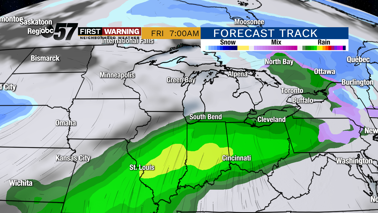
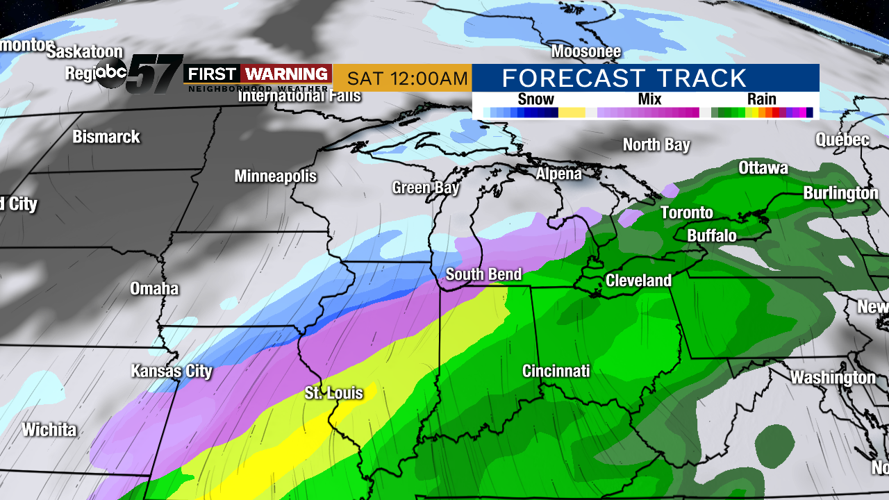
Winter remains on hold for the rest of this week. Tuesday won’t be as sunny and there’s a chance of drizzle/flurries but temperatures remain too mild for any accumulation. Wednesday will be the coldest day this week before temperatures spike near 50 to end the week. Rain is likely Thursday-Friday, changing to a sloppy rain/snow Saturday as temperatures fall.
Tonight: Partly cloudy. Low of 28.
Tuesday: Mostly cloudy, slight chance of snow/mix. High of 38.
Wednesday: Partly cloudy. High of 28.
Thursday: Mostly cloudy, PM rain. High of 46.
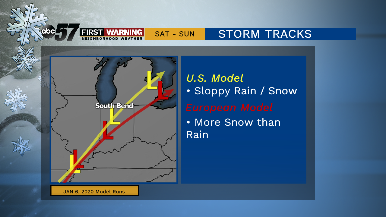
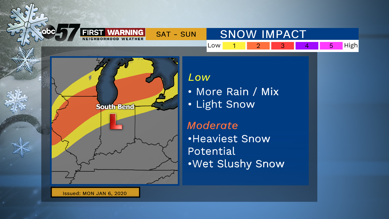
The track of the system on Saturday along with how quickly temperatures cool will be the forecast focus. This will determine how sloppy or snowy the impact will be.
Sign up for the ABC 57 Newsletter