Rain and isolated thunderstorms could impact Notre Dame Football late today


Rain and a few thunderstorms are in today’s forecast, and they could have an impact on Notre Dame Football. Saturday morning is starting cool but dry, with temperatures in the low 60s. By lunchtime, we’ve warmed just under the 70 degree mark. Later this afternoon, we’ll reach a high around 80 degrees. It will stay cloudy throughout the day. A cold front passes Michiana from west to east, bringing with it rain and a few thunderstorms.
Kickoff time today is 2:30. The game should start dry.
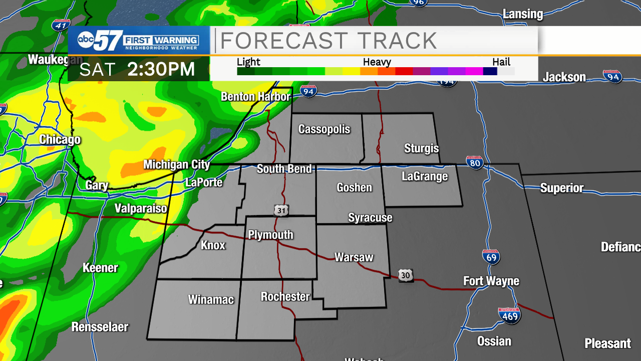
As the game progresses, it will probably be played with a few rain showers.
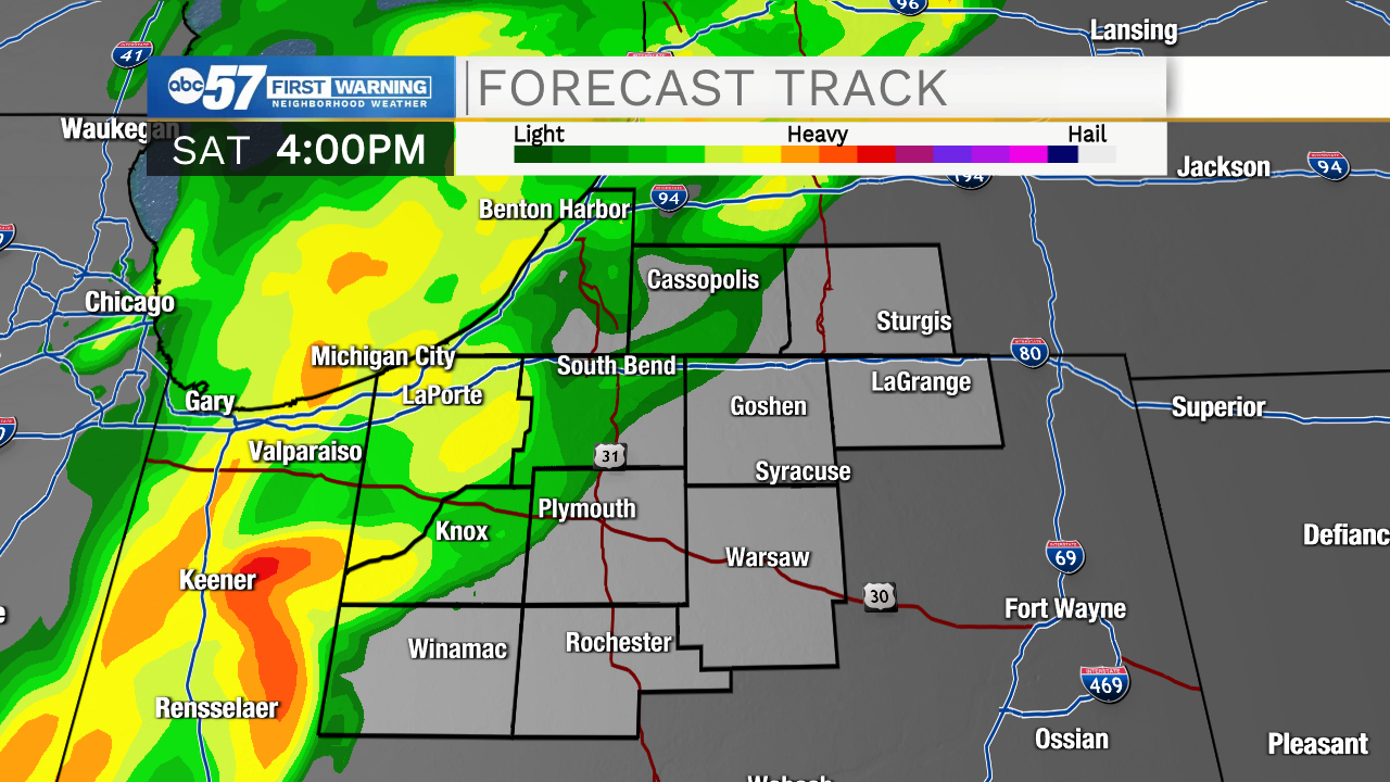
Near the end of the game, showers have the potential to become a little heavier with the possibility of isolated thunderstorms. This could mean a brief lightning delay near the end of the game. Showers and thunderstorms will become more widespread later this evening and into the overnight hours.
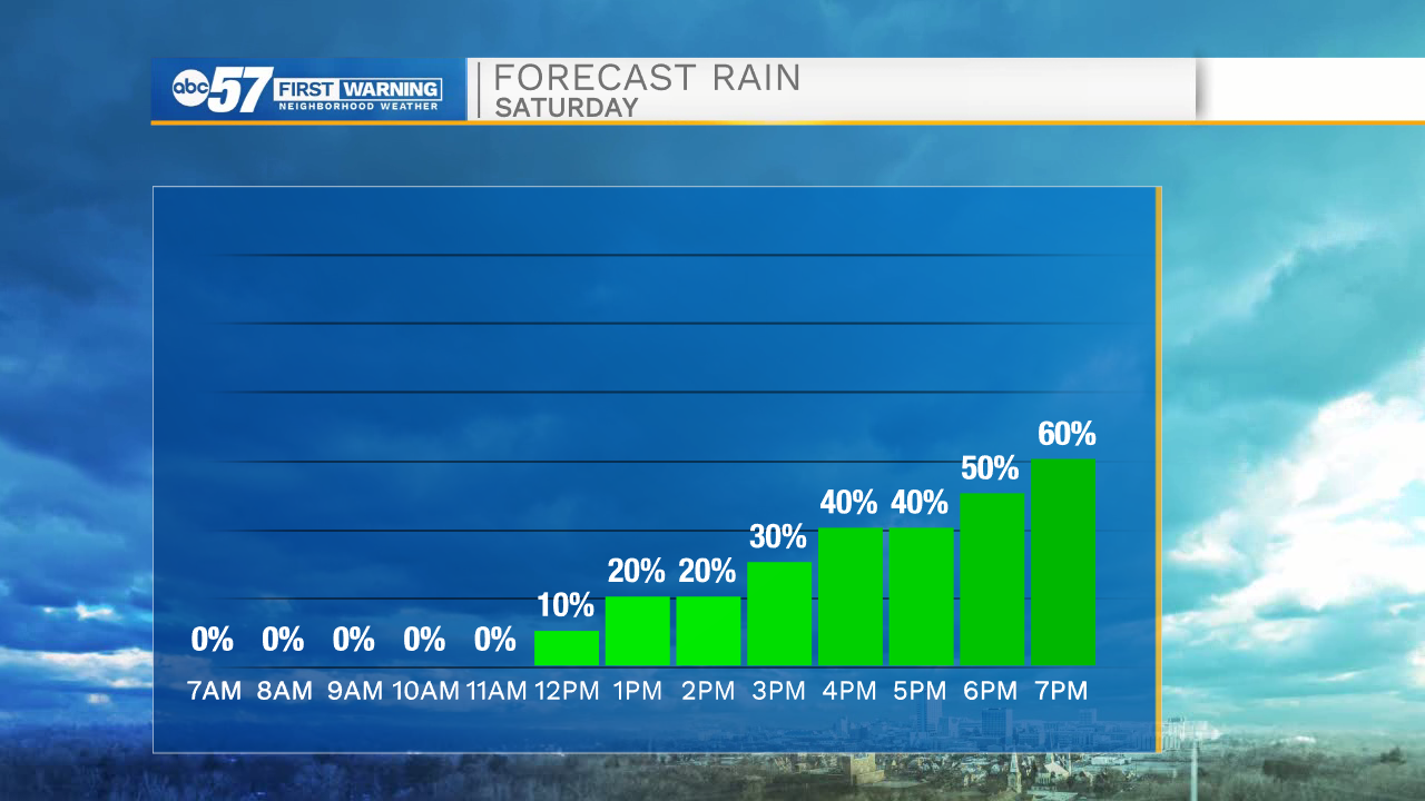
The storms do not look severe—a few could be on the strong side with gusty winds around 50 mph. Temperatures fall into the mid 60s overnight.
Sunday starts mostly cloudy, but will turn out to be a mostly sunny afternoon with comfortable temperatures in the low to mid 70s. The forecast stays dry and mostly sunny Monday through Wednesday of this week before a chance of showers Thursday. Daytime highs stay in the mid to upper 70s most of this week, although Wednesday could be near the 80 degree mark.
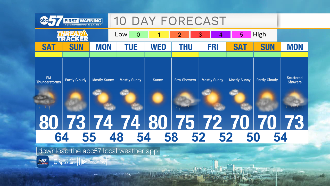
Today: Mostly cloudy, showers and thunderstorms during the late afternoon. High 80.
Tonight: Showers, isolated thunderstorms. Low 64.
Sunday: A few showers early, then mostly sunny afternoon. High 73.
Monday: Sunny. High 74.