Preparing for the weekend winter storm
By: Erica Horvatin
Posted: Jan 11, 2019 5:48 PM EDT

-
0:32

Layoffs at Whirlpool could affect workers in Benton Harbor
-
1:03

Annual District Sisterhood Conference at Ivy Tech empowers students
-
1:49

Back home in downtown South Bend, YMCA to open new location
-
2:16

This week’s ABC57 Cub Reporter is Nicholas Zentz
-
3:05

Amazon Web Services invests $11 billion to build data center...
-
4:05

Riley High School student center stage at the NFL Draft
-
1:35

Rain, wind, and milder temperatures forecast this weekend
-
2:49

Joe Alt expected to be drafted in the first round of NFL Draft
-
2:11

Students gearing up for local careers in Manufacturing
-
2:13

Sunny today, but expect a wetter and warmer weekend
-
0:54

Goodwill ’Little Black Dress’ event raises funds for community...
-
1:45

Cheers Bar and Grill liquor license renewed following controversy

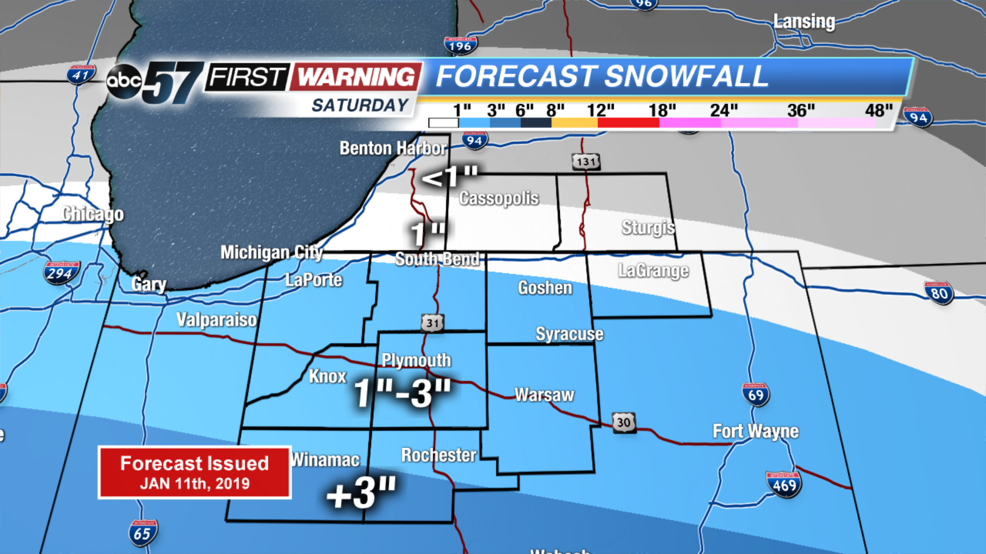
The big Midwest winter storm will move into Michiana Saturday mid-morning, with snowfall peaking in the afternoon.
Cities south of US-30 will have the highest impacts, with over 3" of snow possible throughout Saturday. Avoid driving around during the afternoon if you live in Pulaski or Fulton counties.
Here's a look at potential snowfall totals for Saturday.
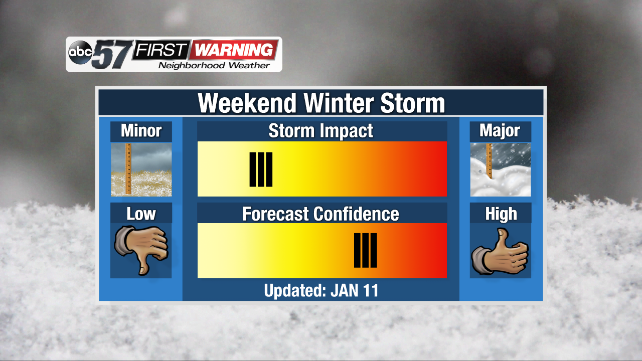
Impacts from this storm will be on the low end, because we receive 1-3" of snow on a regular basis during winter. Confidence in this forecast is on the high end, but not 100%. This is because if the storm shifts north, that could mean more snow for us, and if it shifts south, it could mean less snow.
Sign up for the ABC 57Newsletter