Periods of heavy lake effect snow

-
2:06

Thundershowers tonight, a cooldown tomorrow following cold front
-
0:52

Bethel University celebrates 77th commencement
-
1:36

Beautiful start to the weekend despite morning fog
-
1:03

’Pedals and Petals’ in downtown South Bend
-
3:18

Owners urged to vaccinate dogs after puppy left for dead outside...
-
1:54

Threat of drought, even with rainy spring in Michiana
-
3:43

Protestors arrested on campus of Notre Dame
-
1:17

A fair weekend, minus a few showers Saturday night
-
4:50

“Matilda The Musical“ at the Lerner Theatre
-
2:12

More rain this morning, but overall drier weather going into...
-
2:34

Pro-life group files lawsuit against IDOH for access to abortion...
-
1:01

South Bend students gain hands-on experience at first ’GEAR...

Lake effect snow showers continue through today, creating for slick roads and low visibility at times on the roadways. Give yourself at least 10-15 extra ![]() Very high threat to travel in SW Michigan.
Very high threat to travel in SW Michigan.
A couple flurries are possible Saturday morning but most of the day is dry with partly cloudy skies. It’ll be a great day to run any errands or clean up the snow because a wintry system moves in 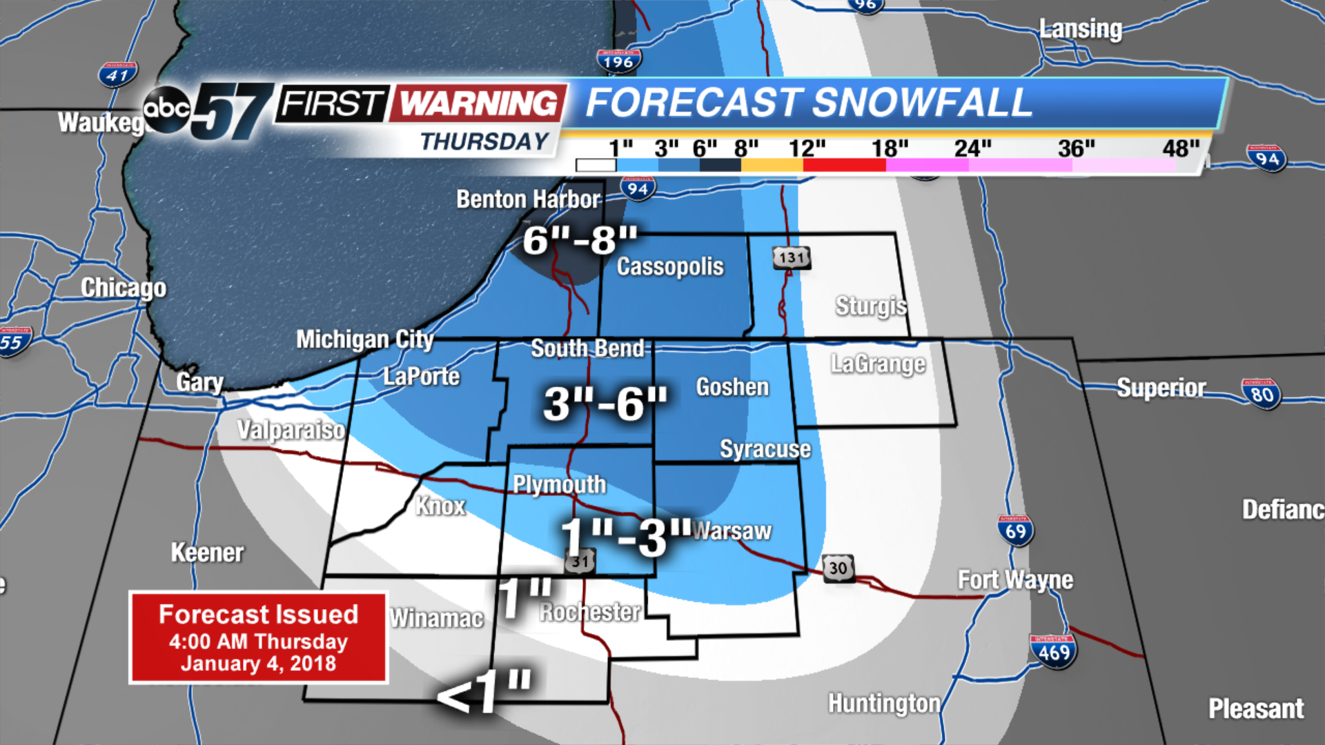 Thursday estimated snowfall total
Today: Lake effect snow showers, high of 14, falling PM temperatures.
Tonight: Lake effect snow showers, low of 4.
Friday: Lake effect snow showers, high of 10.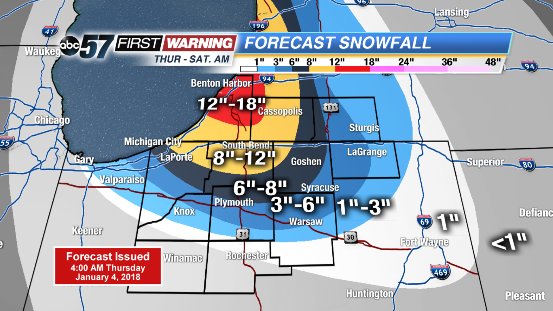 NEW estimated snowfall totals Thursday through Saturday AM.
Saturday: Partly cloudy, high of 15.