
-
1:17

The 80s return next week
-
1:22

Rain showers for the rest of the day
-
2:07

Lemon Creek Winery marks 42nd annual Father’s Day Festival...
-
0:54

Dozens of drivers under investigation after reckless driving...
-
1:16

Showers for your Sunday afternoon
-
1:49

Inaugural ceremony honors Korean War veterans at Battell Park
-
1:51

Person arrested in connection with fatal hit and run from May
-
1:55

Comfortable temperature brings life to the Elkhart Jazz Festival
-
0:28

LGBTQ community celebrates pride month at Potawatomi Park
-
2:35

Plymouth Motor Speedway’s Home Run Street Stock race brings...
-
1:19

Timing out your Father’s Day rain showers
-
1:09

The beautiful conditions continue through the evening

Afternoon Update: Windy this afternoon, gusts will peak in the 45 mph range. The window for thunderstorm is through 5 PM, storms will be scattered and the severe risk is isolated, however in an already windy environment damaging wind gusts +50 mph are possible as well as tornadoes.
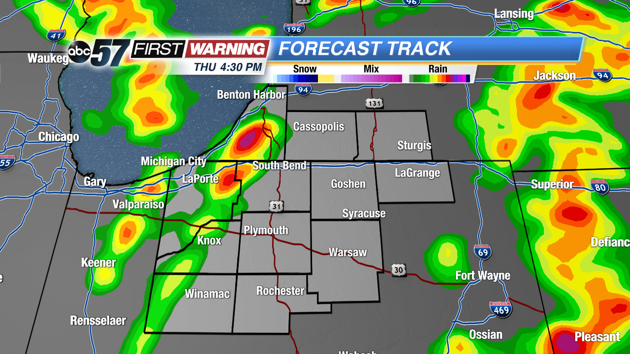
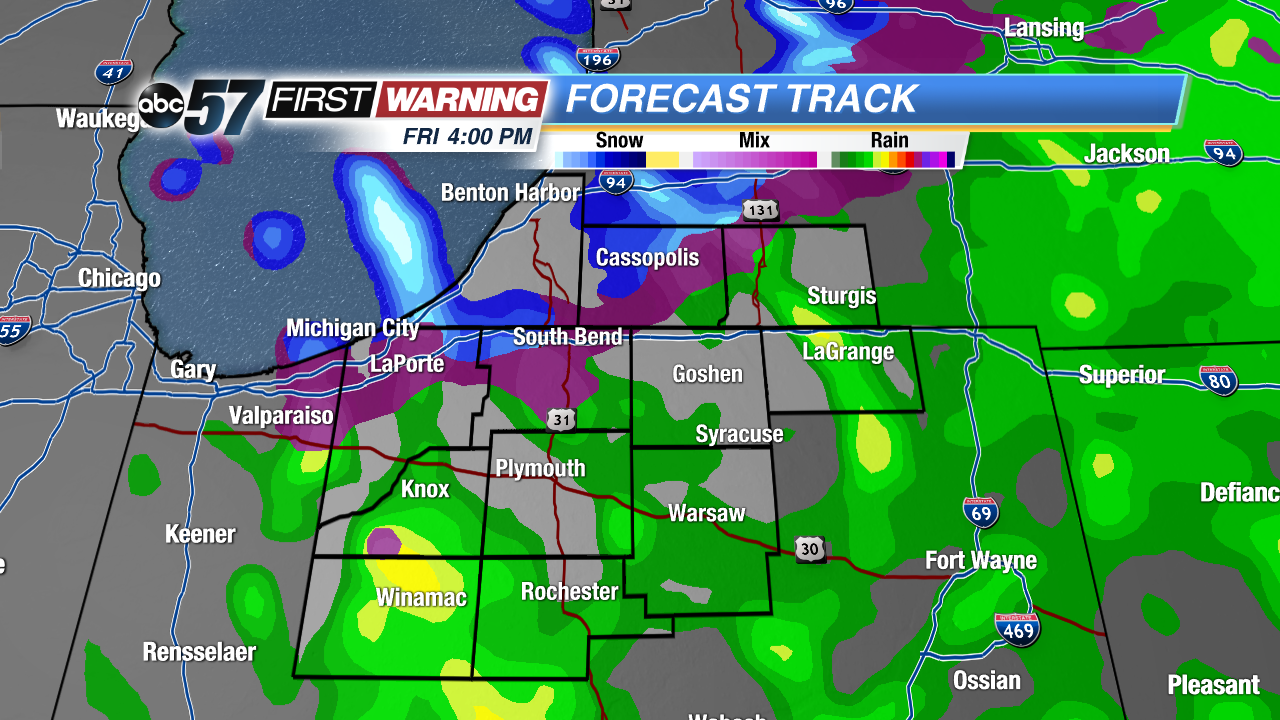
The brief warm spell is over. Temperatures fall from the 40s on Friday and light rain mixes with snow showers Friday afternoon. The weekend is colder and calmer, some sunshine and highs in the 30s and 40s. Temperatures rise gradually through next week, turning more spring-like by next weekend.
Tonight: Breezy, falling temperatures into the lower 40s.
Friday: Mostly cloudy and breezy, chance of rain/snow as temperatures fall from 42.
Saturday: Mostly cloudy, high of 36.
Sunday: Partly cloudy, highs in the low 40s.