
-
0:57

The Unity Gardens brought music, food, and crafts for their Westside...
-
1:50

Quiet evening, Storms after Midnight
-
0:57

Deer Creek Hunt Club throws a skeet shoot event for Deputy Jon...
-
1:44

Two rounds of storms Monday
-
1:07

Mini heat wave starts out the door
-
2:23

La Porte community rallies for Sammy Strong Benefit, raising...
-
1:57

The Potawatomi Zoo opens its gates to Zoo Nights Live
-
2:50

Carson Kvapil wins his first O’Reilly Auto Parts Series win...
-
1:10

William Tuffs honored as the only Indiana man who took part of...
-
0:50

Beacon Health held a Health and Wellness fair for the community
-
1:03

Warm conditions start overnight
-
1:02

Another pleasant day

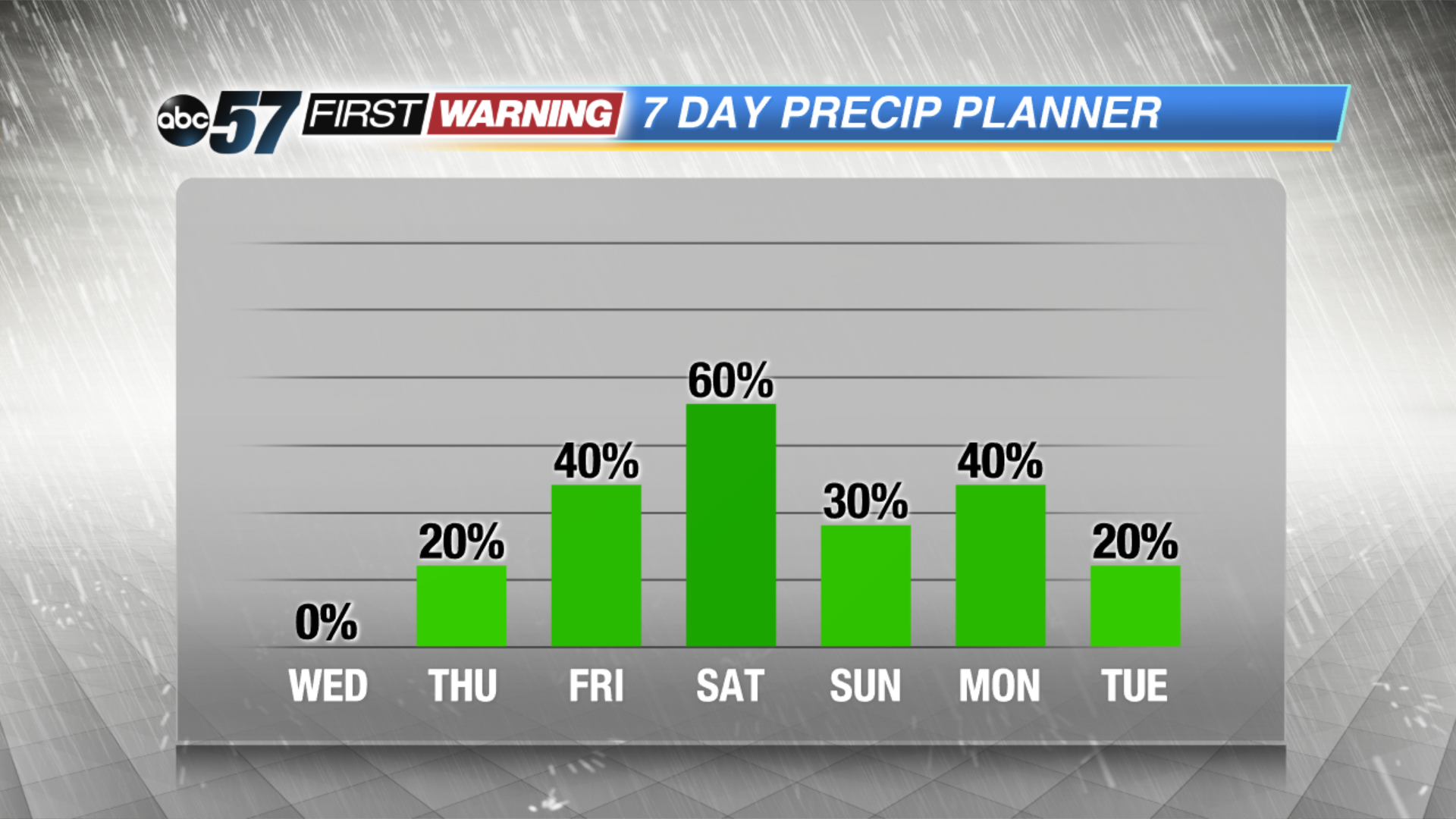
Wednesday is the last mild day before the humidity surges and we begin a summertime stormy pattern. Thursday through Saturday highs warm into the 80s, the mugginess will fuel the cycle of scattered showers and thunderstorms, mostly in the afternoon and evening. Heavy downpours and strong storms are possible but there is no clear timing on a specific event at this time, just the possibility.
Tonight: Mostly clear, low of 48.
Wednesday: Mostly sunny, high of 76.
Thursday: Partly to mostly cloudy, chance of showers late, highs of 82.
Friday: Scattered showers and storms, highs in the mid-80s.
Sign up for the ABC 57 Newsletter