One last warm day before cold front brings chilly weather
By: Emily Kennedy
Posted: Apr 8, 2020 3:15 AM EDT

-
0:54

Still feeling like fall Sunday before summer returns
-
5:04

Growing pains, hard work, and winning on an elite level
-
6:14

New voice of Notre Dame Football, Tony Simeone, and Super Bowl...
-
5:28

Manti Te’o and Director of Fitzgerald Institute for Real Estate...
-
3:27

ABC57 Kickoff’s LeVon Whittaker gets the scoop on Holtz’s...
-
7:16

Manti Te’o sits down with the ABC57 Kickoff Team
-
4:18

ABC57 Kickoff spoke with Andy Garcia, play-by-play voice for...
-
3:16

Fighting Irish football fan attends first game at 89 years old
-
3:15

Coach Freeman one-on-one, biggest win of career over Texas A&M
-
3:35

Tabor Hill Winery keeps the drinks flowing with large selection
-
3:58

One-on-one with former Notre Dame defensive tackle Kurt Hinish
-
5:25

Notre Dame offense clicks at the right time

ABC 57 First Warning Neighborhood Weather
Wednesday, April 8th, 2020
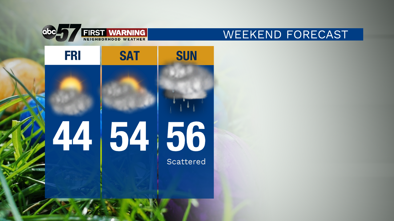
Daytime highs only slightly drop for today, giving us another beautiful day! A strong cold front will move through tonight, bringing rain and thunderstorms starting after 6pm this evening. Much colder drops our daytime highs into the 40s for the remainder of the week. Easter weekend rebounds slightly into the 50s but another system moves through on Easter, bringing more rain.
Today: Partly cloudy, evening rain/storms. High 69.
Tonight: Rain early then partial clearing. Low 38.
Thursday: Partly to mostly cloudy. Breezy. High of 46.
Friday: Chilly, clearing skies. High of 44.
Sign up for the ABC 57Newsletter