One last bitter cold day with lake effect snow
By: Emily Kennedy
Posted: Mar 5, 2019 3:27 AM EDT

-
1:54

South Bend Cubs opener postponed by weather, but fans still find...
-
2:01

Sights and sounds from South Bend Cubs Opening Day
-
1:32

NIPSCO ’flatly rejected’ further negotiations, USW workers...
-
3:36

The art of groundskeeping at Four Winds Field
-
3:32

The history behind America’s only ballpark synagogue turned...
-
1:59

South Bend opens season against Quad Cities in familiar Midwest...
-
4:21

South Bend Cubs owner discusses $48M stadium expansion, changes...
-
3:19

A look into the new South Bend Cubs 2026 roster
-
5:17

Expansion goes beyond Four Winds Field, new restaurants, bars,...
-
6:18

What’s new this season? South Bend Cubs unveil major improvements...
-
2:34

Meteorologist Tom Coomes takes us up in the air over Four Winds...
-
1:38

New bites at the ballpark on opening day

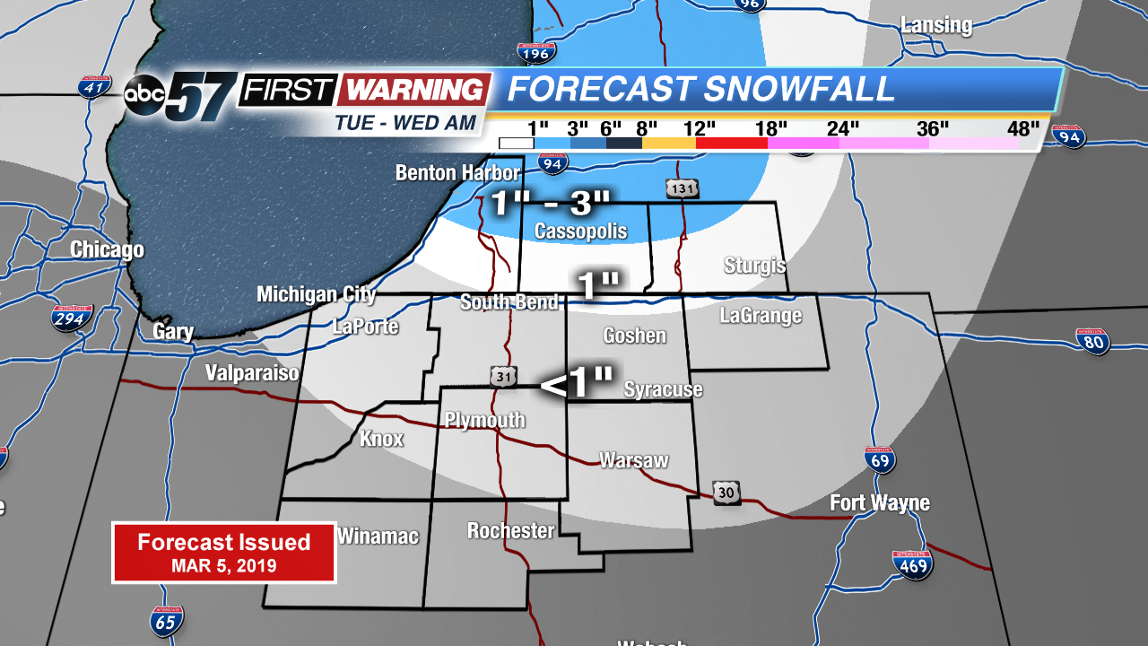
More record cold temperatures possible today with breezy winds making it feel even colder! Lake effect snow shower pick up during the evening through the overnight hours. Lake effect snow tapers off Wednesday morning with sunshine breaking through the clouds. The next chance of snow is Thursday evening into Friday morning. Otherwise temperatures slowly warm up into the weekend. A strong low pressure system brings us mainly rain Saturday night with possible rumbles of thunder.
Today: Mostly cloudy, lake effect snow showers, high of 19. Breezy.
Tonight: Mostly cloudy, lake effect snow showers, low of 10.
Wednesday: Partly to mostly sunny, high of 26.
Thursday: Partly cloudy, chance evening snow, high of 30.
Sign up for the ABC 57 Newsletter