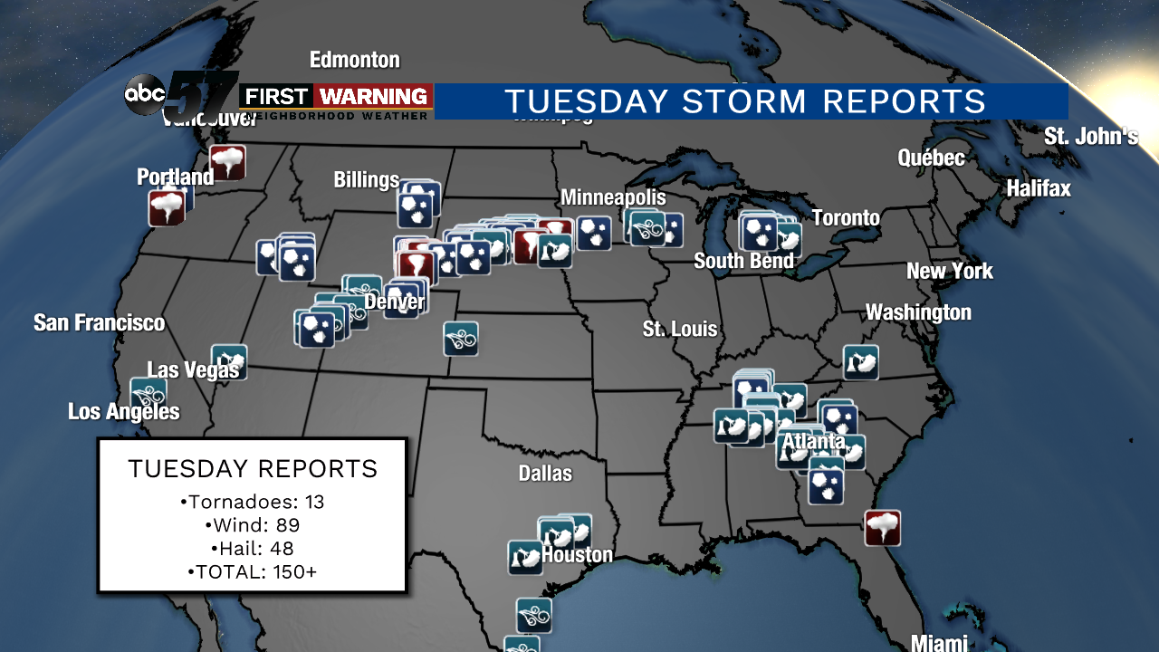
Multiple tornadoes hit Tuesday; more severe weather across Plains, Midwest and Great Lakes for next 3 days
There were more than 150 reports of tornadoes, wind/wind damage and large hail across the country on Tuesday. Included were a few rather strong tornadoes in Wyoming and South Dakota.
 Damage in Sioux Falls, South Dakota.
There were even funnel clouds reported in both Washington and Oregon, which is not exactly a common part of the country for tornadic development.
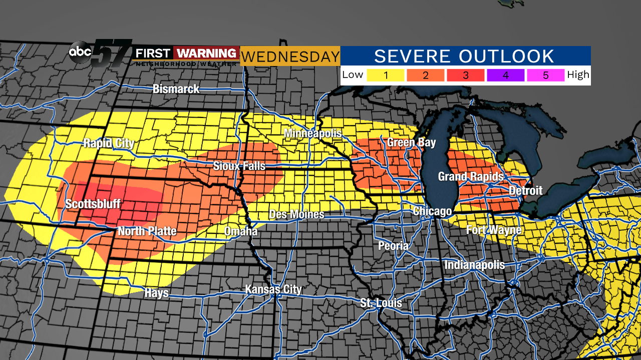 Severe weather outlook for Wednesday and Wednesday night.
The main threats for the Great Lakes region are damaging winds and an isolated tornado.
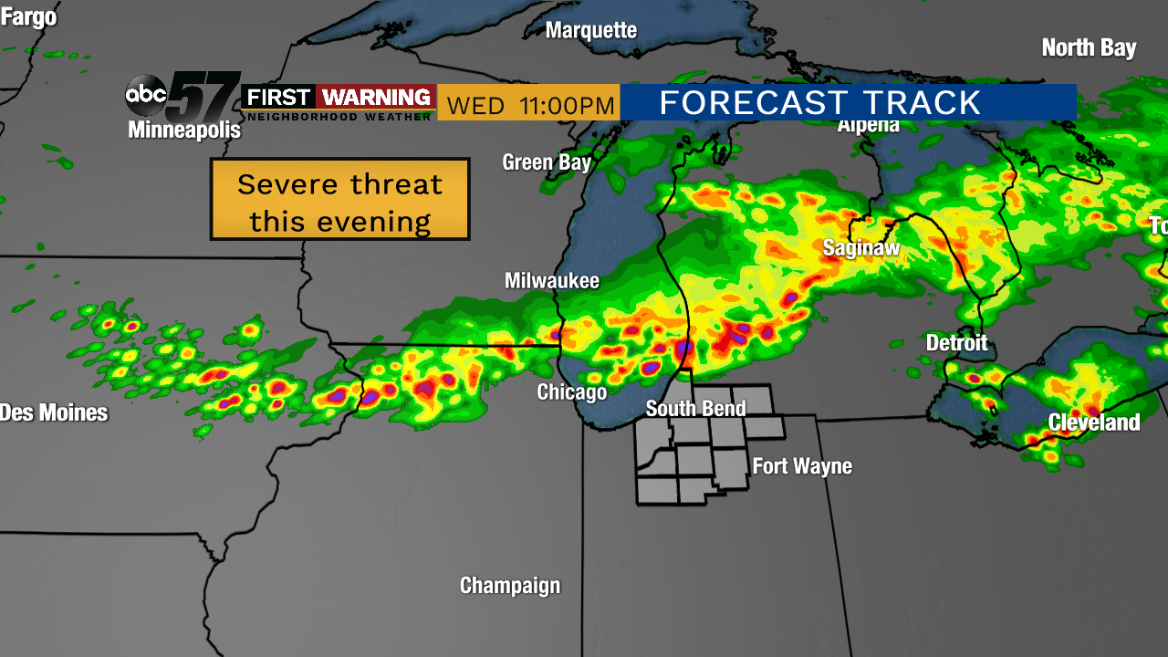 Potential radar Wednesday evening.
Michiana is under a level 1-of-5 "marginal risk" of severe weather for Wednesday evening and night. Widespread severe thunderstorms are no anticipated, but a few stronger cells could make their way into Michiana.
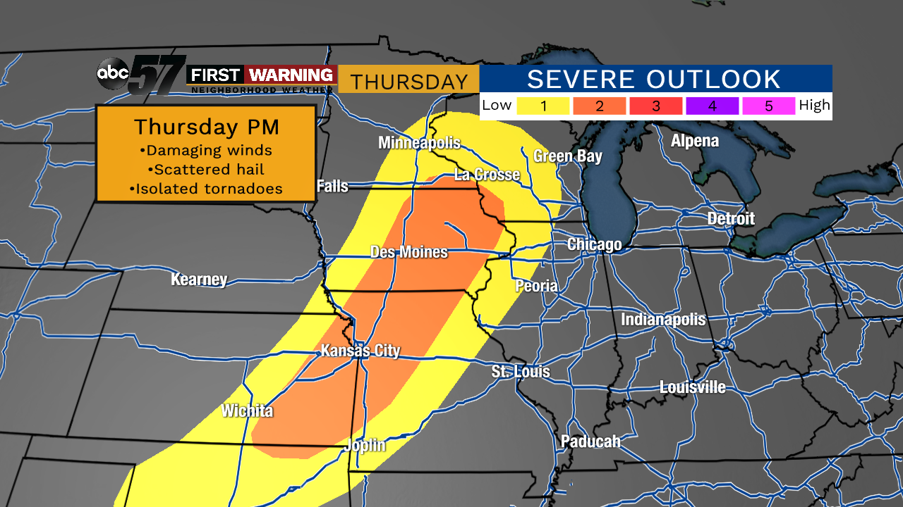 Severe weather outlook for Thursday and Thursday night.
Parts of Minnesota, Iowa, Wisconsin, Missouri, Kansas, and Oklahoma are already included in the severe weather risk zone for Thursday and Thursday night.
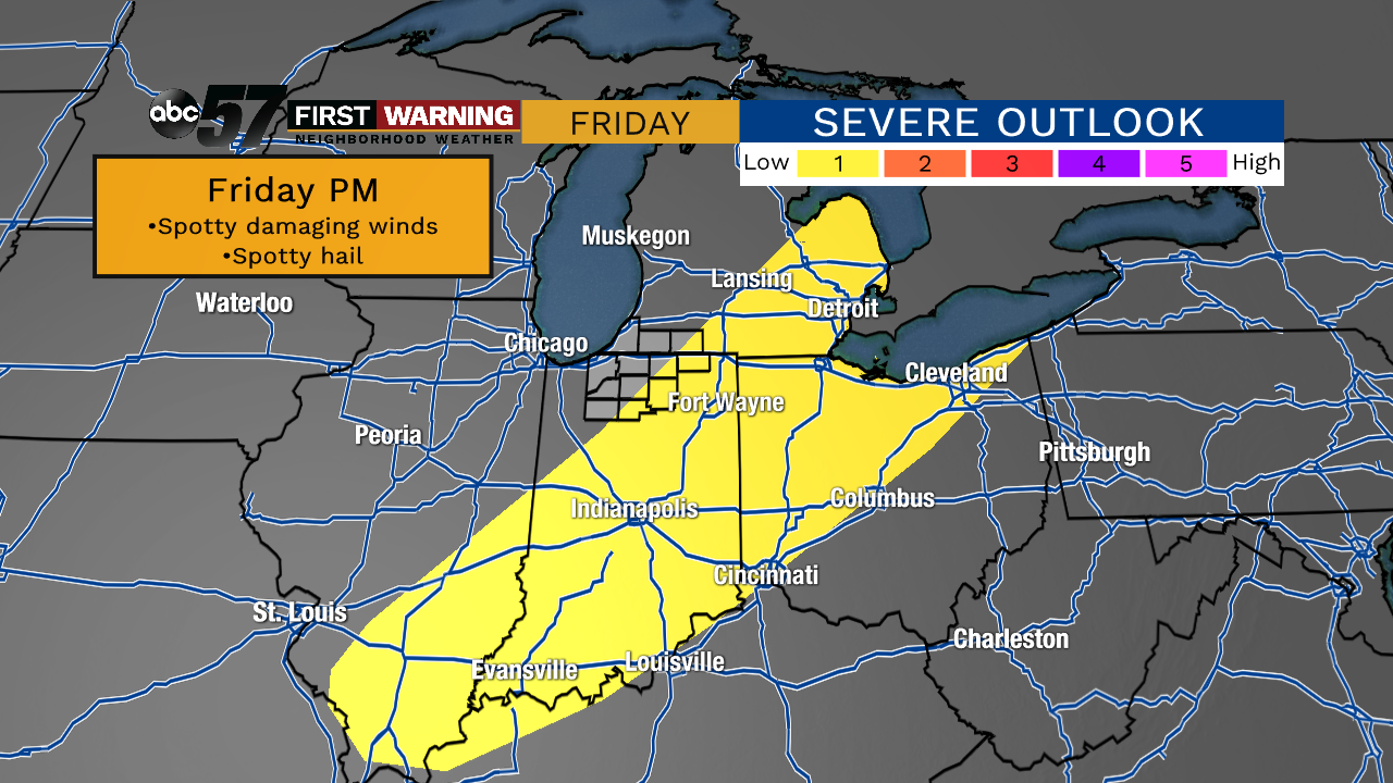 Severe risk zone for Friday.
That's simply due to the timing of the cold frontal passage being Friday morning.
Areas like Fort Wayne, Indianapolis, Evansville, Toledo, Dayton, and Detroit will have a higher chance at seeing strong to perhaps severe thunderstorms on Friday.
