Morning flurries and cold today but we warm this week
By: Emily Kennedy
Posted: Nov 17, 2020 2:30 AM EDT

-
5:36

Hannah Hidalgo wins Naismith Defensive Player of the Year
-
2:50

New South Bend Cubs manager Daniel Wasinger ready for opening...
-
2:24

South Bend Cubs pitcher Kenten Egbert looks to build on strong...
-
1:52

Hoosiers face a gas tax increase as gas prices continue to rise
-
1:45

Iranian cybercrime group claims to have hacked St. Joseph County’s...
-
1:17

Cold and soaking rain today, another severe risk tomorrow
-
0:44

South Bend High School Music Festival highlights student talent
-
1:55

South Bend house fire possibly caused by lightning
-
2:26

Flooding remains a threat into Wednesday
-
0:40

Baxmeyer defends actions amid solar farm bond debate
-
2:11

Southwest Michigan Cares Fund reaches over $70k as families still...
-
1:35

Severe weather threat ending across Michiana

ABC57 First Warning Neighborhood Weather Forecast
Tuesday, November 17th, 2020
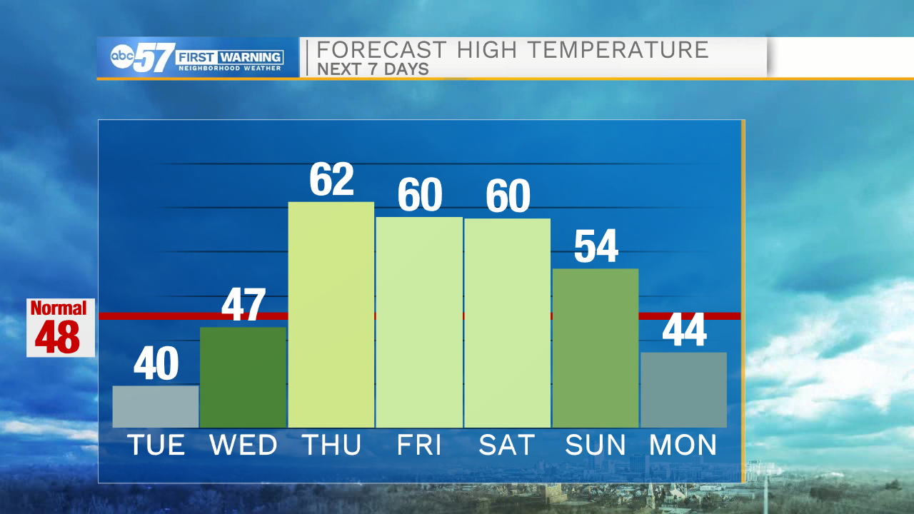
Lake effect mix/snow showers are falling for NW Michiana this morning. The winds out of the NW keep Tuesday chilly, only warming to 40 degrees. It starts to warm back up for Wednesday with plenty of sunshine. Thursday is even nicer as we top out in the low 60s!
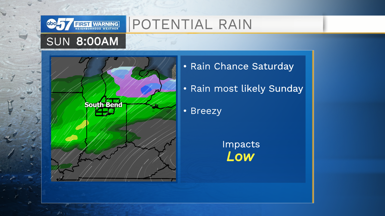
Daytime highs remain near 60 degrees through Saturday but clouds move in for the weekend. The next chance of rain is mostly likely Sunday but a couple of showers are possible on Saturday.
Today: Morning flurry possible, partly cloudy. High 40.
Tonight: Mostly clear. Low 26.
Wednesday: Mostly sunny. High 47.
Thursday: Mostly sunny. High 62.
Sign up for the ABC 57 Newsletter