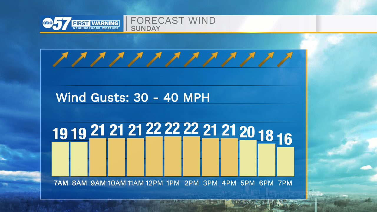
More strong winds in store for Sunday

-
0:37

13th annual Radiothon for Five Star Life takes place
-
1:05

Amazon investing $11 billion into New Carlisle data center
-
1:52

German company Verbio buys new ethanol plant in South Bend
-
0:54

61st annual Salvation Army Pancake Day held
-
5:26

Rep. Rudy Yakym calling for the protection of Jewish students...
-
1:26

Wet, warm & windy this weekend
-
4:24

Michiana Crime Stoppers shredding event
-
1:16

’IvyCares’ program setting students up for success in and...
-
1:45

Windy and wet this weekend, but unseasonable warmth as well
-
3:13

Local players react to $3 million investment in Byer Softball...
-
0:32

Layoffs at Whirlpool could affect workers in Benton Harbor
-
1:03

Annual District Sisterhood Conference at Ivy Tech empowers students

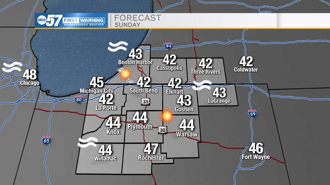
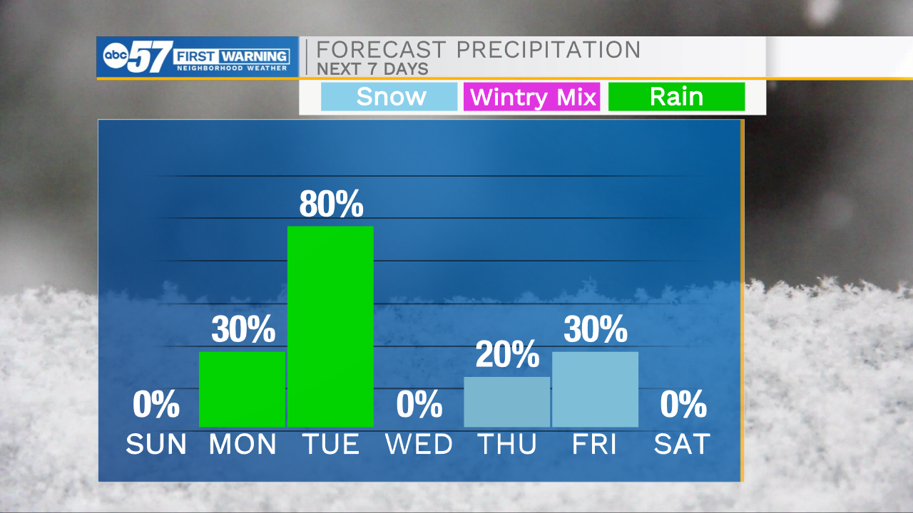
Strong winds and flooding potential will still be the two biggest things we track for Sunday. Sunday morning will start off cold with low temperatures dropping into the single digits. Winds will luckily be out of the southwest, which will help feel like temperatures from dropping into the negatives. Winds will be very strong throughout the day with gusts reaching 30-40mph. The southwesterly winds will pull lots of warm air into Michiana helping highs reach the 40s by tomorrow afternoon. The warm temperatures will stick around into the beginning part of the work week. Highs Monday and Tuesday will reach into the mid 40s and lower 50s. Rain showers are likely Monday evening and Tuesday. This rain mixed with the melting snow will increase the flooding potential throughout Michiana. After the next cold front clears Wednesday, temperatures will drop back into the 20s and 30s heading into next weekend.
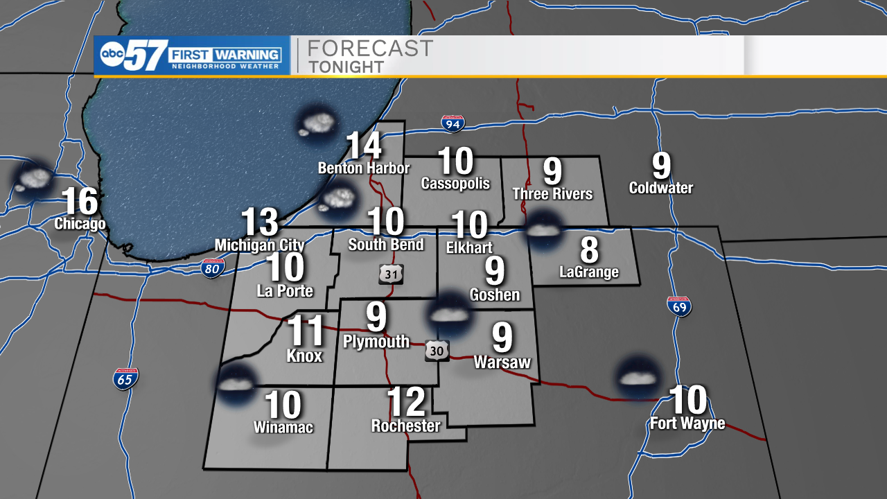
Tonight: Cold. Low 10.
Tomorrow: Windy/Mostly sunny. High 42.
Monday: PM Rain showers. High 45.
Tuesday: Scattered showers. High 50.