More rain overnight, temperatures swing Tuesday

-
1:20

Local fans react to Irish victory over Indiana University
-
2:29

Warming trend begins Monday
-
2:03

Light AM snow, cold Saturday
-
4:33

Coach Freeman looks to the past to prepare for the future
-
6:40

EA Sports College Football 25 back for first time in over a...
-
7:01

’Voice of the Hoosiers’ Don Fischer sits down with the ABC57...
-
6:26

Notre Dame quarterback Riley Leonard’s inspiration for helping...
-
5:57

Former Notre Dame and NFL offensive lineman Alex Bars stops by...
-
3:04

ABC57 Kickoff’s LeVon Whittaker talks about how IU and ND...
-
6:10

Former Irish and NFL linebacker Jaylon Smith chats with the...
-
8:22

Former Notre Dame Receiver Golden Tate makes ABC57 Kickoff debut
-
4:28

IU vs. ND, history in the making at Notre Dame Stadium Friday...

Another round of showers and storms Monday night into early Tuesday as the next front slides through. The severe threat is VERY low.
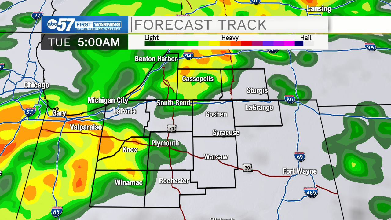
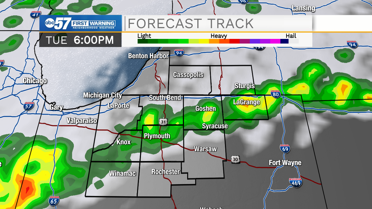
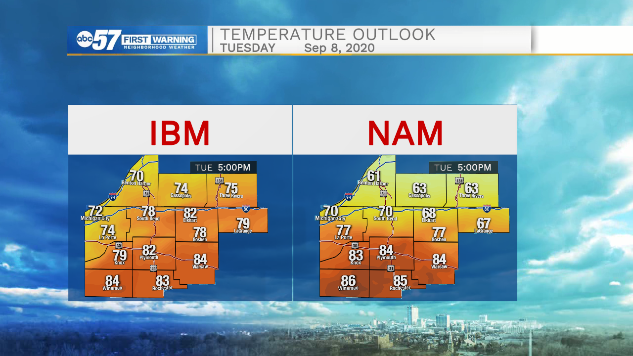
Typical fall turbulence, where uncertainty is the constant. Tuesday will be a little bit of everything, from rain in the morning, breaks of sun and mild temperatures through midday and a quick warm-up with pop-up afternoon storms. There will be a sharp divide in temperature as a front divides the area. Wednesday we warm-up and we cool again quickly Thursday and Friday. The swings continue this weekend with another warm-up and chance of storms Saturday and milder temps Sunday.
Where will the temperature divide be Tuesday afternoon? Models pinpoint somewhere between South Bend and Plymouth.
Tonight: Scattered showers and thunderstorms. Low 62.
Tuesday: Scattered showers and thunderstorms. High 76.
Wednesday: Partly cloudy. High 80.
Thursday: Partly cloudy. High 70