
-
1:01

South Bend students gain hands-on experience at first ’GEAR...
-
1:48

Temperatures swing with rounds of rain
-
2:56

Senior citizens feeling taxed out of their neighborhoods
-
0:26

Monterey adds around-the-clock cameras to combat crime
-
5:06

The NALC is looking for volunteers to ’Stamp Out Hunger’...
-
2:19

Dry and mild start to Thursday, but rain arrives this evening
-
2:56

Pro-Palestinian protesters fill intersection of Walnut and Western...
-
1:55

’Water shut off notices’ return in Benton Harbor
-
0:57

Indiana Lt. Gov. Suzanne Crouch makes local campaign stop
-
3:55

Deliberation about changes to Indiana’s high school graduation...
-
1:44

Temperatures rise and fall to end the week, rain Friday
-
3:19

National College Decision Day is pushed back this year

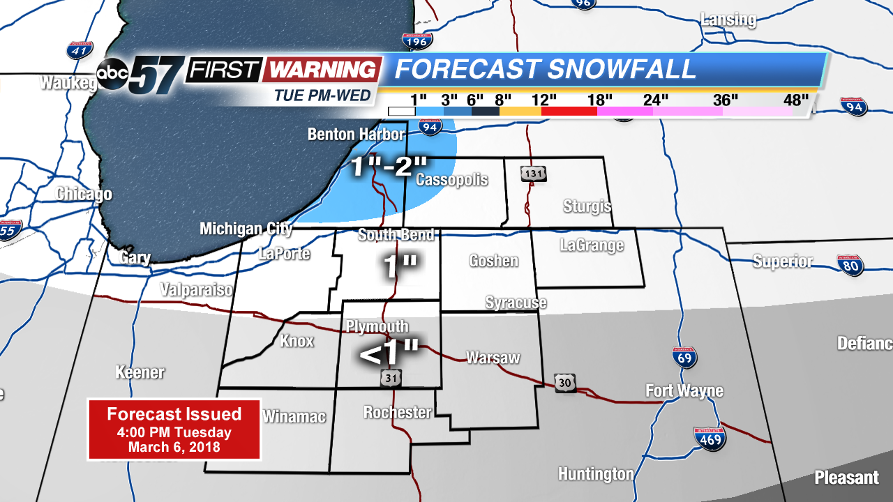
Another night of wintry mix changing to all snow. Accumulation of one to two inches is possible through Wednesday morning. Roads may have a few slick spots for the morning drive.
Snow showers continue Wednesday and cold weather prevails through midweek. As snow showers taper down Wednesday, there still could be some flakes into Thursday but it’s mostly flurries with little accumulation. Temperatures stay below normal through the weekend, before clouds break and temperatures rise gradually next week.
Tonight: Scattered snow showers, low of 28.
Wednesday: Mostly cloudy, light snow and breezy, high of 32.
Thursday: Mostly to partly cloudy, chance of snow, high of 30.
Friday: Mostly sunny, highs in the mid-30s.
Sign up for the ABC 57Newsletter