More hot summer-like temperatures Sunday
-
5:53
Michigan Lt. Governor Gilchrist talks nuclear power with ABC57
-
2:29
Model Elementary School students raise record amount for American...
-
5:08
Hello Gorgeous is holding an event to celebrate women with cancer
-
1:56
Week wraps up mostly dry, but rainy Easter weekend in store
-
3:09
City of South Bend shares plans of ’Madison Lifestyle District’...
-
2:09
Michigan State Trooper opens fire on suspect in Benton Harbor
-
4:10
Palisades to restart with $1.5B federal loan
-
1:21
’Spring into Action for Kids’ at Middlebury Food Pantry
-
1:09
Fair until Saturday, showers on either side of Easter
-
1:19
Baby box named after late Congresswoman Jackie Walorski
-
1:46
County assessor holds town hall in New Carlisle Township
-
2:02
Mishawaka HS hosts college signing day for student athletes!
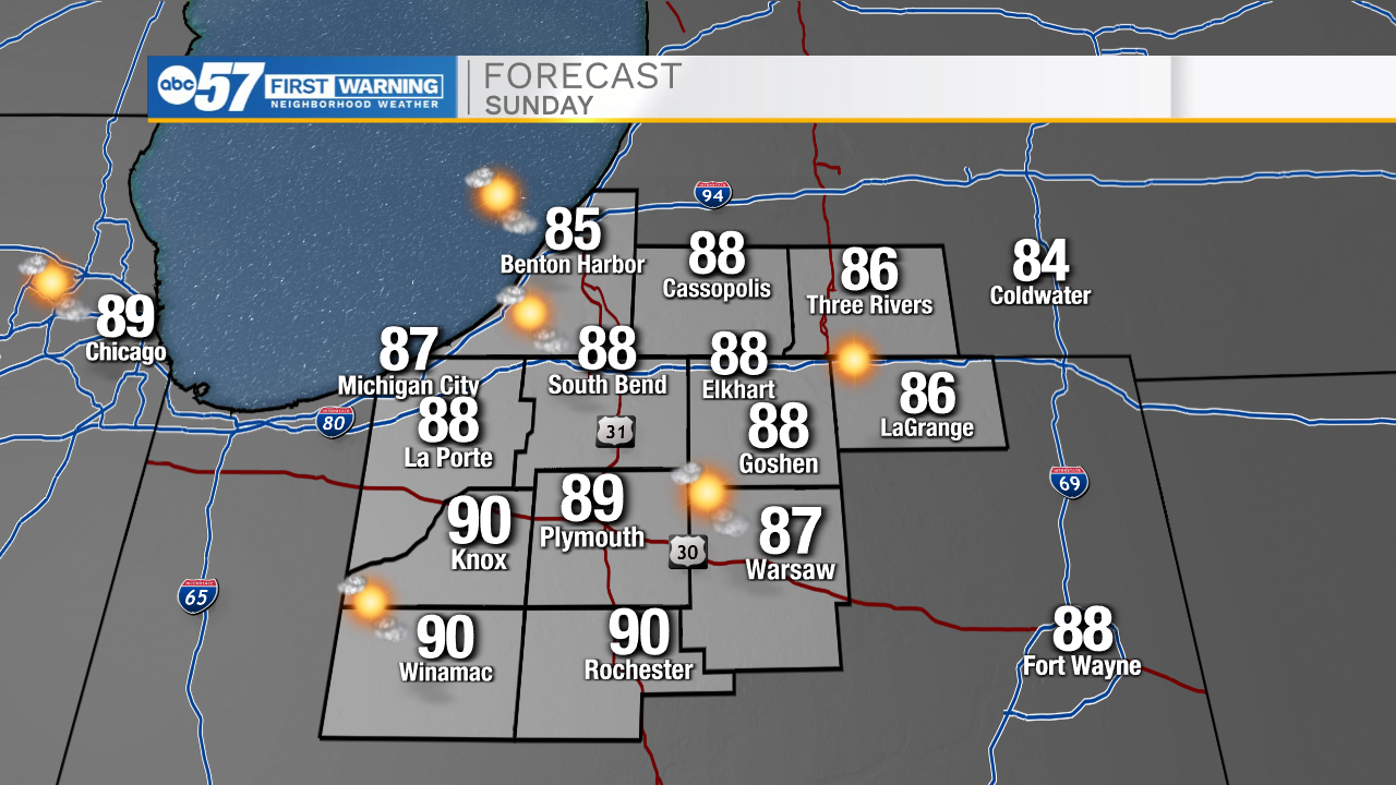
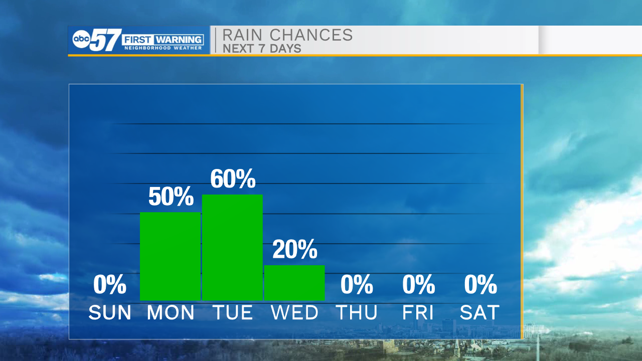
It will be a nice and quiet evening for all of us here in Michiana. Temperatures tomorrow morning will drop into the lower 60s. Tomorrow afternoon will be another hot one with temperatures topping out in the upper 80s. Rain showers will move into Michiana on Monday and stick around into the afternoon and evening. We will catch a small break from the rain but then a line of showers and storms will arrive Tuesday morning. A few of those storms could be on the stronger side. After our next cold front moves through on Tuesday, temperatures will drop into the upper 60s to lower 70s. Beautiful fall weather will stick around through the end of the ten day forecast.
Tonight: Clear. Low 60.
Tomorrow: Mostly sunny. High 80.
Monday: Scattered showers. High 80.
Tuesday: Scattered showers/storms. High 76.