
-
2:35

Tornado Watch issued for Michiana this afternoon
-
0:38

Former assistant theater director charged with Child Seduction...
-
2:49

Upgrading Tuesday’s severe storm threat
-
2:15

Concerns for rise in gun violence after five-year-old injured...
-
2:39

Early voting ahead of May primary
-
2:41

Questions remain after missing 15-year-old Benton Harbor boy...
-
3:24

Landlords feel ’forced’ to raise rent amid rising property...
-
2:15

Two rounds of storms Tuesday
-
1:31

Benton Harbor Area Schools washing away worries for families...
-
2:12

Quiet today, storm threat tomorrow and Wednesday
-
3:50

Plymouth community hosts 5K in the fight against ALS
-
2:10

Sunny Monday ahead, but showers and thunderstorms later this...

The mild week before Christmas continues with highs near 40 through Friday. A weak system could bring some rain Thursday night but the pattern stays quiet until Christmas Eve. Sunday will start the drop in temperatures, teens and twenties for highs and lows in the single digits, next week. There is a chance for a White Christmas but there’s no major snow in the forecast at this time.
Tonight: Mostly cloudy, low of 26.
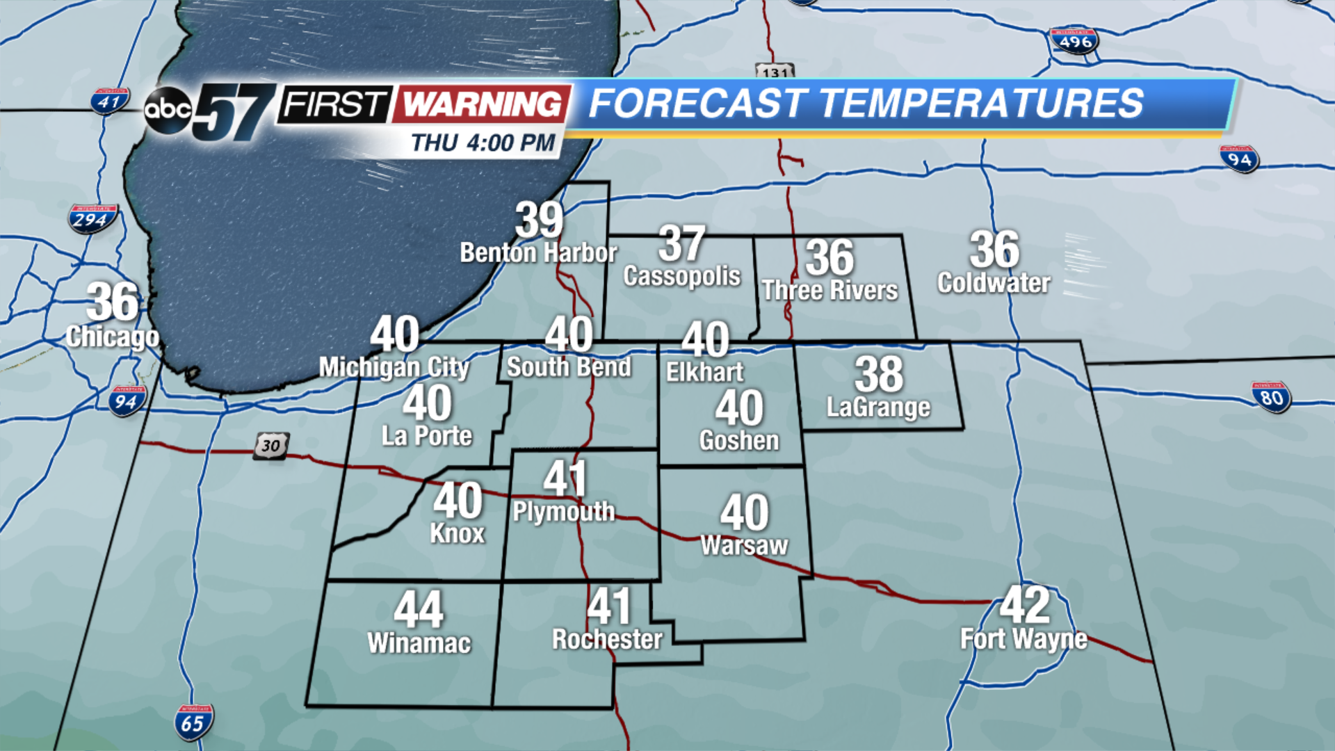 Thursday's Highs
Thursday: Partly cloudy, high of 40, chance of rain late.
Friday: Mostly cloudy, high of 42.
Saturday: Mostly cloudy, highs in the mid-30s.
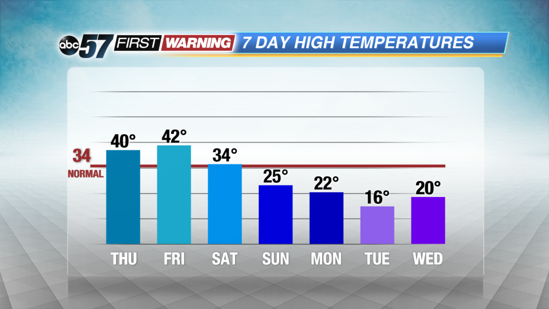 Turning MUCH colder by Christmas Eve.
Sign up for the ABC 57Newsletter