
-
2:56

Pro-Palestinian protesters fill intersection of Walnut and Western...
-
1:55

’Water shut off notices’ return in Benton Harbor
-
0:57

Indiana Lt. Gov. Suzanne Crouch makes local campaign stop
-
3:55

Deliberation about changes to Indiana’s high school graduation...
-
1:44

Temperatures rise and fall to end the week, rain Friday
-
3:19

National College Decision Day is pushed back this year
-
5:25

Michigan State Representative Joey Andrews joins ABC57
-
1:29

A new chapter for the Cass District Library Edwardsburg Branch
-
1:59

Few showers this morning, then quiet again today
-
2:23

PGA and Whirlpool prepare for one last KitchenAid Senior Championship...
-
1:49

Occupants identified in deadly plane crash near Bristol
-
2:44

The new plan to transform much of Potawatomi Park in South Bend

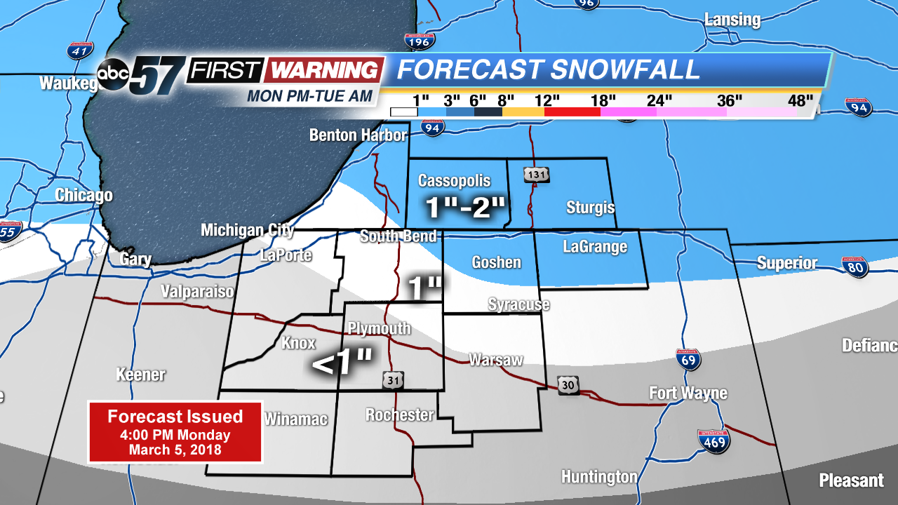
Rain changes to a slushy snow overnight, accumulation of one to three inches possible but will likely melt on most paved surfaces. Wet and slushy travel is expected Monday night and Tuesday morning.
Wintry weather returns midweek, snow changes to rain showers Tuesday afternoon and then changes back to snow again Tuesday night. Snow showers could bring an additional inch or two through Wednesday. However overall accumulation will stay to a minimum, due to melting, as high temperatures waver just above freezing. Temperatures remain below normal through the end of the week.
Tonight: Wintry mix turning snow, low of 30.
Tuesday: A few morning snow showers, mostly cloudy with afternoon rain changing to snow, high of 40.
Wednesday: Mostly cloudy, light snow and windy, high of 33.
Thursday: Mostly to partly cloudy, chance of snow, high of 30.