-
1:45

Windy and wet this weekend, but unseasonable warmth as well
-
3:13

Local players react to $3 million investment in Byer Softball...
-
0:32

Layoffs at Whirlpool could affect workers in Benton Harbor
-
1:03

Annual District Sisterhood Conference at Ivy Tech empowers students
-
1:49

Back home in downtown South Bend, YMCA to open new location
-
2:16

This week’s ABC57 Cub Reporter is Nicholas Zentz
-
3:05

Amazon Web Services invests $11 billion to build data center...
-
4:05

Riley High School student center stage at the NFL Draft
-
1:35

Rain, wind, and milder temperatures forecast this weekend
-
2:49

Joe Alt expected to be drafted in the first round of NFL Draft
-
2:11

Students gearing up for local careers in Manufacturing
-
2:13

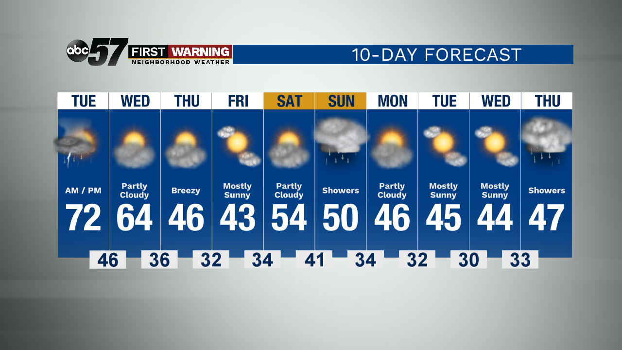
Sunny today, but expect a wetter and warmer weekend

Thunderstorms overnight could be loud with heavy rain, lightning and hail. More an an inch of rain could fall, mostly favored across the northern half of the area. Life threatening severe weather is unlikely. Most of the storm activity is after midnight.
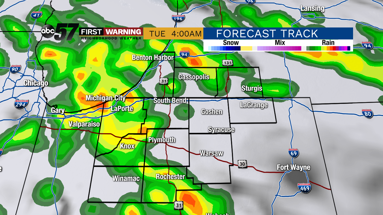
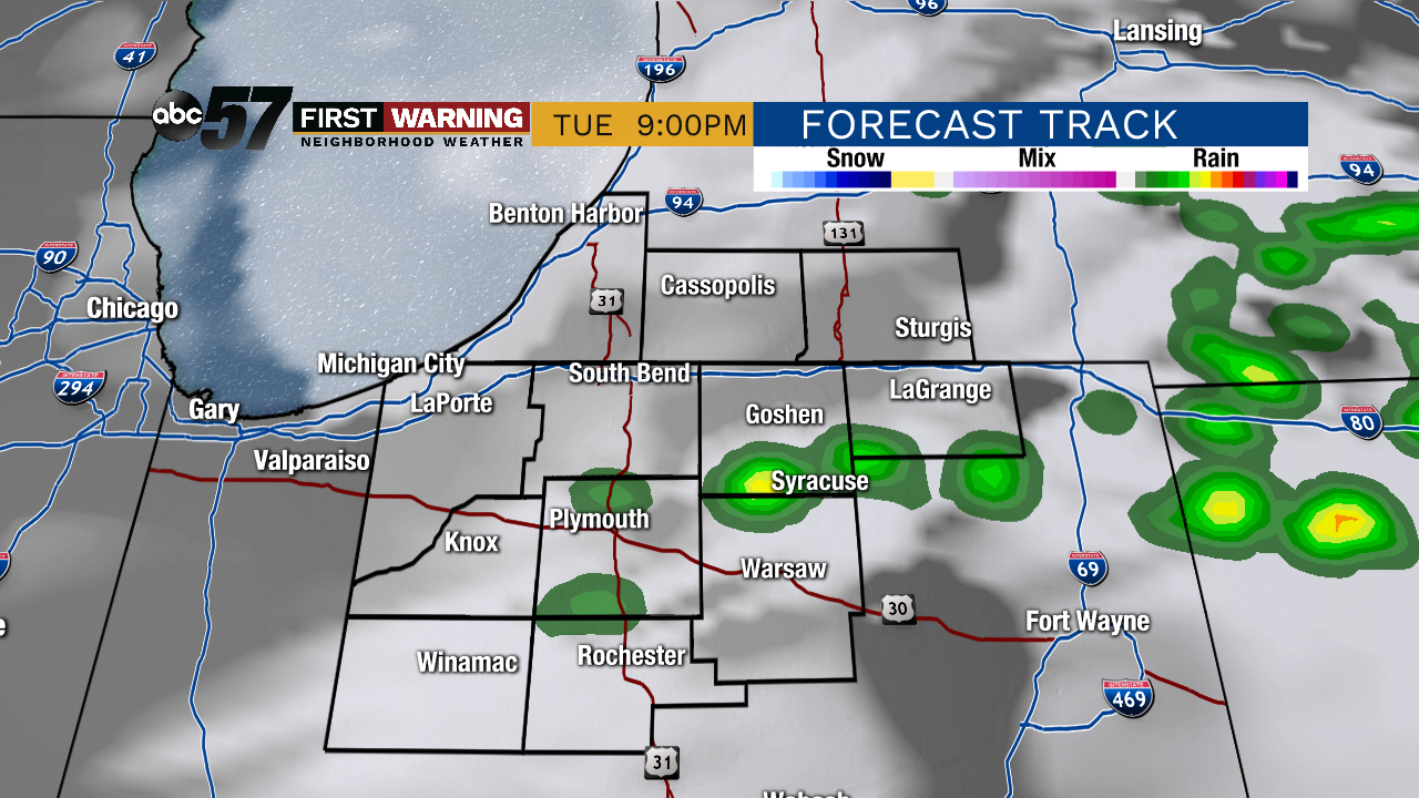
A few showers / thunderstorms linger into early Tuesday, the rain ends and temperatures warm into the 70s by the afternoon during the lull ahead of the cold front. Scattered storms move through Tuesday evening, a few of those storms could be strong to severe, with gusty wind being the main threat. Temperatures fall to end the week, 60s on Wednesday, 40s Thursday and Friday.
Tonight: Overnight thunderstorms. Low of 53.
Tuesday: AM Showers / Evening storms High 72.
Wednesday: Partly sunny. High 64.
Thursday: Breezy. High of 46.