
-
1:48

Scattered showers this evening, Much cooler overnight
-
1:50

Showers and storms this afternoon
-
0:20

One person injured in shooting
-
0:36

Eddies Circuit Robotics holds competition Saturday
-
0:32

21st annual Nappanee Model Train Show
-
0:38

Local boys basketball team headed to IHSAA state finals
-
3:49

Midwest Meowfest brings kitten advocacy to attendees, new homes...
-
1:52

Mild tonight, showers tomorrow
-
1:43

Pleasant to start the weekend
-
3:06

Pulaski County weighs stricter solar rules amid resident concerns
-
0:40

Marian High School hosts World Down Syndrome Awareness Walk
-
2:33

South Bend leaders call for an end to gun violence

Light lake effect snow showers, mostly west of South Bend could bring up to an inch of accumulation for some. Temperatures fall into the lower 20s and upper teens tonight.
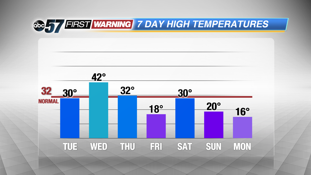
The forecast midweek is still up-and-down, highs struggle to break the freezing mark Tuesday, warm into the 40s Wednesday and then crash again Thursday into Friday. The start of February looks cold again with below normal temperatures and a chance of accumulating snowfall this weekend.
Tonight: Mostly cloudy, lake effect snow, low of 20.
Tuesday: Snow ending, partly cloudy, highs of 30.
Wednesday: Mostly cloudy, high of 42, chance of wintry mix late.
Thursday: Partly cloudy, temperatures fall from the mid-30s.
Sign up for the ABC 57 Newsletter