


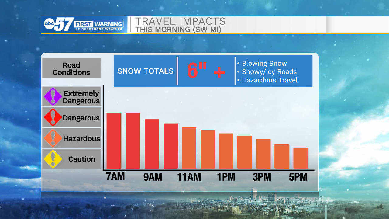
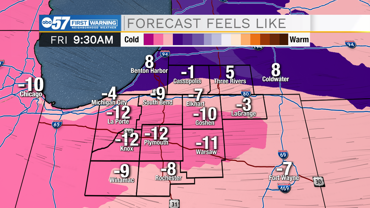
Moderate to heavy lake effect snow will impact northern Michiana through mid-morning. We will finally see the lake effect band move further north and east around lunchtime. Flurries and light snow showers could linger into the early afternoon. Wind chills this morning will be in the negative teens, so if you do have to head outdoors bundle up with multiple layers! Temperatures this afternoon will only top out in the mid to upper teens. We will catch a break from the snow tonight and through the first half of your Saturday. Saturday afternoon rain and mixed wintry precip will move into Michiana. Some freezing rain is possible, but overall accumulations look very low. A few isolated slick spots are likely, especially into Sunday morning. Sunday afternoon sunshine will return with highs in the low to mid 30s. More lake effect snow chances return for Monday morning along with bitter cold temperatures. Overall, most of next week looks generally warmer with highs warming back into the 30s by Wednesday.
Today: Snow showers north/extremely cold. High 18.
Tonight: Extremely cold. Low 5.
Tomorrow: Wintry mix. High 35.
Sunday: AM Wintry mix/PM Sun. High 35.