Lake effect snow: Shifting season and forecasting clues


Lake effect snow can be tricky to forecast as far as the exact location of the heaviest bands and amounts, but all lake effect forms in the same way. First, we need a "warmer" lake, or at least one where water temperatures are warmer than the surrounding air. The air just above the warmer water surface will want to rise, since it's less dense, and it interacts with colder air blowing over the lake. The rising air then cools, condenses, and forms clouds. In certain situations, the air will continue to rise, cool, and condense enough to form snow. Lastly, the cold air blowing over the lake continues to push those lake effect clouds and snow showers onshore, where they dump all of that snow.
Now, not every situation can create lake effect snow, but we have clues the atmosphere leaves behind to help give us the hint. First, we obviously need a big temperature difference between the land and the water.
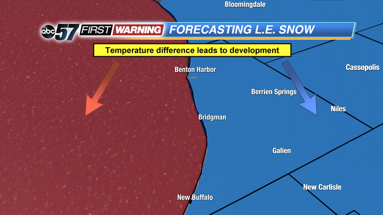
This departure at least has to be enough to where the air right over the lake wants to rise. Second, it's very helpful to have a low moving away from us to our east while a high pressure system comes in from the west.
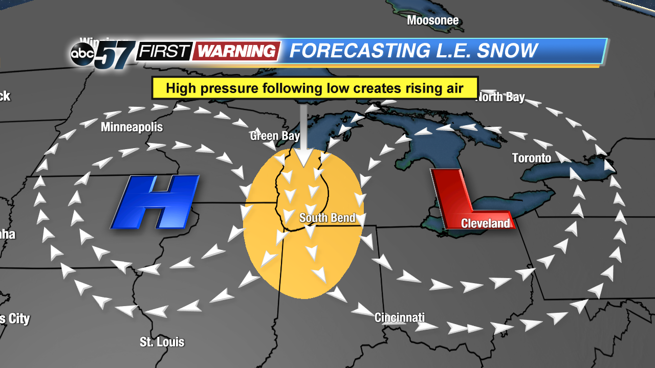
That's why we can sometimes get lake effect snow after a storm system moves through and there's enough cold air in place. The wind direction shifts out of the northwest and there's enough lift in place to generate rising air.
We all know lake effect snow can be a big problem around Michiana this year, and it can be difficult to forecast timing, location, and amounts from time to time. But, the lake effect season may actually be changing thanks to a shortening fall and spring over the next several decades. I'm sure a few of you at home have noticed that we have tended to go right from summer to winter during fall and from winter to summer during spring. Well, those big shifts in temperature in greatly affecting when we typically see lake effect snow. In the past, it's been mainly confined to the late and the first half of winter, but may be shifting.
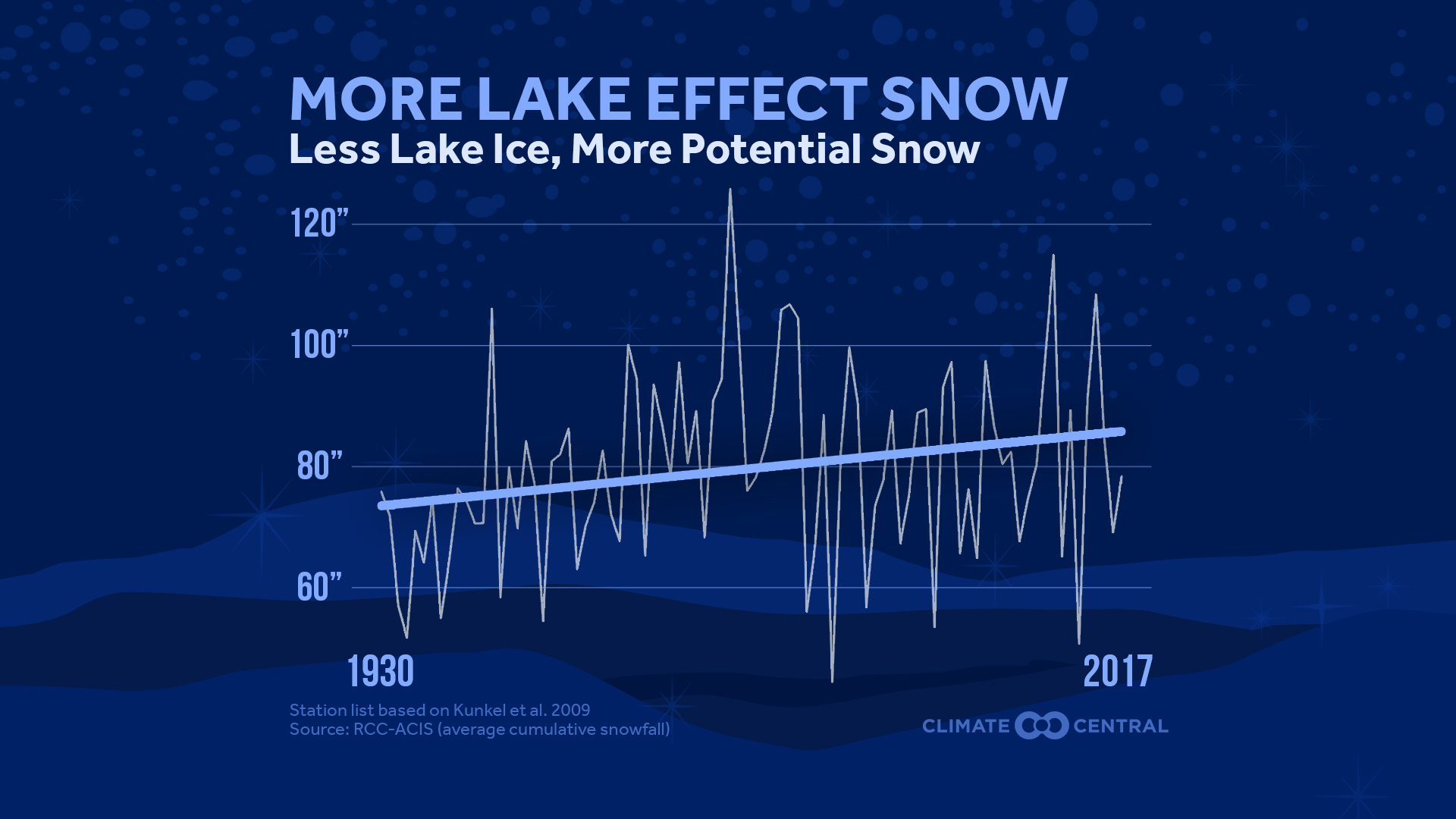
Thanks to the warming temperatures, there's been less and less ice forming on the Great Lakes, which means more and more potential for lake effect snow. And it's been slowing growing, on average, since the 1930s.
 Courtesy: Climate Central
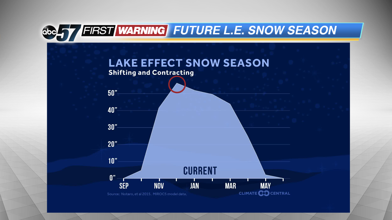 Notice how the peak of the lake effect season becomes later as the years go on.
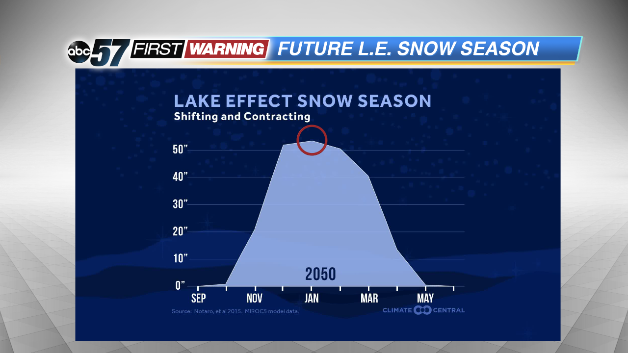
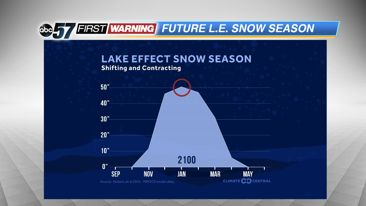
When we will see all of that snow will shift into the "dead of winter". That is, January, February, and March. As you can see, across the entire Great Lakes region, the time when we see the most lake effect snow shifts from December to January, and maybe even February by the turn of the next century.