
-
2:59

Dusty May leads Michigan back to Final Four with dominant win...
-
0:37

Vendors and cosplayers showcase art at South Bend Anime Fest
-
3:06

Palm Sunday procession in South Bend unites faiths in call to...
-
0:48

2026 Auto Show brings crowd to Century Center Sunday
-
2:34

Warm to start the week, Rainy week ahead
-
2:44

Warmer, breezier, and cloudier than yesterday
-
0:46

Crowds gather for Fins and Feathers Fest at La Porte City Fairgrounds
-
0:46

Paramount School of Excellence hosts teacher fair
-
2:30

Voting advocacy, peaceful demonstrations and donations: South...
-
2:04

Warming to start the week, Showers and storms by Tuesday
-
2:10

Cool, but calm, today
-
1:23

City of South Bend presents an ’Age-Friendly Plan’ to better...

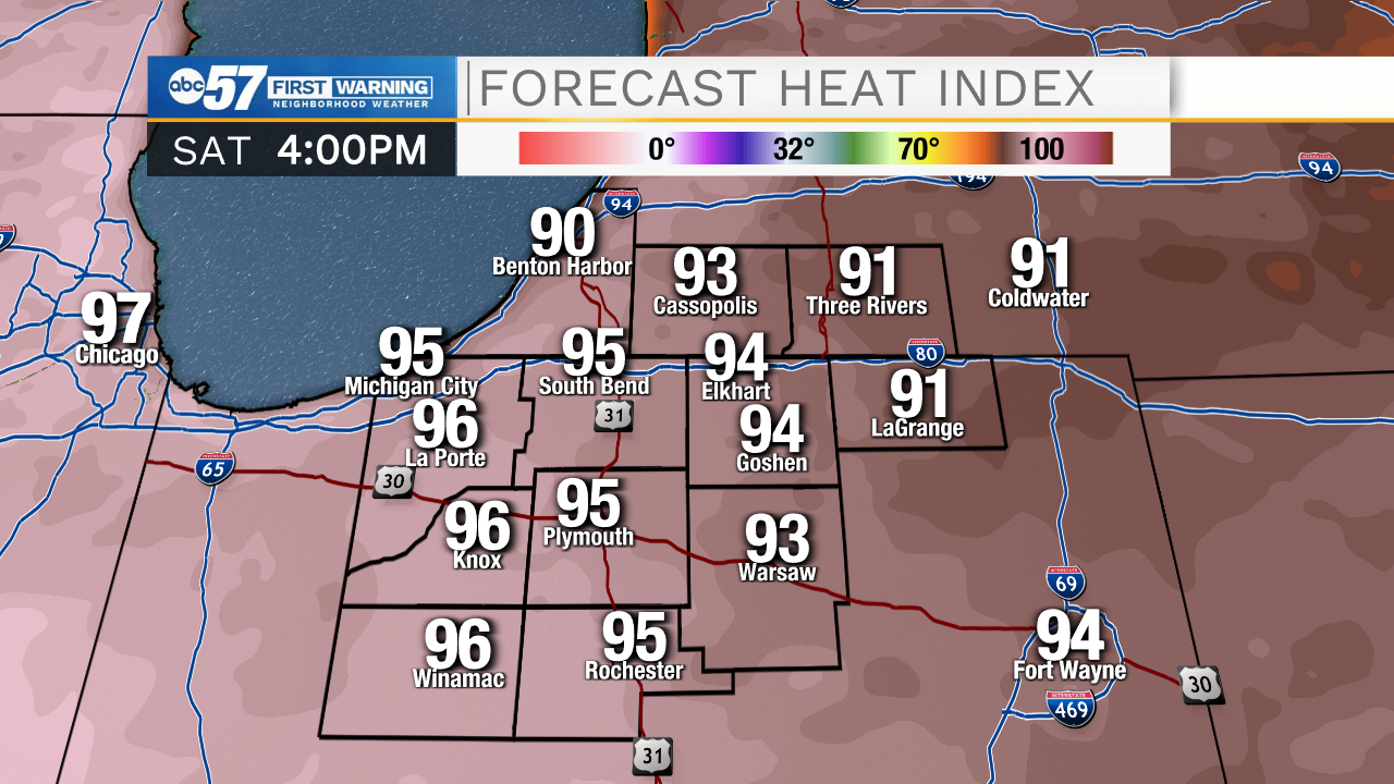
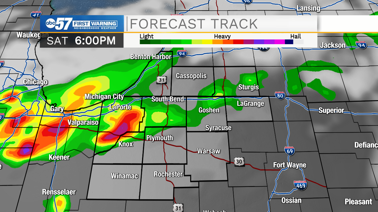
Smoke, haze and high humidity Saturday, air quality will be at worst through Saturday evening, until a front changes the wind direction. There is also the chance of showers and thunderstorms Saturday evening, a few storms could be strong to severe. There's still some uncertainty in how wide the coverage of storms will be, the greatest threat is wind gusts more than 50 mph. The smoke clears Sunday but the heat stays, highs flirt with 90 through the middle of next week.
Tonight: Partly cloudy. Low 72.
Saturday: PM thunderstorms. High 88.
Sunday: Mostly sunny. High 88.
Monday: Sunny. High 88.
Sign up for the ABC 57 Newsletter